:quality(70)/cloudfront-us-east-1.images.arcpublishing.com/cmg/4BY52YP3URHB3CBG6342FEUNGQ.jpg)
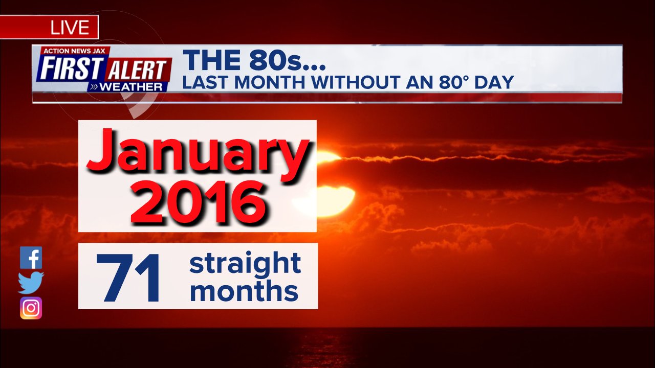
Jacksonville, FL — Yet another month with another 80-degree day! JIA officially hit 80 degrees Mon., Dec. 6th - the 71st straight month with at least one 80-degree day! Which means one has to go all the way back to January, 2016 since we’ve gone an entire month without an 80-degree day.
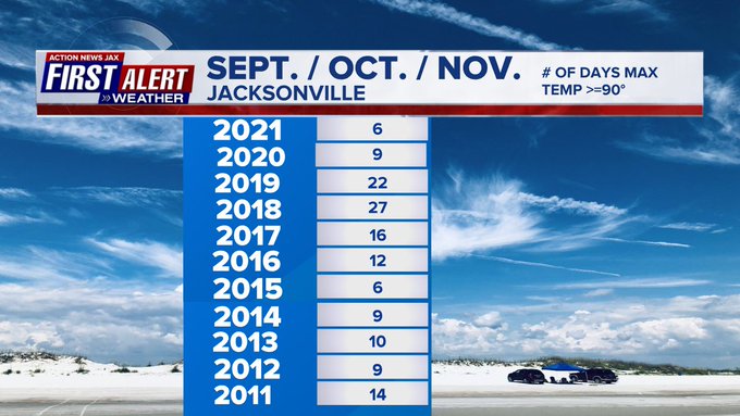
But fall as a whole was not all that hot. There were “only” 6 90-degree days this past Sept./Oct./Nov. vs. the 10-year avg. of 13 days & far less than the last few years. This comes after a year with “only” 65 90-degree days... far below the avg. of 82 days.
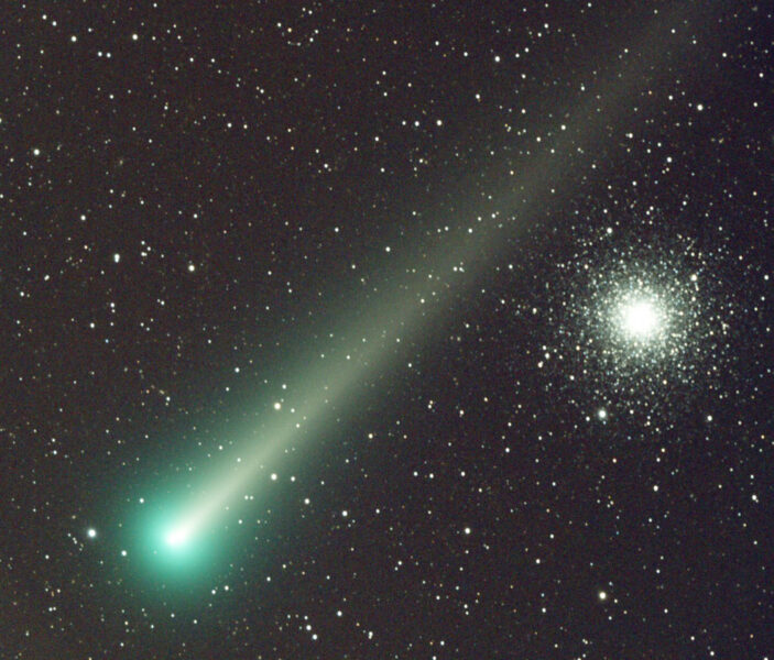
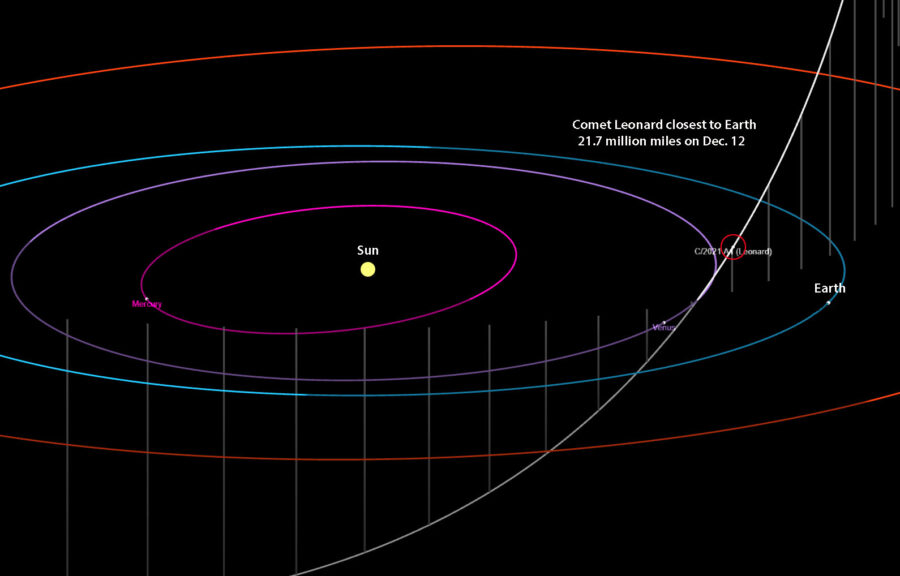
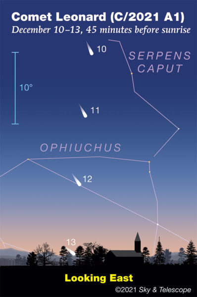
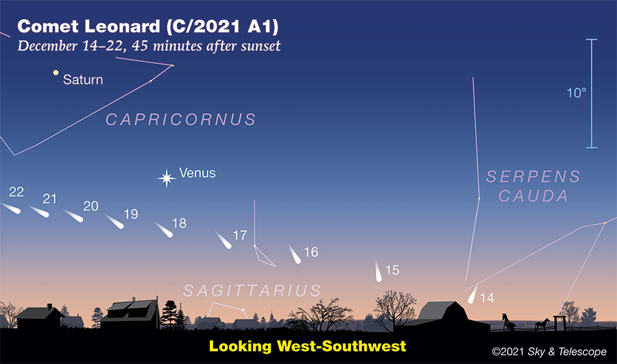
The comet “Leonard” is visible this month. Using binoculars will most likely be required, but we might get lucky & be able to get a view with the naked eye faint as that view might be. Comets are highly unpredictable & any view is expected to become dim over the next couple of weeks before completely leaving the Northern Hemisphere skies. More from Sky & Telescope * here * & below:
“After steadily brightening, it has recently shown signs of plateauing. Assuming its nucleus hangs together, binoculars should reveal the coma as a soft patch of light, brighter toward the center, about half the Moon’s apparent diameter. With averted vision you may glimpse a degree or more of faint tail pointing upward to the northwest.
Keep a close eye on Leonard on as many mornings as possible. Should the nucleus break apart due to solar heating or other forces, it could experience a modest outburst and then fade rapidly.”
Martin Mobberley:
NASA/JPL:
Sky & Telescope illustrations with the comet visible early in the morning through the 13th... then in the evening sky Dec. 14-22:
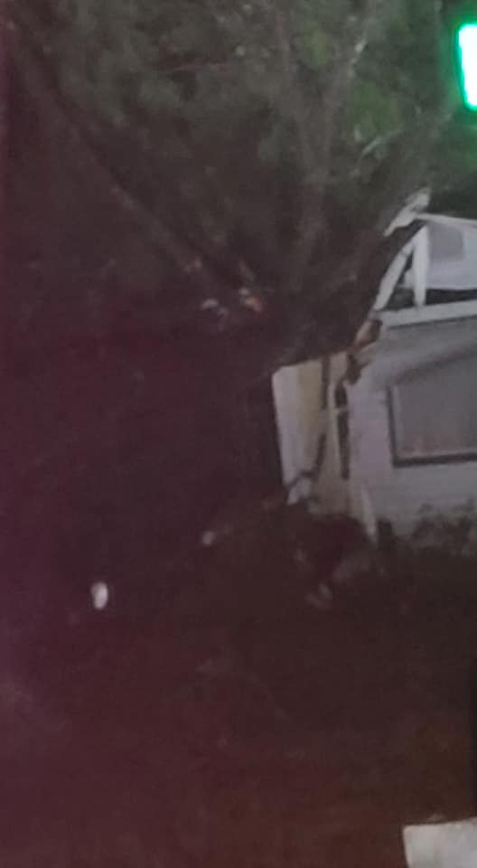
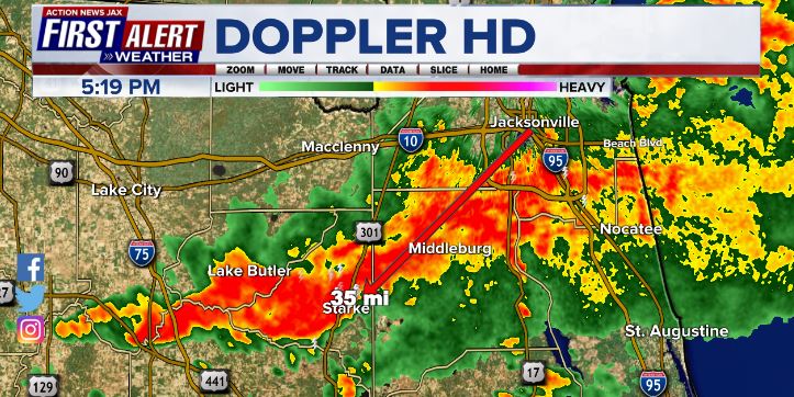
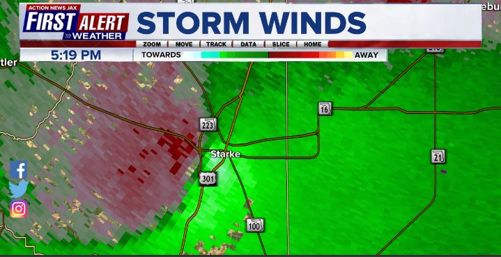
A cold front rolled across NE Fl. & SE Ga. Wed. (Dec. 8) producing the most widespread rain in more than a month. The front also triggered a few strong t’storms. One of the most intense storms produced damage in Starke about 35 miles southwest of d’town Jacksonville that was determined to be caused by an EF-1 tornado. No injuries but several homes were damaged enough to displace residents. Damage pics below from the Starke Police Dep’t. Radar imagery is from First Alert Doppler HD showing the storm moving into Starke - 1st - reflectivity or rainfall... 2nd: velocity or winds.
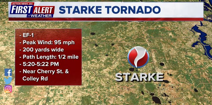

The velocity imagery below shows the circulation with winds toward the radar site in green & away from the radar in red.
©2021 Cox Media Group

:quality(70)/cloudfront-us-east-1.images.arcpublishing.com/cmg/4YJSDF6HCZB4XNDARMEQ2TBOX4.jpg)
:quality(70)/cloudfront-us-east-1.images.arcpublishing.com/cmg/2ONNMC3BENET7KURYKMMLU3UP4.jpg)
:quality(70)/cloudfront-us-east-1.images.arcpublishing.com/cmg/UPSNZVHYKZE2VDSCN54C3FTF5E.png)
:quality(70)/d1hfln2sfez66z.cloudfront.net/04-23-2024/t_8846f6a1613746e2863363cea1df0c34_name_file_960x540_1200_v3_1_.jpg)
:quality(70)/cloudfront-us-east-1.images.arcpublishing.com/cmg/LVFP5UMHGFHPXHBCTWMTFMCLA4.jpg)