:quality(70)/cloudfront-us-east-1.images.arcpublishing.com/cmg/4BY52YP3URHB3CBG6342FEUNGQ.jpg)
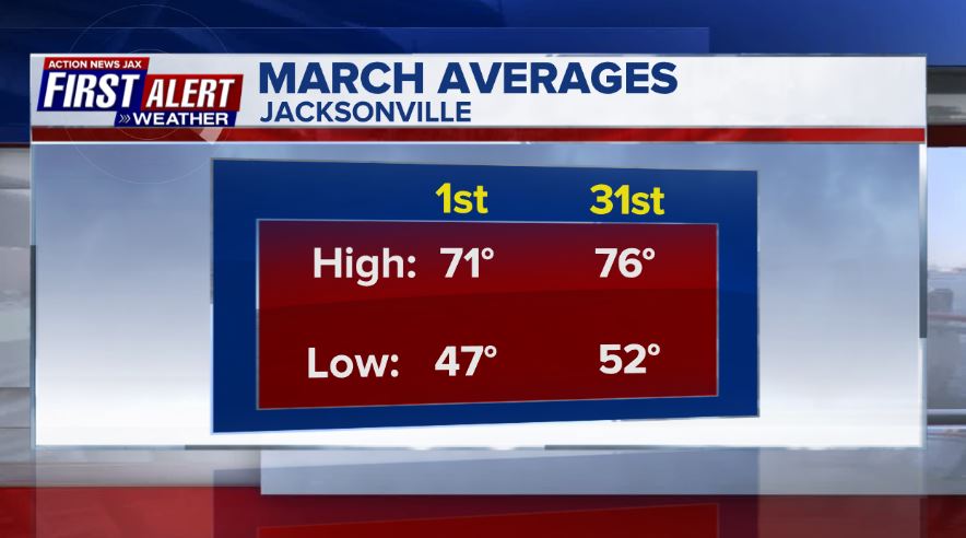
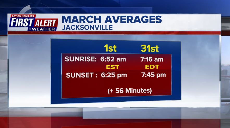
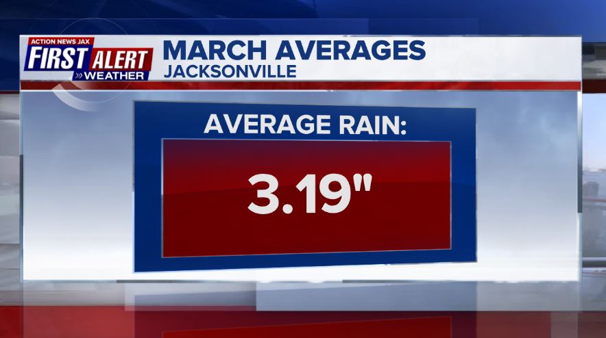
Jacksonville, FL — Time to look ahead to spring! The March averages for JIA:
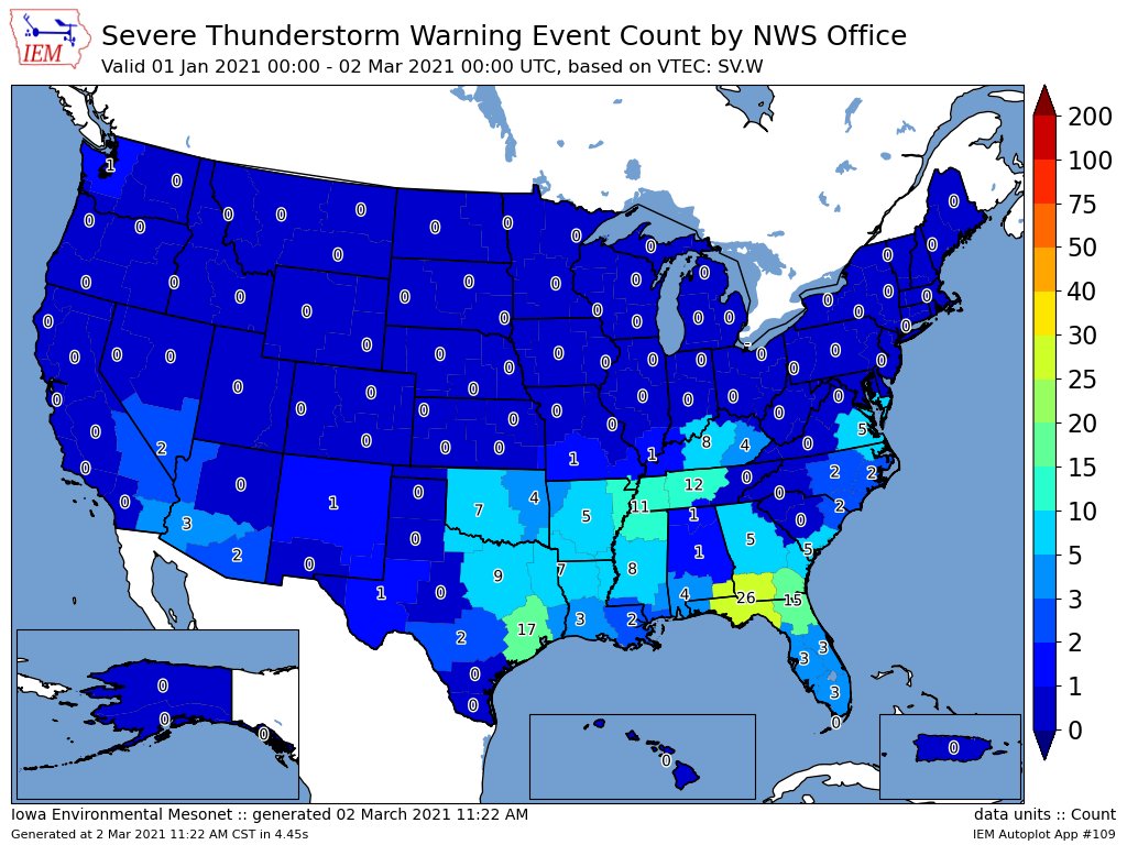
As we head toward the typical peak of our wildfire season - April & May - we did at least have a wet Feb. Officially at JIA, the 6.63″ of rain is 3.44″ above avg. making the month the 10th wettest on record. It’s worth noting the wettest Feb. ever - in 1998 with 11.12″ - was followed by an extremely dry May & June that resulted in a terrible wildfire season. Other Feb. totals from the N.W.S.:
FL GAINESVILLE RGNL AP 6.01
FL JACKSONVILLE CRAIG MUNI AP 7.81
FL JACKSONVILLE INTL AP 6.63
FL BUNNELL EOC 3.33
FL PALM COAST 6NE 7.21
FL NORTHWEST PALM COAST 7.33
FL WEST PALM COAST 5.51
FL EAGLE ROCK 7.24
FL FLAGLER BEACH 3.07
FL SOUTHEAST FLAGLER BEACH 4.25
GA ALMA BACON CO AP 5.95
GA BRUNSWICK MALCOLM MCKINNON AP 4.86
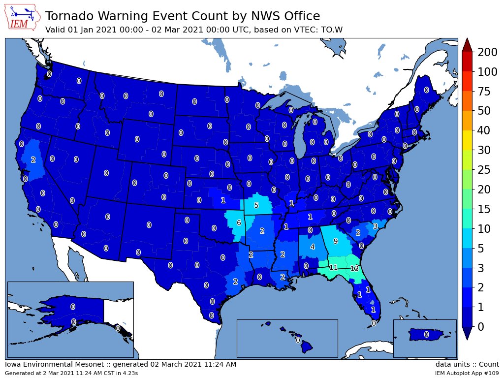
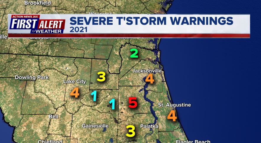
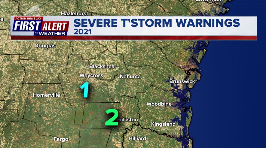
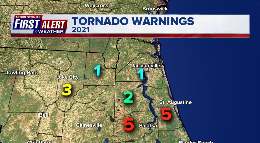
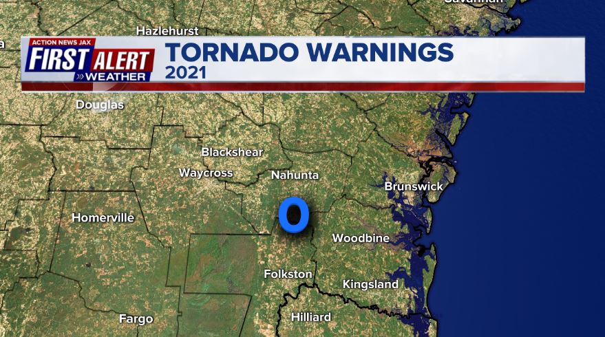
The wet Feb. was also stormy. In fact the Jax N.W.S. has issued the most tornado warnings - so far - in 2021! The arctic outbreak through the middle of the U.S. left a frontal boundary near the area for several weeks resulting in a lot of storminess.
The National Hurricane Center has announced that the Tropical Weather Outlook (TWO) will now begin to be issued May 15th instead of the typical start of the hurricane season on June 1st. The official statement:
“In order to provide more frequent information on the potential for tropical cyclone formation as the official June 1 start of the Atlantic hurricane season approaches, the National Hurricane Center will begin routine issuance of the Atlantic Tropical Weather Outlook (TWO) and the Graphical TWO at 800 AM EDT (1200 UTC) May 15, 2021. Given recent increased tropical cyclone activity in the Atlantic basin in late May, routine issuance of the Atlantic TWO starting on May 15 offers a service improvement over unscheduled Special TWOs that are issued to discuss the possibility of tropical cyclone formation prior to the official start of hurricane season on June 1.”
Cox Media Group
:quality(70)/cloudfront-us-east-1.images.arcpublishing.com/cmg/QHT46DYGFFBQEHWRTYQW7PQQU4.jpg)
:quality(70)/cloudfront-us-east-1.images.arcpublishing.com/cmg/N7YMXJTJYJEFBCXSUI6KPLO7OM.png)
:quality(70)/d1hfln2sfez66z.cloudfront.net/04-18-2024/t_b399b953598a462d8ba0c4539e279e62_name_file_960x540_1200_v3_1_.jpg)
:quality(70)/d1hfln2sfez66z.cloudfront.net/04-16-2024/t_980912f57edf41ed844a9a1fcf0a511f_name_file_960x540_1200_v3_1_.jpg)
:quality(70)/cloudfront-us-east-1.images.arcpublishing.com/cmg/NQCTWRA7OVFP5ABEQBTBAG2E3A.jpg)