:quality(70)/cloudfront-us-east-1.images.arcpublishing.com/cmg/4BY52YP3URHB3CBG6342FEUNGQ.jpg)
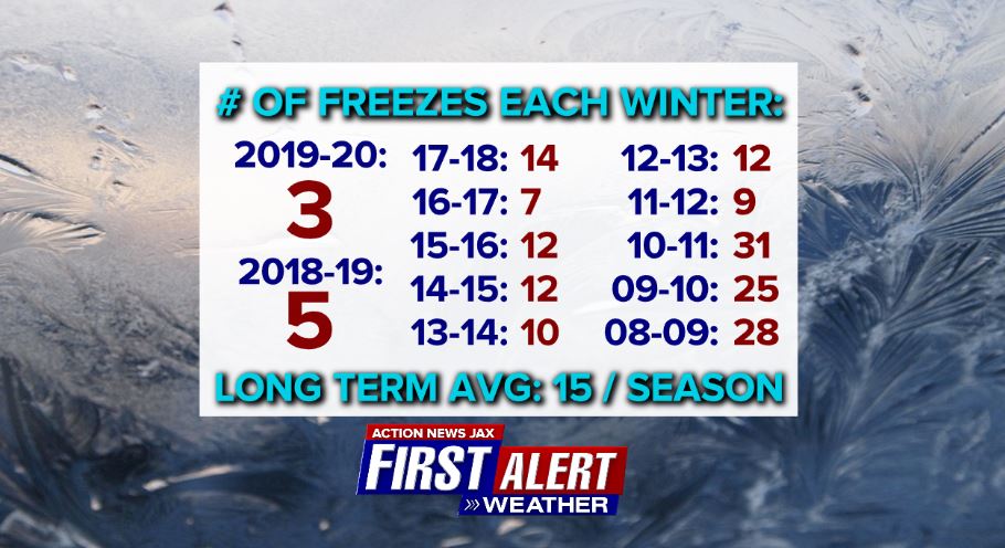
Jacksonville, FL — We’re now more than half way through meteorological winter (Dec./Jan./Feb.) & many have noticed it’s been relatively chilly so far. And they’re right! Through Jan. 20th, there have been 9 freezes at JIA - that’s more than the last 2 winters combined. In fact, NE Fl. has not reached the avg. 15 freezes/winter since 2010-’11 - a pretty remarkable stretch of mild winters with few freezes.
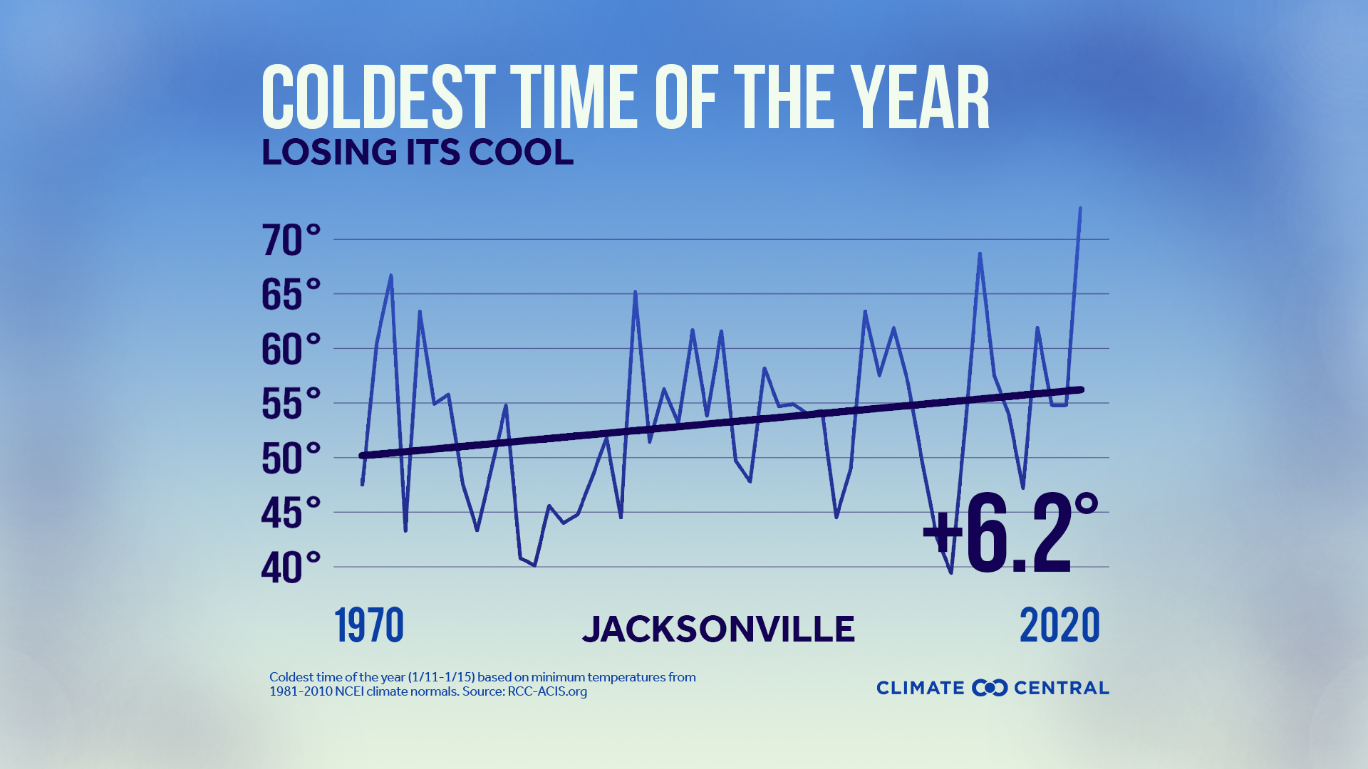
Jacksonville’s coolest avg. temps. of the year are from Jan. 2nd - 13th but have increased by about 6.2 degrees F since 1970.
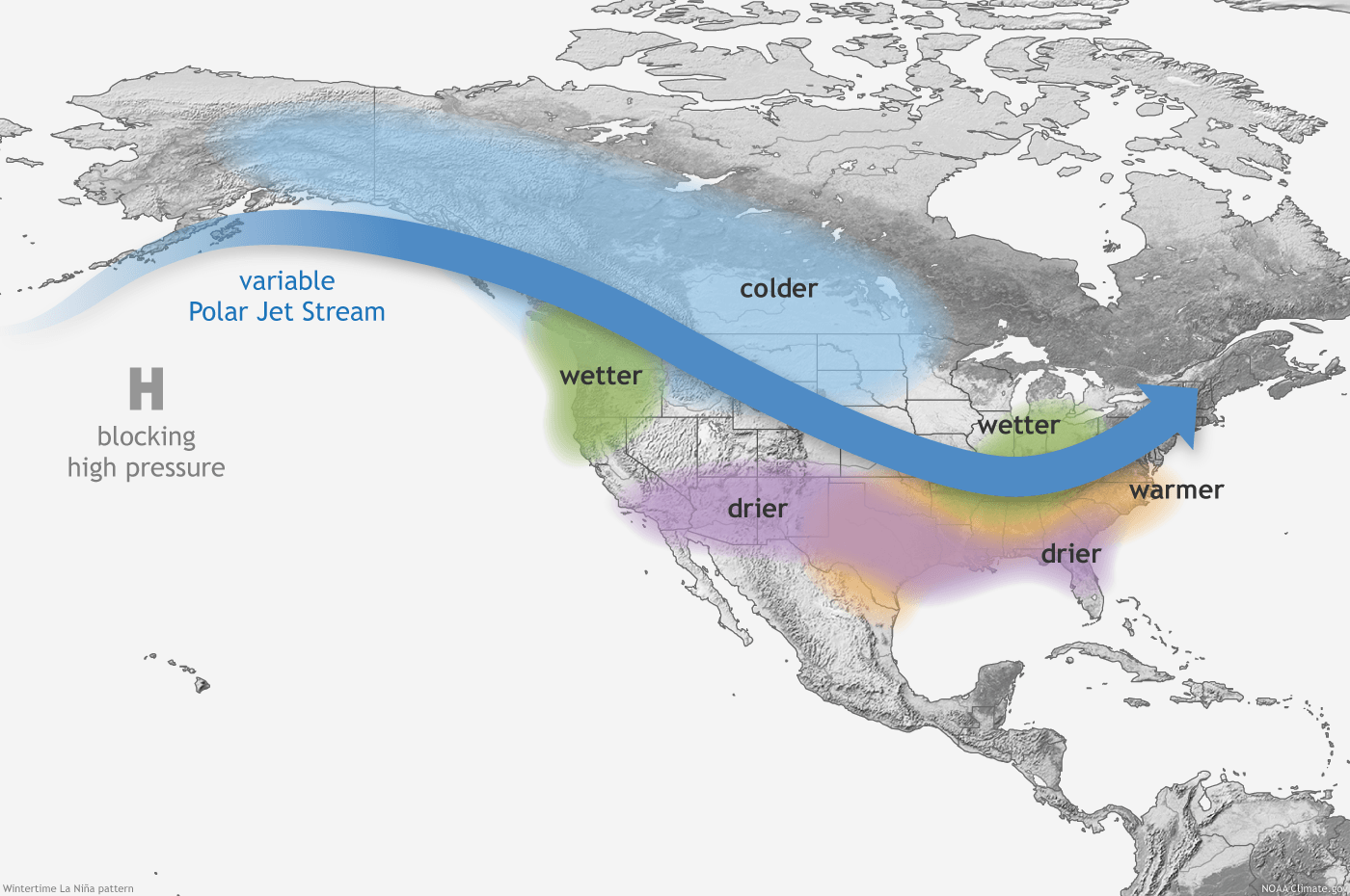
La Nina update: The cooler than avg. equatorial Pacific continues in full swing. Forecast models - the 2nd image below - are forecasting the La Nina to continue at least the next couple months then gradually wane & become close to neutral over the summer. So relatively big temp. swings but leaning milder + less than avg. rainfall would be the typical result for NE Fl./SE Ga. followed by a potentially dry spring. It’s worth mentioning, however, that our ENSO (El Nino Southern Oscillation) patterns have been less “reliable” (typical) in recent years. It’s possible that’s because of the warming globe & especially warm oceans.


Typical La Nina winter pattern for the U.S.:
Cox Media Group
:quality(70)/d1hfln2sfez66z.cloudfront.net/04-19-2024/t_744a0fe392b04fa194c322a11f1cea0c_name_file_960x540_1200_v3_1_.jpg)
:quality(70)/d1hfln2sfez66z.cloudfront.net/04-20-2024/t_27c4ee35a0bd498ab102ed62d7b8a798_name_file_960x540_1200_v3_1_.jpg)
:quality(70)/cloudfront-us-east-1.images.arcpublishing.com/cmg/N7YMXJTJYJEFBCXSUI6KPLO7OM.png)

:quality(70)/cloudfront-us-east-1.images.arcpublishing.com/cmg/UBK5OW6GKNESZPPDL26F4NQT7U.jpg)