Jacksonville, Fl. — The “Buresh Bottom Line”: Always be prepared!.....First Alert Hurricane Survival Guide... City of Jacksonville Preparedness Guide... Georgia Hurricane Guide.
STAY INFORMED: Get the * FREE * First Alert Weather app
FREE NEWS UPDATES, ALERTS: Action News Jax app for Apple | For Android
WATCH “Talking & Tracking the Tropics: The Science Behind the Season”
WATCH “Preparing for the Storm”
READ the First Alert Hurricane Center “Survival Guide”
*** At this time no direct impacts from the tropics for Jacksonville/NE Fl./SE Ga. through at least the weekend. Gonzalo will, however, impact the Southern & possibly Central Lesser Antilles then will move into the Caribbean... tropical depression #8 is over the Gulf of Mexico & will move into Texas Friday into the weekend - possibly as a tropical storm... & hurricane Douglas over the E. Pacific will be near Hawaii this weekend. ***
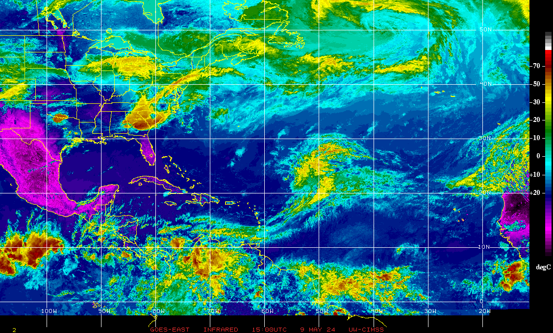
(1) low pressure over the Central Atlantic became tropical depression #7 Tue. & then tropical storm “Gonzalo” Wed. This is the fastest ever to the 7th named storm over the Atlantic beating “Gert” in 2005 by two days. The avg. date of the 7th named storm is not until Sept. 16th. The forecast track is rather straight forward the next few days: a steady, rather fast westward movement turning a little northwest by the weekend over the Caribbean. Most global forecast models - both the European & GFS for instance - are not very strong (even dissipate it in some forecast cycles) with the tropical cyclone, especially once into the Caribbean likely because of pretty dry mid & upper level air as well as some shear. Close proximity to the S. American coast may also play a role. But it should be noted that neither is model is initializing the small tropical cyclone very well.
Conditions may change some + shear looks weaker over the Western Caribbean so the long term prognosis is still up in the air, especially if Gonzalo can survive the less favorable conditions over/near the Eastern Caribbean. At least some heavy/gusty squalls can be expected for some of the Central/Southern Lesser Antilles Fri. into Saturday.
(2) the tropical wave/disturbance that’s been moving northwest into the Gulf of Mexico has strengthened into tropical depression #8. Continued gradual organization/strengthening of this wave should continue before reaching the Texas coast Friday/Fri. night while bending toward the west. Heavy rain & isolated tornadoes look to be the biggest threat with what could be “Hanna” upon landfall.
(3) A strong tropical wave has just come off the coast of Africa but is void of much convection & at a higher latitude than t.d. #7 but does appear to possibly have some long term potential.
Overall.... it looks like a much more active Atlantic late this month into at least the first week of Aug. More on that further down - see “Velocity Potential Anomalies”.


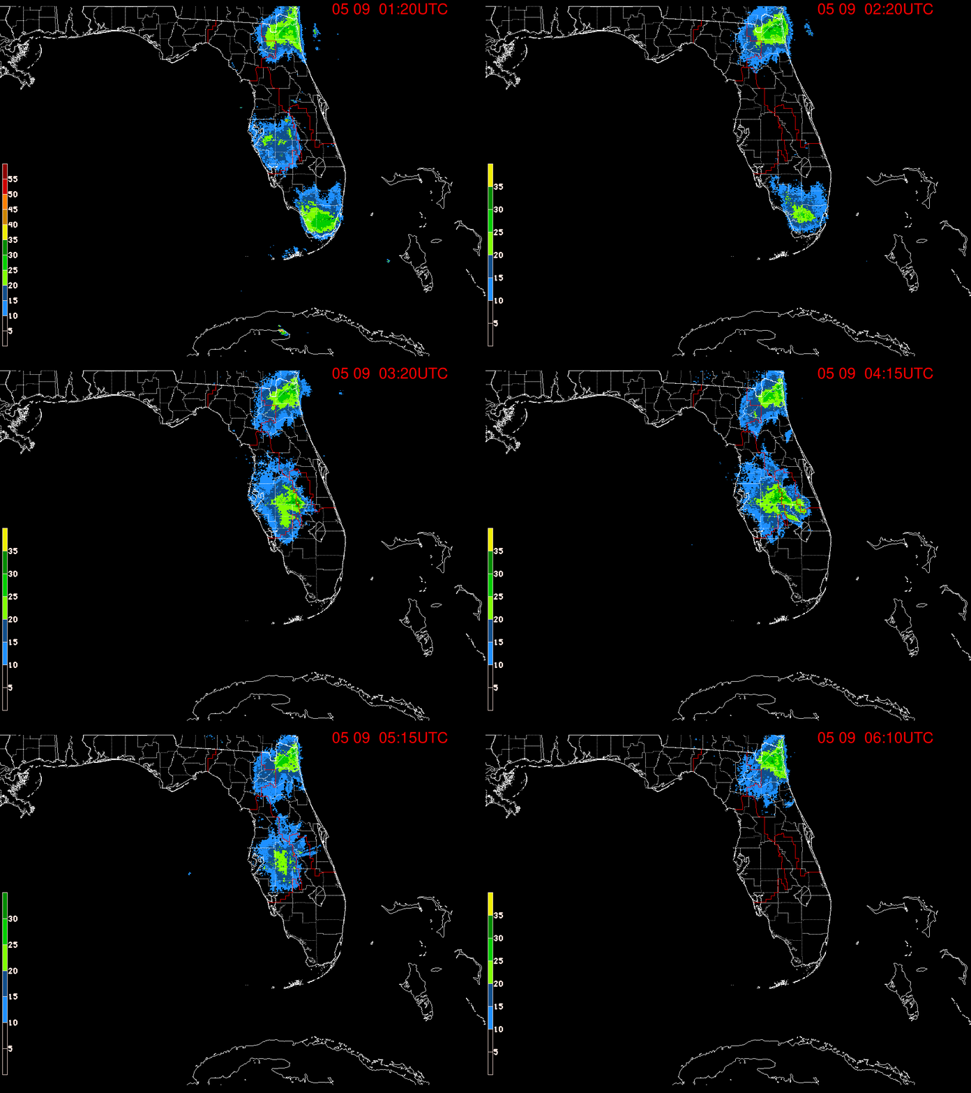
Radar imagery below courtesy South Florida Water Management District:


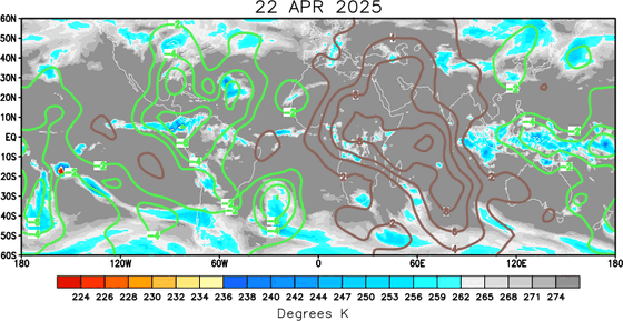
Meanwhile... “velocity potential anomalies” map below shows why we could - & should - see more tropical activity over both the E. Pacific & Atlantic in the coming weeks. The green lines indicate “upward” vertical velocities which are shown to be in a narrow but strong corridor spreading over the Central & Eastern Pacific. This upward motion in the atmosphere often correlates with increased t’storm activity & sometimes tropical development & is right in concert with the development of tropical cyclone Douglas over the E. Pacific. I would expect to see at least a couple of named storms pop over the Atlantic Basin between now & August 10th.


:quality(70)/cloudfront-us-east-1.images.arcpublishing.com/cmg/WW5AJL3ARQUGDQMAQUNSFX4CLE.jpg)


:quality(70)/cloudfront-us-east-1.images.arcpublishing.com/cmg/NQCTWRA7OVFP5ABEQBTBAG2E3A.jpg)
:quality(70)/cloudfront-us-east-1.images.arcpublishing.com/cmg/66OQ2JVK7JEQVJQFU67HE76KXQ.jpg)
:quality(70)/d1hfln2sfez66z.cloudfront.net/04-17-2024/t_6061b3560fca4ac9aa6b873a534bfe28_name_file_960x540_1200_v3_1_.jpg)
:quality(70)/d1hfln2sfez66z.cloudfront.net/04-16-2024/t_df20ecc7bd6a4ec69132a4173b162c6e_name_file_960x540_1200_v3_1_.jpg)
:quality(70)/cloudfront-us-east-1.images.arcpublishing.com/cmg/ZGZMPWZQ7RDCREAUK36BYM3ANA.jpg)