Jacksonville, Fl. — The “Buresh Bottom Line”: Always be prepared!.....First Alert Hurricane Survival Guide... City of Jacksonville Preparedness Guide... Georgia Hurricane Guide.
STAY INFORMED: Get the * FREE * First Alert Weather app
FREE NEWS UPDATES, ALERTS: Action News Jax app for Apple | For Android
WATCH “Talking & Tracking the Tropics: The Science Behind the Season”
WATCH “Preparing for the Storm”
READ the First Alert Hurricane Center “Survival Guide”
LOCAL - Jacksonville/NE Fl./SE Ga. impacts from “Cristobal”:
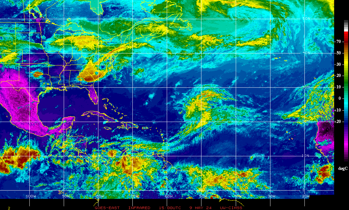
The Atlantic Basin has gone mostly quiet. Low pressure is continues to spin over the Central Atlantic with some potential for subtropical development while drifting westward. Nothing significant expected.
We still need to keep an eye on the NW Caribbean &/or Gulf of Mexico for possible development later this month. In fact, a tropical wave is approaching the SE Caribbean & might be something to monitor for long range development. For the moment... lots of shear should limit much organization but some “squally” weather will occur over the Southern Lesser Antilles.
Otherwise we’re in “good shape” through the weekend in the tropics.


:quality(70)/cloudfront-us-east-1.images.arcpublishing.com/cmg/WW5AJL3ARQUGDQMAQUNSFX4CLE.jpg)


:quality(70)/cloudfront-us-east-1.images.arcpublishing.com/cmg/UPSNZVHYKZE2VDSCN54C3FTF5E.png)
:quality(70)/d1hfln2sfez66z.cloudfront.net/04-23-2024/t_8846f6a1613746e2863363cea1df0c34_name_file_960x540_1200_v3_1_.jpg)
:quality(70)/cloudfront-us-east-1.images.arcpublishing.com/cmg/5BGF6ZRBF5BH3JEEOYZ2JOLJAA.png)
:quality(70)/cloudfront-us-east-1.images.arcpublishing.com/cmg/Z5VHE63WVZHORWO5B25EALQYUA.jpg)
:quality(70)/cloudfront-us-east-1.images.arcpublishing.com/cmg/2DRMH62PQ5ABDFQX52PYU2KKLQ.jpg)