
Sept. 26, 2017 — Photos: Must-see photos of Irma damage in Jacksonville area .... hurricane Irma recap
Live updates: Maria is a Category 1 hurricane
"Maria" moving northward - tropical storm WARNING for coastal N. Carolina.... hurricane "Lee" over Central Atlantic.... there has been a named storm at least somewhere over the Atlantic each day since Aug. 23rd!
The "Buresh Bottom Line": Always be prepared!..... City of Jacksonville Preparedness Guide... Georgia Hurricane Guide.
Maria:
LOCAL (JACKSONVILLE) IMPACTS - Maria has made its closest approach & is moving away:
- a high rip current risk through Tue. evening
- offshore winds out of the west - "clean" surf continues!
- no rainfall..... no high winds .... no storm surge directly associated with Maria for NE Fl./SE Ga.
Maria went Cat. 5 & then some with a minimum pressure of at least 909 mb Tue. evening making the hurricane among the top 10 most intense on record for any part of the Atlantic Basin. Maria was the 2nd Cat. 5 of the season over the Atlantic - the first time that's happened since 2007 (Dean & Felix). The catastrophic move over Puerto Rico caused some weakening before more intensification once over the warm water of the Southwest Atlantic. A gradual weakening will continue as shear increases out of the west & southwest & the eye moves over cooler water - some of which is upwelling from the previous pass of "Jose".
When it comes to movement.... how do we solve a problem like Maria? Well... much will come down to any upper level ridging near the U.S. east coast & an approaching upper level trough. All indications are that Maria will follow a wake of sorts to the south of what was "Jose".


Spaghetti model plot for Maria:


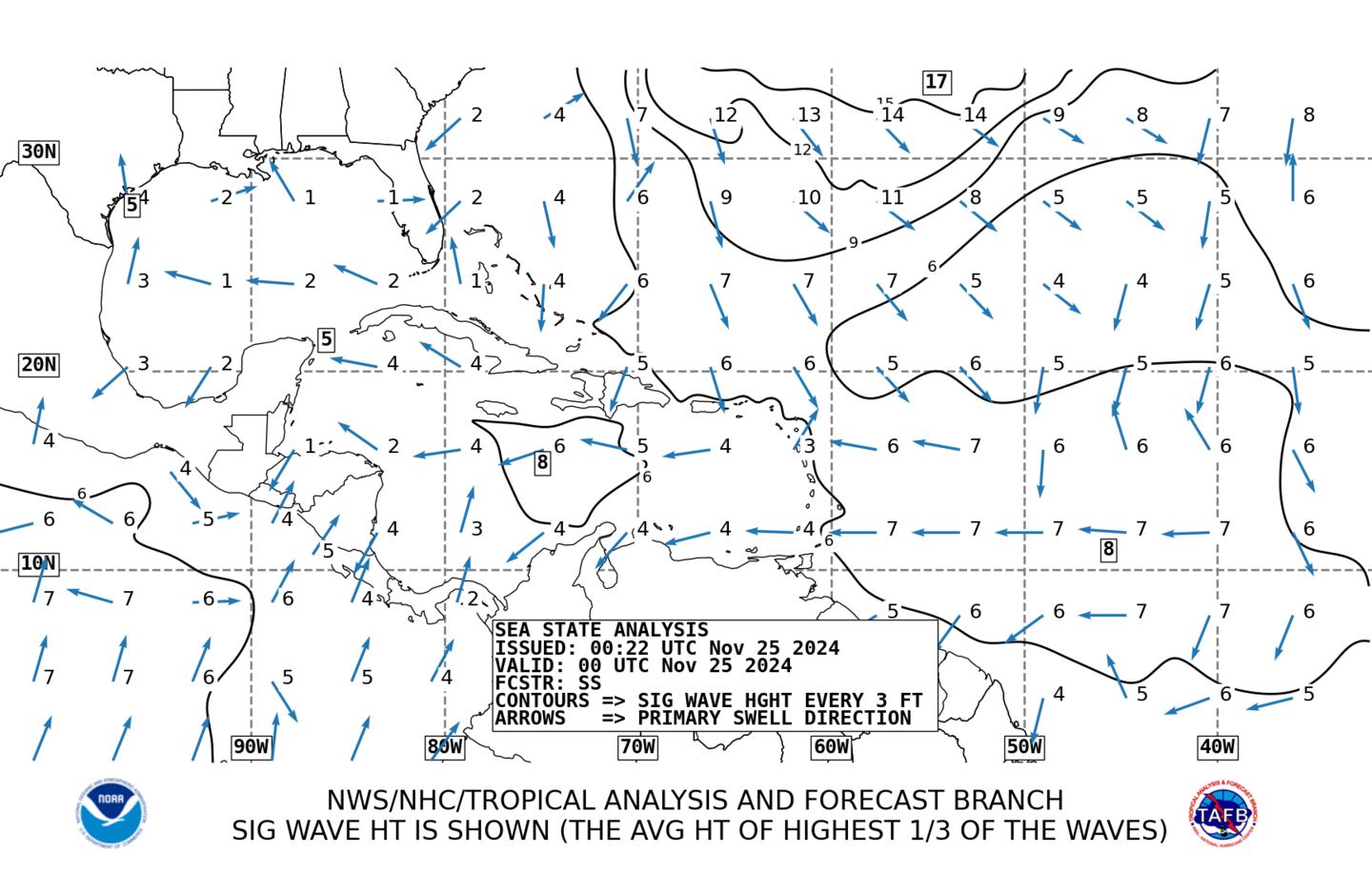
Average wave heights:
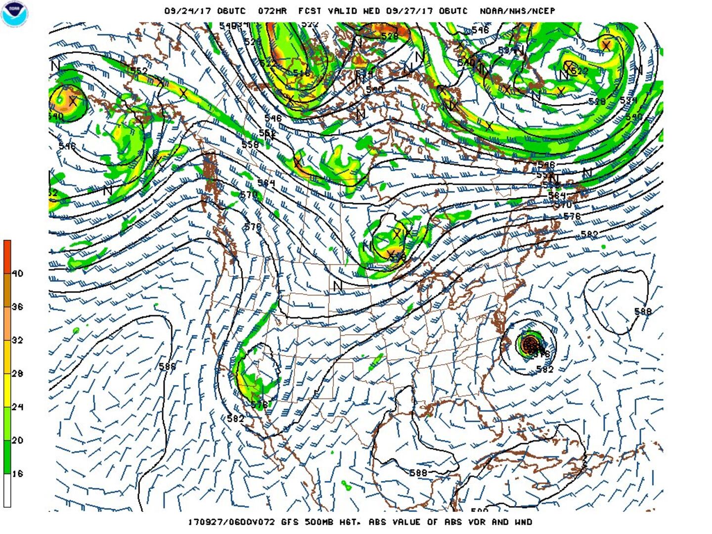
The chart below is the 500mb (upper level) forecast from the GFS model for early Wed., 09/27. The atmosphere is going through some major "restructuring". The Bermuda high over the Atlantic is trying to re-establish itself now that Jose has essentially dissipated while a trough of low pressure moves eastward across the Northern U.S. Maria will move east of the NC Outer Banks by Wed.... though a true landfall does not appear to be in the cards. But Maria is a broad storm with tropical storm force winds extending 200+ miles from the center. So despite the overall weakening, at least tropical storm force wind gusts appear likely for the coast of N. Carolina through Wed.
Maria made its closest approach to Jacksonville.... still hundreds of miles to the east. Now a flirt with middle U.S. east coast through Wed.
Once the trough gets to the north (similar longitude as Maria), Maria will turn sharply east/northeast & accelerate away from the U.S. late in the week.
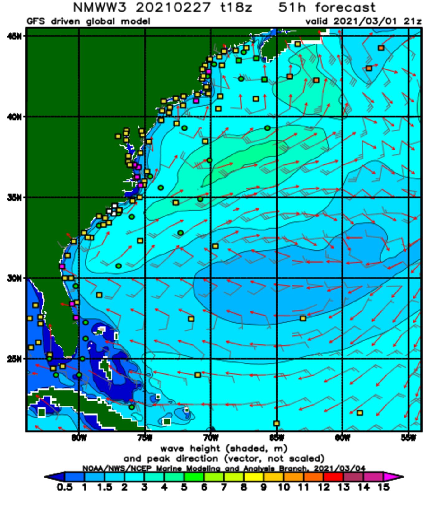
NOAA WaveWatch III below predicated on GFS model - will change & update - hit refresh for latest + loop:
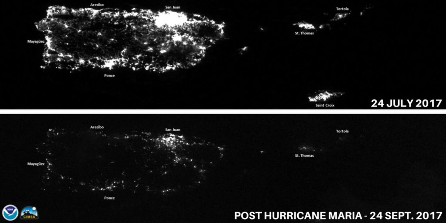
NOAA satellite imagery of Puerto Rico "electricity from space" - before vs. after "Maria":
Lee:
Tropical cyclone "Lee" went through a rapid intensification cycle over the weekend becoming a hurricane over the Central Atlantic. Movement will be to the west then north over the open Atlantic before responding to an approaching mid/upper latitude trough by late week that will accelerate Lee to the northeast -- no threat to cross the Atlantic.

0
1
Very warm ocean water persists:
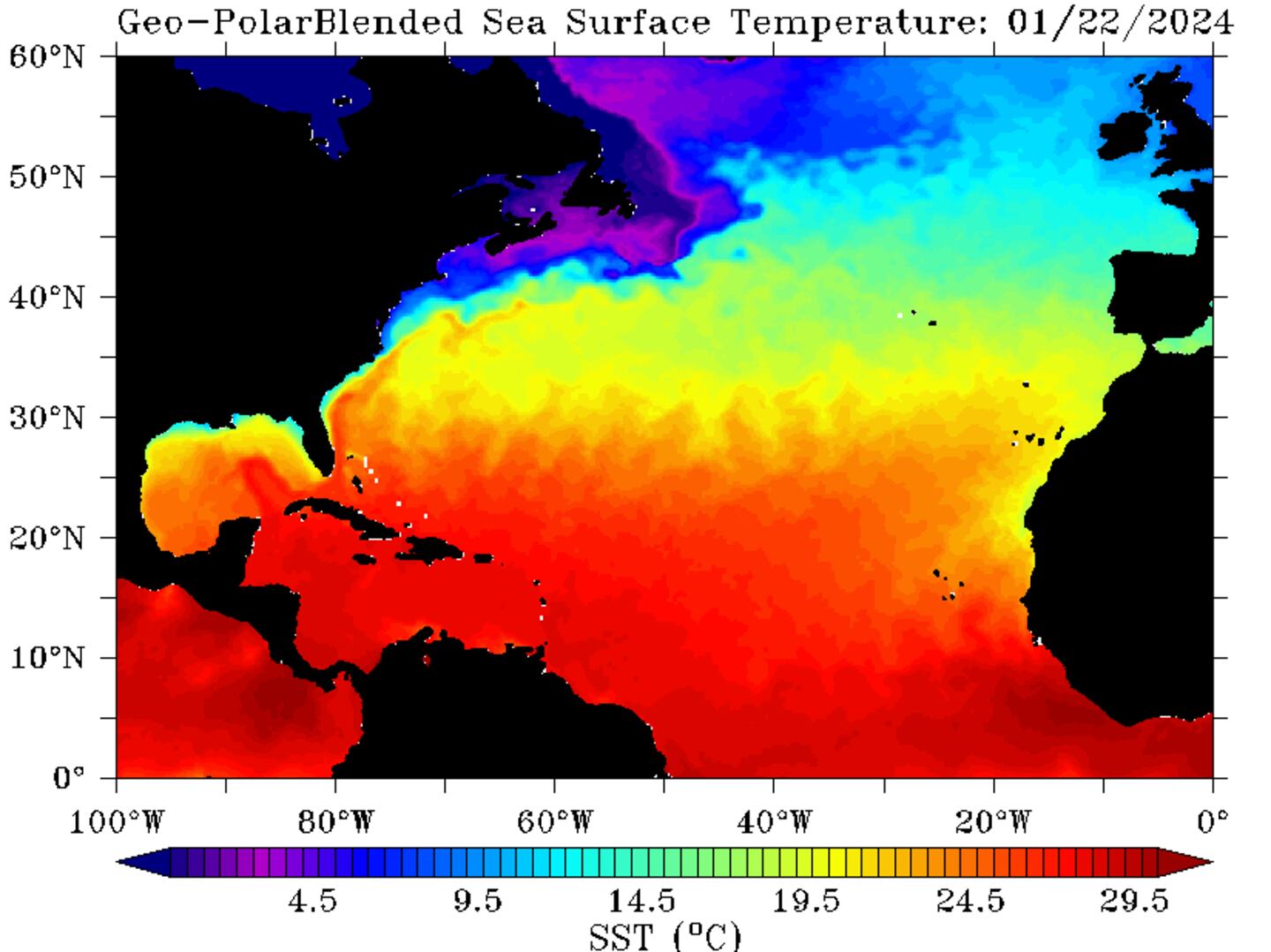
Deep oceanic heat content is still very evident - especially over the Caribbean & Gulf. We will have more tropical troubles before the season is over.

Sea surface temp. anomalies are slowly recovering over/near the Gulf / Fl./ SW Atlantic since the passing of multiple hurricanes (Harvey, Irma, Jose, Maria)....

The Gulf remains mostly quiet while the Caribbean is becoming more unsettled. There are indications of a general lowering of surface pressures across this area for late month which might be a hint pointing to tropical "mischief" the first week or so of Oct. Some forecast models to show weak low pressure near S. Fl. as early as this weekend. More probable - & more concerning - is the potential for gradual tropical development over or near the Gulf/Caribbean next week.

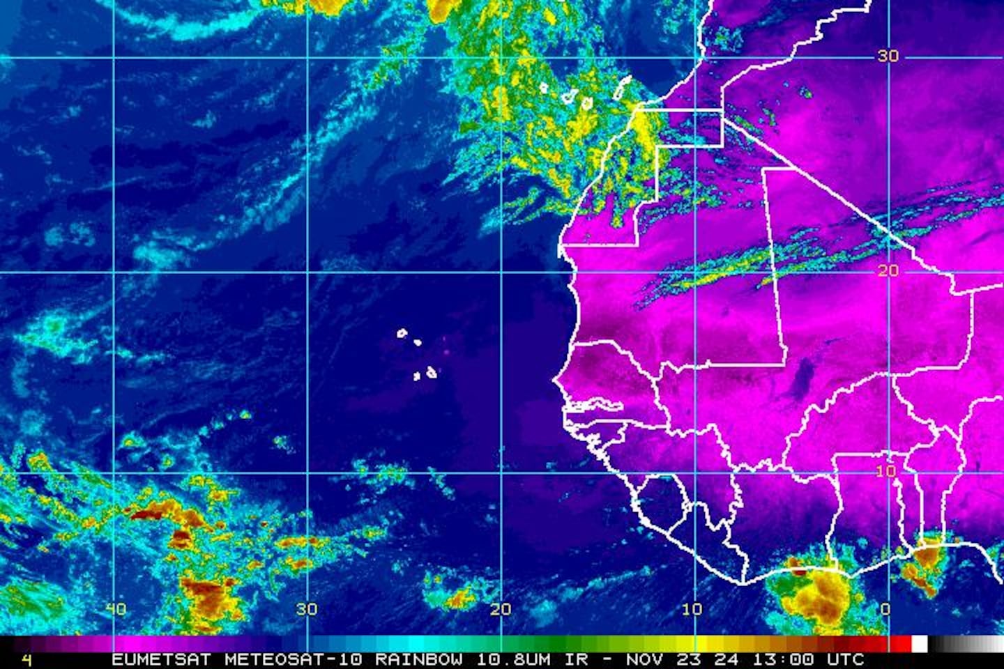
East Atlantic IR satellite:
Mid & upper level wind shear (enemy of tropical cyclones) analysis (CIMMS):

SE U.S. surface map:


Surface analysis centered on the tropical Atlantic:
0
Surface analysis of the Gulf:
1
Caribbean:
2
Extensive hurricane Irma recap - click here.
3
Cox Media Group


