
Aug. 5, 2017 — There remain two areas of interest/concern:
(1) SW Gulf of Mexico & Bay of Campeche - gradual tropical development possible through the weekend/early next week. This can be a "hot bed' this time of year & any development would primarily impact Mexico &/or far South Texas. The tropical wave - 90L - currently over the Caribbean is moving steadily west/northwest showing some signs at attempted organization as the shear gradually lessen the more west the wave goes. The European model continues to be the strongest taking a hurricane into Mexico well south of Brownsville, Texas while the GFS model holds off development a little longer longer resulting in a somewhat weaker system but hitting about the same area. The UKMET model shows little or no development keeping the low pressure farther south & therefore more over the land mass of Mexico & Central America. It would appear the window for greatest concern for a full fledged tropical cyclone hit south of Texas would be Tue./Wed. (if the storm develops).
(2) Eastern & Central Atlantic where an active tropical wave ('99-L') has a good chance to develop into a tropical cyclone but is showing no signs of organization for the moment. The GFS model has been the most emphatic on this wave becoming a powerful hurricane & making a beeline west/northwest underneath the strong Bermuda high over the Central/Eastern Atlantic though has backed off on recent model runs (that's why one should never get too wrapped up in individual model cycles). The European model eventually dissipates a weak tropical cyclone... the UKMET model is generally somewhere inbetween. It's most likely the a faster/stronger developing system would end up farther north (poleward) while a weaker system would go farther west largely steered by the low level trade winds. For the moment.... I favor a weaker system that ends up farther west - at least initially. The problem could be in the longer term when conditions might become more favoarable for stronger development (late next week/next weekend - ish).


'90L':


Another midsummer cold front is diving deep into the South, but this one will stall earlier than last week's front.


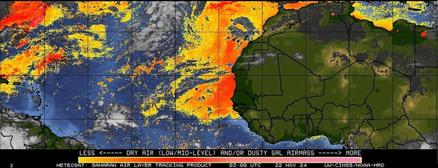
Imagery below courtesy CIMMS continues shows the persistent stream of African Saharan dust (orange & red) breaking up a little but reorganizing off the NW coast of Africa:
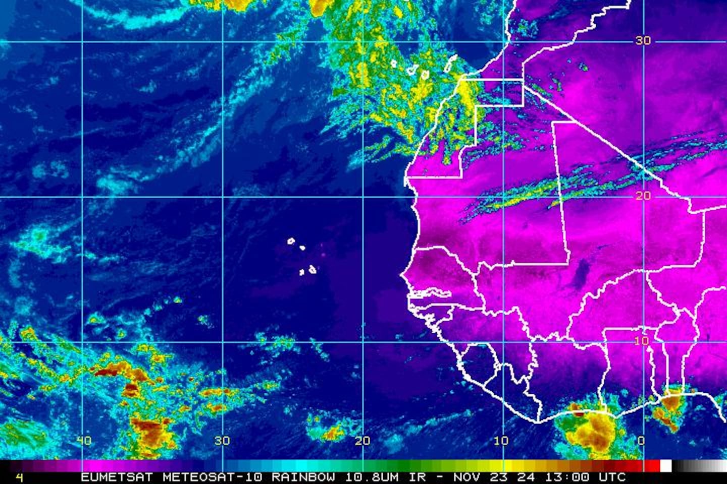
Water vapor imagery shows moisure returning to Florida....
0
Surface analysis centered on the tropical Atlantic shows the strong Bermuda high remains anchored over the Central Atlantic...
1
Surface analysis of the Gulf:

Caribbean:

Wind shear analysis (red is stronger shear)...

The W. Pacific...... the broad eye of "Noru" will make a hit on Southern & Central Japan over the weekend perhaps as a Cat. 1 or 2 typhoon (could be cause for concern on wave '99L' now in the E. Atlantic using teleconnection):


"Noru":

Cox Media Group


