
Aug. 2, 2017 — The last advisory on "Emily" was issued late Tue. The remnant low pressure system will move harmlessly northeast over the open Atlantic.
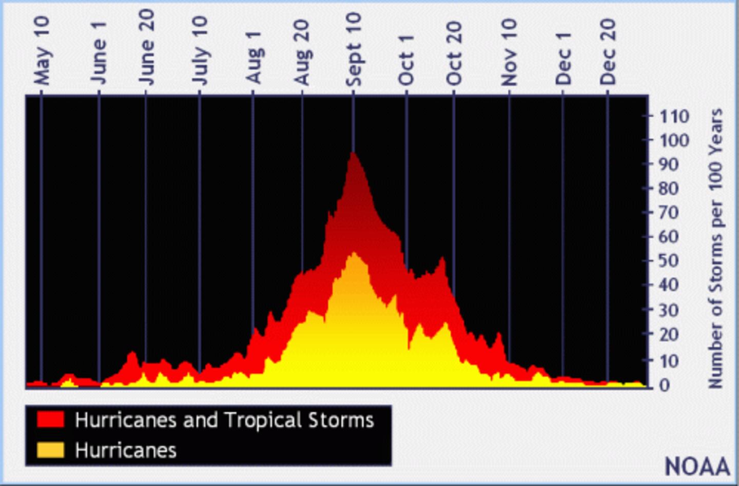
The development of "Emily" close to Florida might be a warning shot of sorts for the rest of the hurricane season. We might see future tropical development not far from the U.S..... in addition to possible deep tropical development. The climatological peak of the hurricane season is but 5 weeks away (Sept. 10).
Weak low pressure has developed over the Northeast Gulf of Mexico & will track northeast toward the Fl. Panhandle/Big Bend. The low is nontropical & the close proximity to land + strong shear should keep this system "in check".
Radar imagery courtesy S. Florida Water Management District:


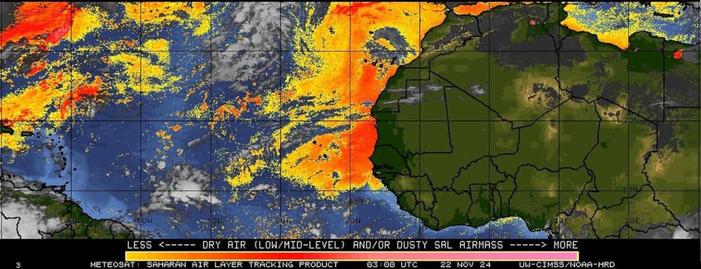
Imagery below courtesy CIMMS continues shows the persistent & widespread stream of African Saharan dust (orange & red) over the Central & Eastern Atlantic with some of the dust destined for Florida over the next few days. A few tropical waves are moving west on the underside of the dust plume & have some potential for gradual development over the next week or two.
Water vapor imagery shows moisure returning to Florida....

Surface analysis centered on the tropical Atlantic shows the strong Bermuda high remains anchored over the Central Atlantic...

Surface analysis of the Gulf:
0
Caribbean:
1
Wind shear analysis (red is stronger shear)...

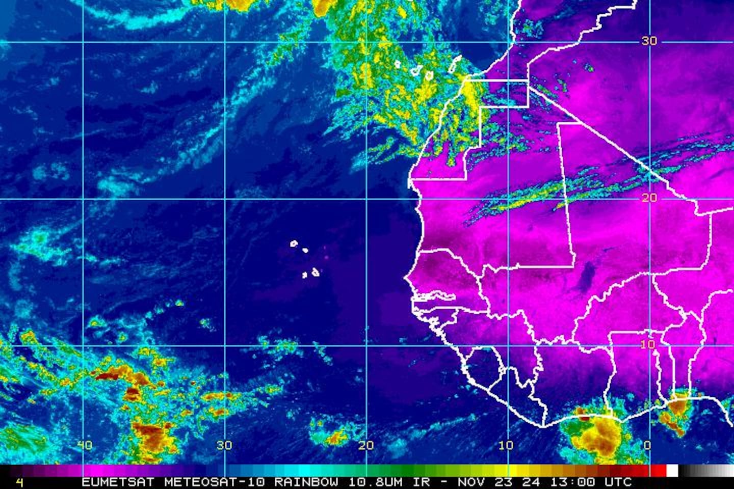
Eastern Atlantic:
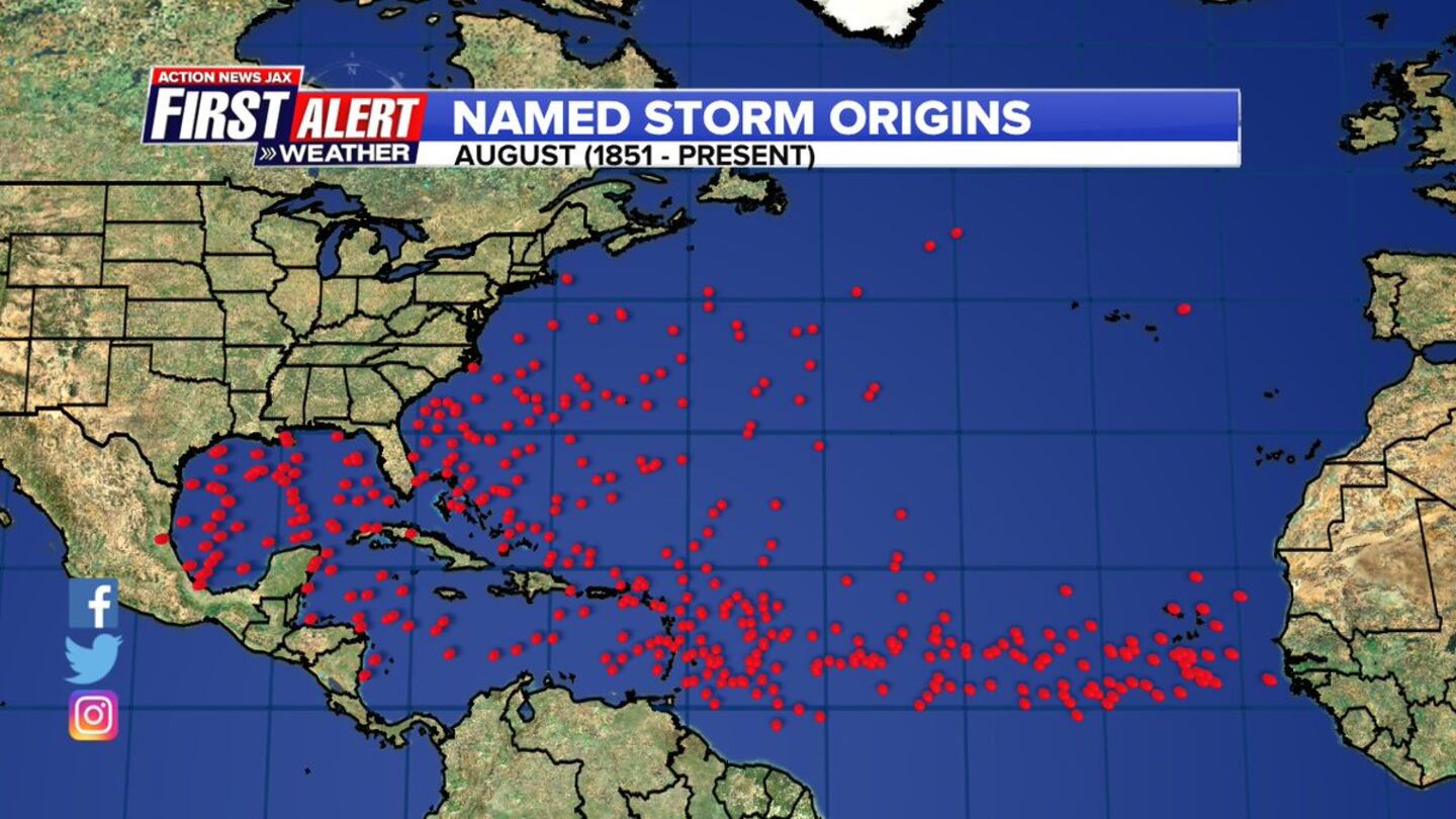
The Atlantic Basin typically starts to become more active in August. The map below was prepared by Action News Jax Certified Broadcast Meteorologist Garrett Bedenbaugh courtesy data documented by Dr. Phil Klotzbach:
The W. Pacific...... "Noru" will make a long term move toward the south tip of Japan over the next week....

"Noru":

Cox Media Group


