
Oct. 13, 2016 — Powerful hurricane "Nicole" pounding Bermuda....

"Nicole" continues over the Central Atlantic & is hammering Bermuda. There will be no direct hit on the U.S. but -- while far to the east -- "Nicole" will still push an easterly swell to NE Fl./SE Ga. & much of the U.S. east coast through the end of the week adding to the already elevated rip current risk & continued rough seas & surf at area beaches. "Nicole" is otherwise no threat to the east coast of the U.S. as the storm turns more northeast while crossing Bermuda & then will reside over the N. Atlantic for some time as the storm becomes extra-tropical. Click -- here -- for a radar loop from Bermuda. Bermuda is accustomed to hurricanes but a major hurricane is less common. According to the NHC, there have only been 7 major hurricanes to pass within 40 miles of the island since 1851. "Nicole" is the third "major" (Cat. 3+) hurricane of the Atlantic season - the most since 2011.

Model spaghetti plots for "Nicole":

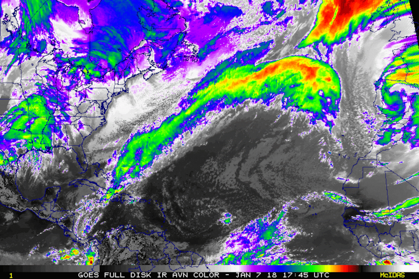
Zoomed in satellite imagery of "Nicole":


Water vapor imagery..... the big "spin" over the Eastern Atlantic is large upper level low. Dry mid & upper level air is expansive across the Gulf of Mexico:

The wind shear (red lines represent strongest shear) analysis:
0
Gulf of Mexico:
1
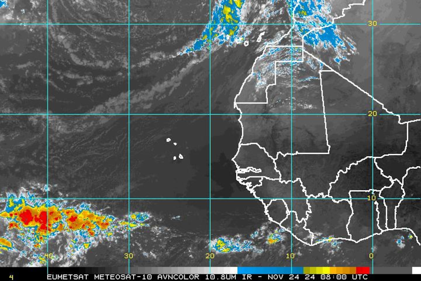
East Atlantic:
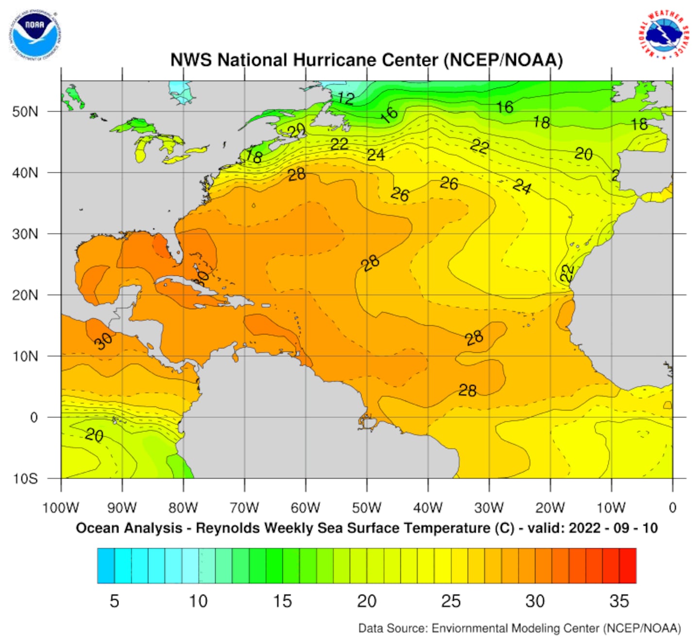
Lots of warm water remains to help "feed" tropical cyclones. Water temps. of 28 degrees Celsius equate to 82 degrees Fahrenheit. Tropical cyclones generally need at least 80 degree water to thrive.
Sea surface temps. vs. average:

Long range global forecast models are hinting at possible Caribbean development the last 10-12 days of Oct. that might be tied to tropical waves & "disturbed" weather now over parts of the Central & Eastern Atlantic. But a more likely scenario could be an extended period of a lowering of the overall pressure pattern over the Caribbean (as high pressure genearlly dominates northern latitudes) that eventually gives birth to a tropical cyclone. I've seen such occur often late in the season. The Caribbean & nearby areas are definitely an area to watch but there's nothing imminent. I should note that it appears a fairly strong upper level trough could sweep across or near the Southeast U.S. a week from this weekend so any tropical mischief over the Caribbean might -- at that point -- get pulled north or northeast. Time will tell.


Cleanup continues from Virginia to Florida following one of the more destructive hurricanes to impact the U.S. in many years. "Matthew's" only U.S. landfall -- but third overall -- was a hit 0n the upper S. Carolina coast not far from Myrtle Beach Sat. morning (previous landfalls were Haiti & Cuba). The land interaction deteriorated the core enough so that no redevelopment occurred once back over water thus ending any threat for a loop. A new coastal inlet in extreme Southern St. Johns Co. was confirmed by the Jax N.W.S. Wed. I am working on a write-up regarding "Matthew", but I am days from its completion. In the meantime, you can find pics & reports on my Twitter account + Facebook fan page.
The Jax N.W.S. has posted a preliminary synopsis -- including top wind gusts & rainfall & county by county breakout of the some of the more hard hit areas of Duval, St. Johns, Nassau, Putnam & Clay Co. -- with much more detailed info. to follow.

Cox Media Group


. The land interaction deteriorated the core enough so that no redevelopment occurred once back over water thus ending any threat for a loop this week.</p> <p>The Jax N.W.S. has posted a <a href="http://nws.weather.gov/blog/nwsjacksonville/2016/10/09/quick-review-of-major-hurricane-matthew/">preliminary synopsis</a> -- including top wind gusts & rainfall & county by county breakout of the some of the more hard hit areas of Duval, St. Johns, Nassau, Putnam & Clay Co. -- with much more detailed info. to follow.</p> <p><img src="http://nws.weather.gov/blog/nwsjacksonville/wp-content/uploads/sites/7/2016/10/Hurricane-Matthew-Track.png" border="0" alt="" width="479" /></p> <p><img src="http://www.ssd.noaa.gov/goes/east/eaus/rb-l.jpg" border="0" alt="" width="479" /></p> <p><strong>Meanwhile.... "Nicole"</strong> continues over the Central Atlantic & is turning northward with Bermuda in its sights. There will be no direct hit on the U.S. but -- while far to the east -- "Nicole" will still push an easterly swell to NE Fl./SE Ga. through midweek aided by onshore flow only adding to the already elevated rip current risk & continued rough seas & surf at area beaches - through mid to late week.</p> <p><img src="http://www.nhc.noaa.gov/storm_graphics/AT15/refresh/AL1516W5_NL+gif/145259W5_NL_sm.gif" border="0" alt="" width="479" /></p> <p>Model spaghetti plots for "Nicole":</p> <p><img src="http://www.sfwmd.gov/sfwmd/common/images/weather/plots/storm_15.gif" border="0" alt="" width="479" /></p> <p>3-5 foot waves forecast by Wed. at Fl. beaches:</p> <p><img src="http://polar.ncep.noaa.gov/waves/WEB/multi_1.latest_run/plots/US_eastcoast.hs.f045h.png" border="0" alt="" width="479" /></p> <p>Zoomed in satellite imagery of "Nicole": </p> <p><img src="http://www.ssd.noaa.gov/PS/TROP/floaters/15L/imagery/avn0-lalo.gif" border="0" alt="" width="479" /></p> <p><img src="http://www.ssd.noaa.gov/PS/TROP/gglcontent/natl.gif" border="0" alt="" width="479" /></p> <p><img src="http://www.ssd.noaa.gov/goes/east/carb/rb-l.jpg" border="0" alt="" width="479" /></p> <p><img src="http://www.nhc.noaa.gov/tafb_latest/WATL_latest.gif" border="0" alt="" width="479" /></p> <p><img src="http://www.nhc.noaa.gov/tafb_latest/atlsea_latestBW.gif" border="0" alt="" width="479" /></p> <p><img src="http://www.nhc.noaa.gov/tafb_latest/graphicast_at_latest_sm3.png" border="0" alt="" width="479" /></p> <p>Water vapor imagery:</p> <p><img src="http://www.ssd.noaa.gov/goes/east/tatl/wv-l.jpg" border="0" alt="" width="479" /></p> <p>The wind shear (red lines represent strongest shear) analysis:</p> <p><img src="http://tropic.ssec.wisc.edu/real-time/atlantic/winds/wg8shr.GIF" border="0" alt="" width="479" /></p> <p>Gulf of Mexico:</p> <p><img src="http://www.ssd.noaa.gov/goes/east/gmex/avn-l.jpg" border="0" alt="" width="479" /></p> <p>East Atlantic: </p> <p><img src="http://www.ssd.noaa.gov/eumet/eatl/avn-l.jpg" border="0" alt="" width="479" /></p> <p>Lots of warm water to help "feed" tropical cyclones. Water temps. of 28 degrees Celsius equates to 82 degrees Fahrenheit. Tropical cyclones generally need at least 80 degree water to thrive. </p> <p><img src="http://www.nhc.noaa.gov/tafb/atl_anal.gif" border="0" alt="" width="479" /></p> <p>Sea surface temps. vs. average:</p> <p><img src="http://www.nhc.noaa.gov/tafb/atl_anom.gif" border="0" alt="" width="479" /></p> <p>Long range global forecast models are hinting at possible Caribbean development the last 10-12 days of Oct. that might be tied to tropical waves & "disturbed" weather now over parts of the Central & Eastern Atlantic but there's nothing imminent.</p> <p><img src="http://www.ssd.noaa.gov/goes/east/tatl/avn-l.jpg" border="0" alt="" width="479" /></p> <p><img src="http://www.ssd.noaa.gov/goes/east/tatl/avn-animated.gif" border="0" alt="" width="479" /></p>)