
July 16, 2017 — A large & strong upper low is over the W. Atlantic several hundred miles east/northeast of the Bahamas - no tropical development expected....

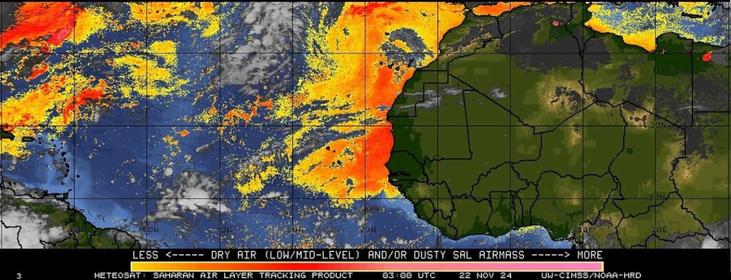
Imagery below courtesy CIMMS shows a well established "blob" of African Saharan dust (orange & red) continues over the Central & especially E. Atlantic - an indication of dry air.
The Gulf of Mexico... Caribbean & SW Atlantic... a tropical wave - '95L' - is 500+ miles east of the Lesser Antilles. There is some potential for long range development & hurricane hunter aircraft are scheduled to investigate this wave Mon. afternoon though the flight may very well be cancelled.

Spaghetti plots for wave '95L':


Water vapor imagery:

Surface analysis centered on the tropical Atlantic:

Surface analysis of the Gulf:

Caribbean:

Wind shear analysis - pretty harsh across the Central Atlantic & much of the Caribbean (typical for July):
0
Tropical waves are moving off the coast of Africa but are not particularly impressive. The area is largely being held in check by the Saharan dust plume alluded to earlier.... & the "popcorn" type cloud cover from 10 to 30 degrees N (also visible in the 4 image from the top) is indicative of stable air. The overall environment for tropical cyclones over the deep tropics will become more conducive for tropical development the last 10-12 days of July, so the Central Atlantic will remain an area to watch.
1
In the E. Pacific.... powerful hurricane "Fernanda" is over open water & will move steadily northwest then bend more west with a weakening trend for much of the upcoming week well before reaching Hawaii.


Cox Media Group


