Sept. 8, 2017 — HURRICANE IRMA: Latest updates, shelter info, evacuation info
STAY INFORMED: First Alert Weather app (latest track, radar, warnings)
There is a hurricane warning for parts of South Florida and the Florida Keys and eventually hurricane or tropical storm watches will likely be issued for parts of Northeast Florida and Southeast Georgia.
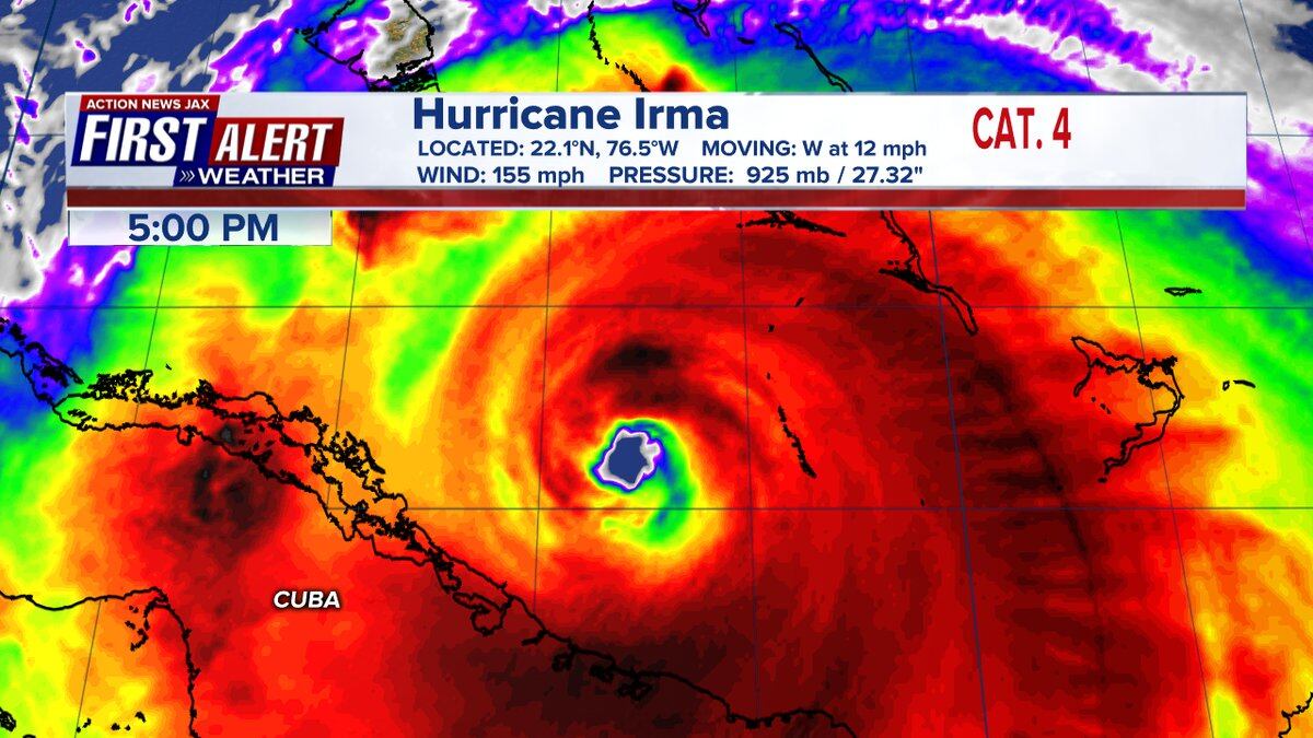
Good deal of uncertainty continues regarding the final path of Irma in the long range.... models seem to be "settling down" at this point.... Hurricane warning for all of the Bahamas... & north coast of Cuba...
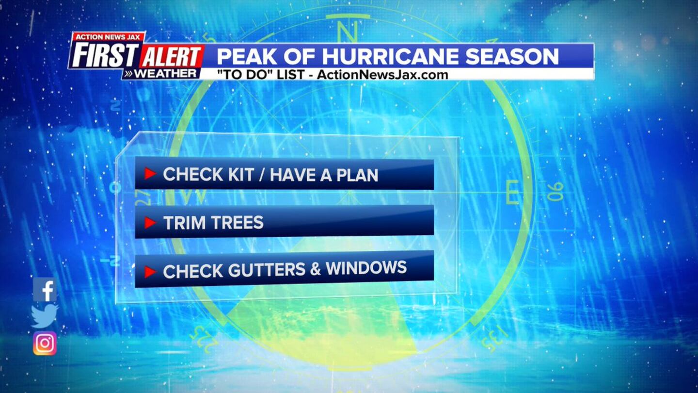
The "Buresh Bottom Line" is: stay tuned!... Always be prepared!..... City of Jacksonville Preparedness Guide... Georgia Hurricane Guide.
It's still a little too early to pinpoint exact & especially magnitude local (Jacksonville/NE Fl./SE Ga) impacts, but I am certain that there will be at least some impact Sunday through Mon. in the form of heavy rain, strong onshore flow & winds, storm surge, flooding & a few tornadoes.
IT IS STILL QUITE LIKELY THAT THERE WILL BE ADJUSTMENTS IN THE FORECAST TRACK FOR HOW CLOSE TO JACKSONVILLE THE EYE WILL BE EARLY MON.... EVEN EAST OF JACKSONVILLE IS STILL POSSIBLE!.........
NE FL./SE GA:
- high winds arrive during the day Sunday & peak Sunday night-Mon. .... ranging from 40 - 70 mph sustained, higher gusts. Breezy onshore flow will precede the true Irma winds with gusts of 30-40 mph as early as Saturday, especially with any rain bands.
- storm surge flooding will begin by Sunday and continue into Monday. Surge values appear destined to average 3-5 feet above ground level along the coast, 2 - 4 feet for the intracoastal & 2 - 4 feet along the St. Johns River, but will vary depending on topography & exact location/intensity of Irma.... & especially the relation to the approach angle to the coast vs. river.
- heavy rain from fringe Irma bands may affect the local area as early as Saturday but "prime time" will be Sunday - Monday. Rainfall will average 5 - 10 inches but could reach a foot or more near the coast. In fact, as much as 5" of rain fell Fri. afternoon in parts of St. Johns Co.
- a few tornadoes & waterspouts will likely occur
This does - at the very least - look like a pounding for area beaches. Areas hit hard by Matthew less than a year ago are potentially especially vulnerable. If you are told to evacuate, then evacuate is what you should do. If utilities are cut &/or compromised, you could have no modern conveniences for days. If flooding is considerable, you could become isolated & will have to deal with fire ants (see Texas during Harvey), snakes & other wildlife that might be seeking refuge.
Worst case scenarios point to a storm with greater impacts/consequences for some areas than hurricane Matthew last Oct. It is important that you do not make decisions based on trying to compare Matthew to Irma as the comparison is not apples to apples, so to speak. At the moment, I would appear inland winds will be stronger than with Matthew along with a higher threat of tornadoes while the storm surge will not as severe with Irma.
Know your evacuation zone......
"Irma" remains a classic deep tropics long track (trans-Atlantic) hurricane. Changes in structure (eyewall replacement cycles) from time to time will lead to fluctuations in intensity but Irma - overall - should remain a major hurricane into the weekend. In fact, an eyewall replacement cycle was completed Fri. morning followed by another cycle early Fri. evening (most recent of multiple such cycles since Irma matured). Once the cycle of the outter / old eyewall giving way to a new tighter inner eyewall is complete, some restrengthening will be possible. Satellite imagery shows a well developed hurricane with a concentric (2) eyes & excellent outflow over the top. NOAA hurricane research planes are flying through (avg. 1,000-10,000 feet) & around "Irma" pretty regularly giving us a better idea of the structure & intensity & - above all - hopefully add to some consistency & accuracy in model forecasts assuming better analysis/input for the models.
I cannot emphasize enough -- forecasting exactly where Irma is going to go in the long run is still difficult. But it's becoming more & more obvious that there will be direct impacts in one form another & to one degree or another for much of the area from Fl. to the Carolina's to Virginia. Stay cool, calm & collected... NOW is the time to prepare:(1) peak of the hurricane season is upon us
(2) you'll be prepared for anything mother nature throws at us - hurricane, lightning, flooding, tornadoes, etc. Preparations do not need to take a long time nor do preparations need to be expensive. But preparing now will offer peace of mind for when & if a storm is headed your direction & will also give you a better chance to survive the storm then allow you thrive after the storm.
(3) know your evacuation zone
Forecast models are still jumping some but have seemed to generally stabilize recently. The GFS, European & - finally - now the UKMET are sensing the weakness over the Eastern U.S. which Irma is likely to follow - the million dollar (literally!) question is when & how much. The UKMET is still farthest south & west initially before a sharp turn north & implies some land interaction with Cuba - then a turn north/northeast to near Jacksonville Mon. (The UKMET has had a tendency to be a bit too far south with Irma)... the GFS is farther east but takes the center a little west of Jax... the European is inbetween moving right up the spine of Florida before bending northwest near the Fl./Ga. border. More adjustments & changes are ahead - it would be prudent to not hang on each & every individual model run but rather look at the bigger picture in the coming days. The mountainous terrain of Cuba still might come into play but not for long. And any building/movement &/or strengthening of the Bermuda High - which has been a strong mainstay for months - makes full storm recurvature more difficult - this is a sentence have had in this blog since early last week & is obviously now coming into play. The model's differences seem to be related to the upper level trough over the Eastern U.S. & just how strong the Bermuda high remains. The models farther west show the trough backing up a bit to the west which allows Irma to move over or very near Florida. We have to look for slowing of this large hurricane before it can make the northward turn - laws of physics generally won't allow for a dead turn north while steadily moving W/NW. So we should see some slowing by Sat., & that will be our clue that the northward turn should soon follow.
There will be quite an increase in mid & upper level shear once Irma starts to gain latitude not to mention being over land so once over Fl., there should be fairly steady weakening.
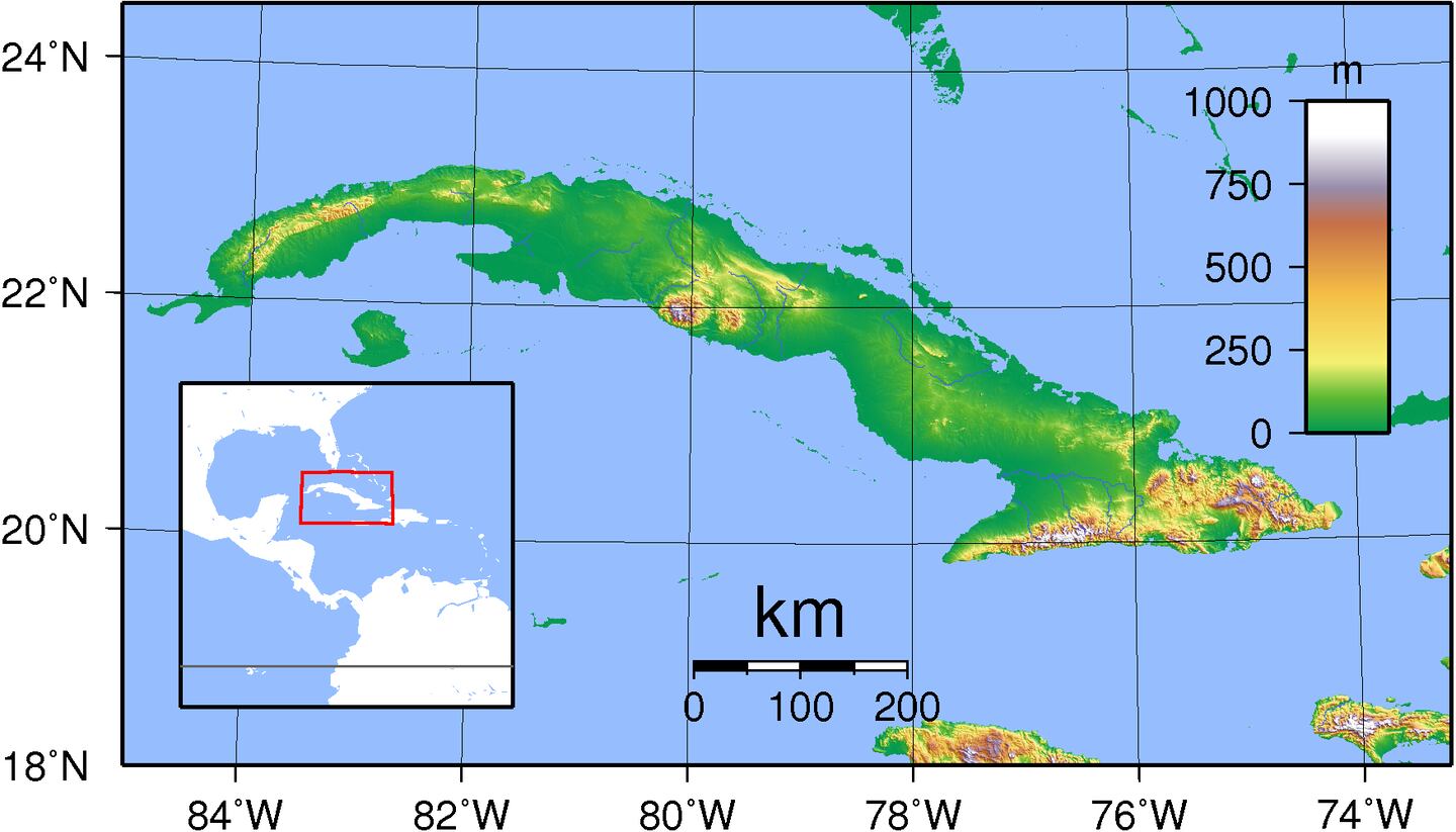
Topographical map of Cuba shows the highest mountains in the Central & far eastern parts of the country are not likely to come into play as much as the lower elevation northern coast.
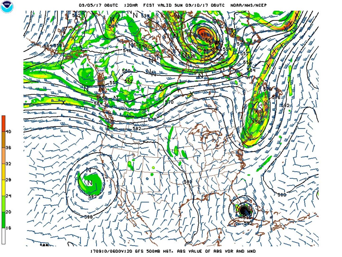
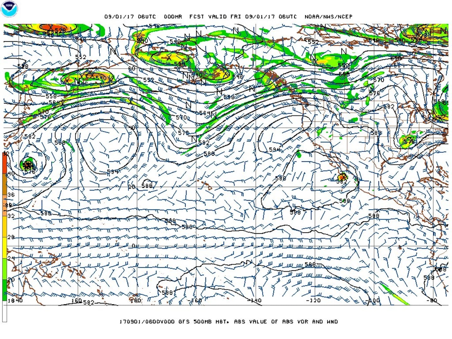
A rather deep upper level trough over the Eastern U.S. today will play a pivotal role in the eventual movement of "Irma" (that's why extra weather soundings are being released in the Midwest). The GFS model upper level (500 mb) chart below for Sun., 09/10 shows the strong trough lifting out far to the north & not picking up Irma but still leaving behind the clear alleyway along the U.S. east coast. As the trough lifts out, a strong surface high will build into the Northeast U.S. which will block Irma from getting too far north while an upper level ridge builds underneath the departing trough. This puts the coastline from Fl./Ga. to Virginia on high alert!.... with a move that will be into Florida & quite possibly close to Jacksonville by Monday. And by no means is this set in stone!
I still believe an abrupt turn to the north will occur Sat. - Sat. night. The question becomes when & where. But it is clear - to me - the big eastern U.S. trough will be fast moving & transient & that "Irma" does not get sucked up into the trough & taken far to the east over the Atlantic. In other words, no escape route & the question is what part of the U.S. coast line is most at risk & then gets hit the hardest.
SUMMARY:
Global forecast models will continue to try to correct into Sat. A combination of plots from each model's run (ensemble) points to near Florida over the weekend/early next week.
People have been asking about a "way out" - where Irma doesn't impact Florida at all or at least that Irma weakens ... or even the U.S. While that seems unlikely, there are 2 possibilities that aren't off the table:
(1) land interaction with Cuba - this is the "best" possibility but, of course, would be bad for Cuba.
(2) a path far to the east. But even the most east solution would suggest profound impacts on Florida's coast as well as the Carolina's due to a likely bend to the northwest by Monday. This bend will have to be watched carefully & could translate into a big hit on coastal Georgia &/or the Carolina's.
Upper level (500 mb) chart below from GFS for early Sunday:

Camaguey, Cuba radar:


"Irma" model plots:


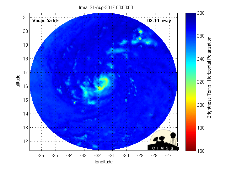
Fascinating imagery(!) from CIMMS, University of Wisconsin, Madison - Microwave radar-simulated imagery showing Irma wrapping up... click here for full definition..... as "Irma" rapidly tightens up then weakens....
0
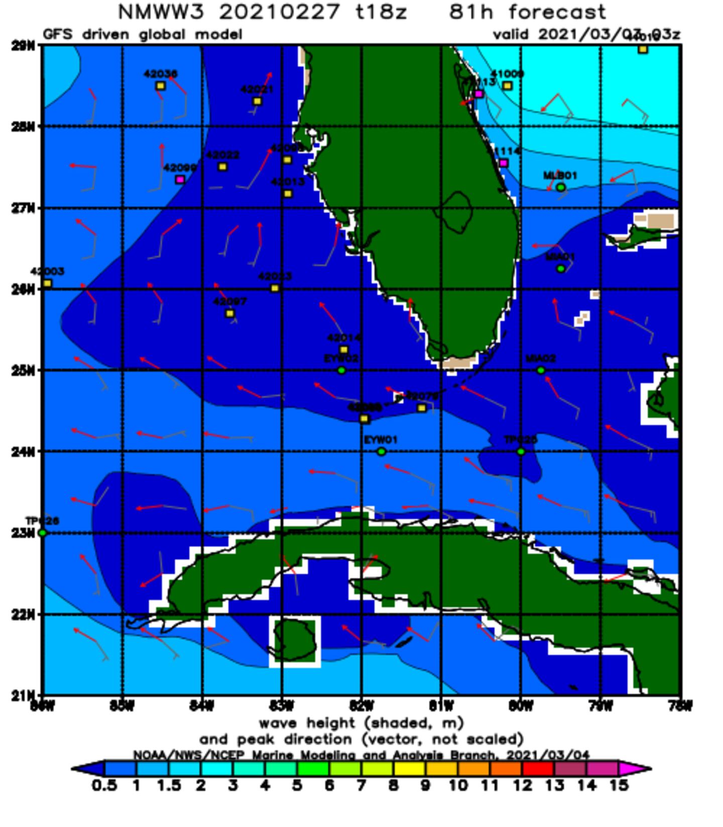
Wave forecast:.
NOAA WaveWatch III below predicated on GFS model - will change & update - hit refresh for latest + loop:
1
Hurricane "Jose" to the east/southeast of "Irma"... & Hurricane "Katia" Western Gulf of Mexico....

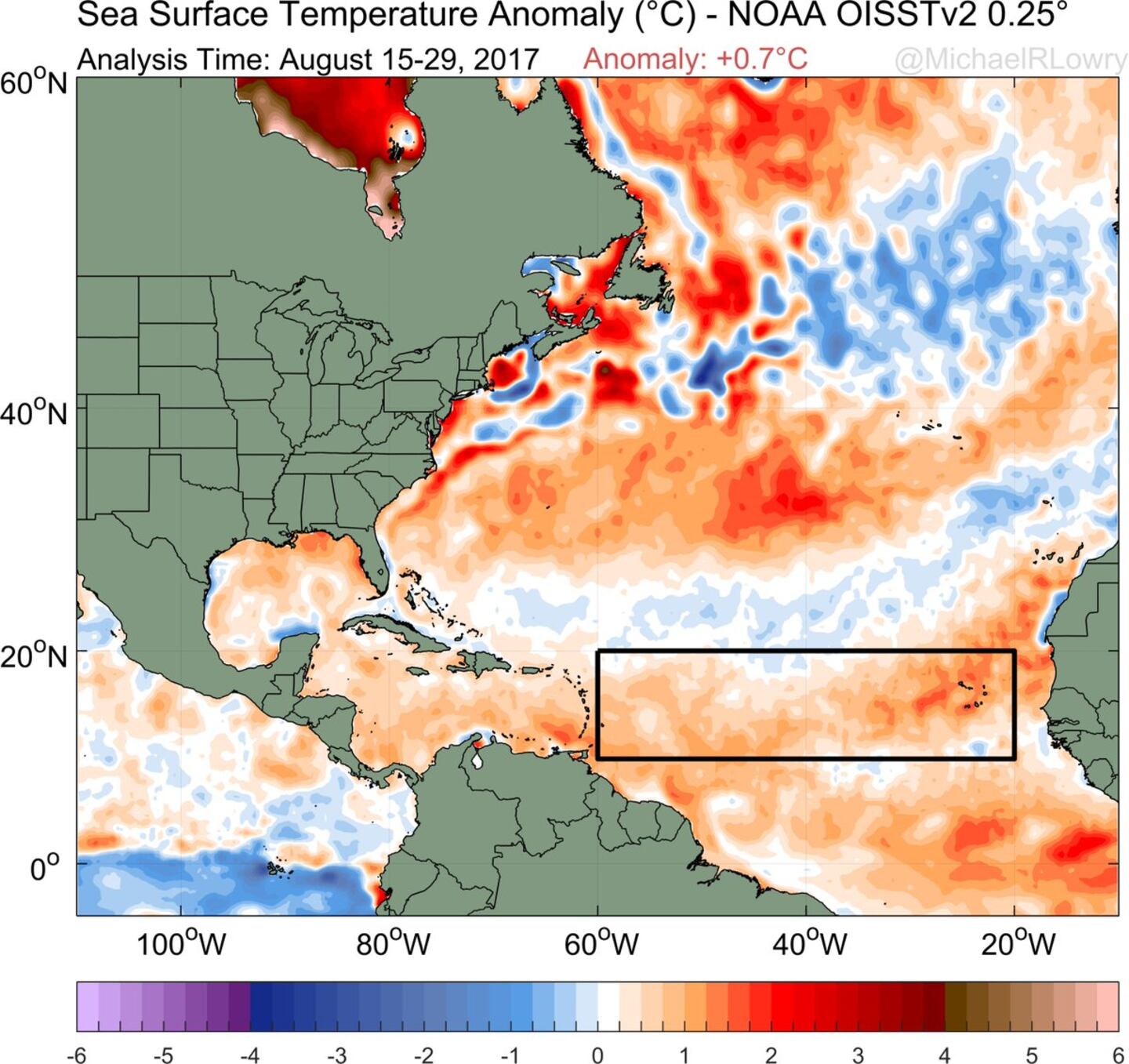
Very warm ocean water ahead for Irma:
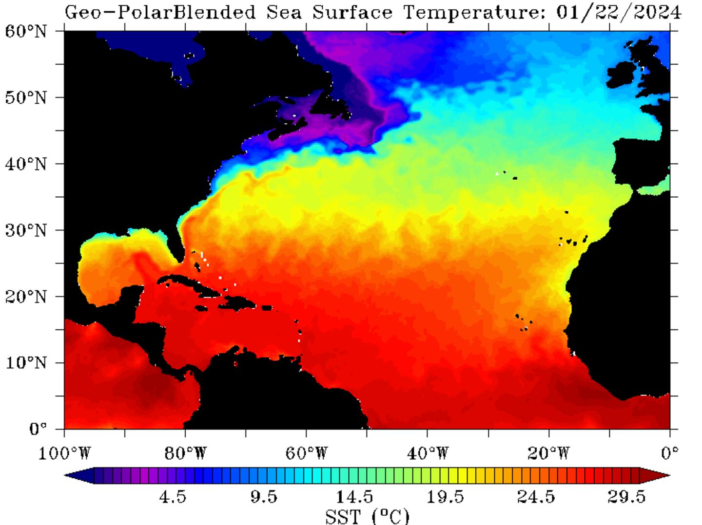
Even more telling - the oceanic heat content showing a wealth of deep warm water over the SW Atlantic/Caribbean & Gulf of Mexico:

And let's dust off our Pacific typhoon teleconnection for trying to forecast "Irma" - it's not quite exactly lined up but is becoming close enough to possibly draw some parallels. The 500mb chart below from the GFS for the N. Pacific to the Northern U.S. shows trough, ridge, trough, ridge, trough - the last trough being over or near the Eastern U.S. (it's what's picking up the "Harvey" remnants). The W. Pacific trough is picking up typhoon "Sanvu" keeping the tropical cyclone very near or to the immediate east of Japan with a recurve into the N. Pacific. This MIGHT be - & so far has been - an early clue that at least some semblance of troughing or alleyway will remain in place over or near the Eastern U.S. which COULD draw Irma northward near or over U.S. coast.

Satellite imagery below shows a band of clouds over the Eastern U.S./W. Atlantic - a weakening front that will be reinforced over the next couple days & is part of the weakness in the upper level flow that gradually pulls Irma northward....

Jose:
.... has become a hurricane & will languish in the "backwash" of Irma for many days but will impact the Northern Lesser Antilles over the weekend where warnings are in effect for some of the same islands hit by Irma! I'm still not certain this simply stays out to sea so bears watching in the long run - 10-14 days - for a possible loop then turn more to the west. At least a brush with the U.S. east coast is not out of the question as an upper level ridge rebuils underneath departing/decaying Irma & to the north of "Jose". At the very least it appears a loop will occur over the Central Atlantic about the middle of next week.


"Katia":
The 11th named storm of the season developed over the far W. Gulf of Mexico & has intensified into a hurricane. A strong upper level ridge over the Western U.S. should be the primary guiding influence on Katia pushing the storm more southeast then eventually west into Mexico as a hurricane. No impacts for the U.S. & no additional widespread significant rain for Texas or Louisiana from Katia.


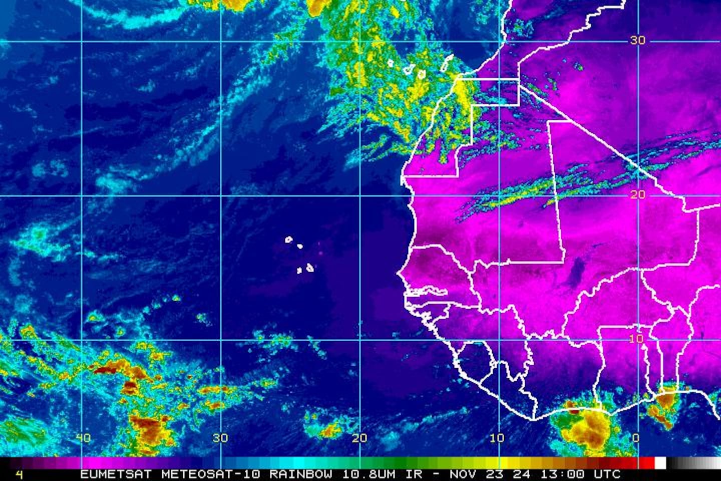
East Atlantic IR satellite:
Mid & upper level wind shear (enemy of tropical cyclones) analysis (CIMMS) - note how strong the shear is across the N. Gulf of Mexico, the north two-thirds of Fl. into the W. Atlantic:

The main development region (MDR) shows above avg. temps. - in fact - only 2005 & 2010 were warmer. The deep warm ocean water can "energize" tropical cyclones:
SE U.S. surface map - cold front is part of the equation for where Irma goes....


Surface analysis centered on the tropical Atlantic:

Surface analysis of the Gulf:

Caribbean:

Cox Media Group


