JACKSONVILLE, Fla. — Here’s what the First Alert Weather Team said you can expect for the forecast:
- Isolated showers and storms have popped Sunday afternoon
- A broken line of storms is pushing into our Southeast Georgia counties
- The best chance for rain into the evening will be north of I-10
- Monday’s rain coverage looks slightly more than today
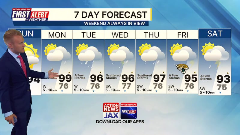
- The days turn even wetter with scattered storms mid-week
- We’ll still see a few storms each day for Friday and the weekend
- We’re tracking Friday evening’s forecast as it pertains to the Jags preseason game
- A few storms continue each day next weekend
- Temperatures remain above average to start the week
- We’ll trend slightly cooler by the weekend but it will still be hot
TROPICS
- No active storms and no development expected the next week

TONIGHT: Isolated shower/storm north of I-10, Partly Cloudy. Low: 76
TOMORROW: Partly Sunny, A Few Storms. High: 96
TUE: Partly Cloudy, A Few Storms. 76/96
WED: Partly Cloudy, Scattered Storms. 77/96
THU: Partly Cloudy, Scattered Storms. 76/97
FRI: Partly Sunny, A Few Storms. 76/95
SAT: Partly Cloudy, A Few Storms. 75/93
SUN: Partly Sunny, A Few Storms. 75/92
WATCH THE FORECAST | DOWNLOAD THE APPS
Follow Action News Jax Meteorologists on Twitter for updates:
Mike Buresh | Garrett Bedenbaugh | Corey Simma | Trevor Gibbs
ALLERGY TRACKER: See what the pollen counts look like in our area
LISTEN: Mike Buresh ‘All the Weather, All the Time’ Podcast
INTERACTIVE RADAR: Keep track of the rain as it moves through your neighborhood


