Sept. 11, 2018 — The "Buresh Bottom Line": Always be prepared!.....First Alert Hurricane Survival Guide... City of Jacksonville Preparedness Guide... Georgia Hurricane Guide.
STAY INFORMED: Get the (free) First Alert Weather app
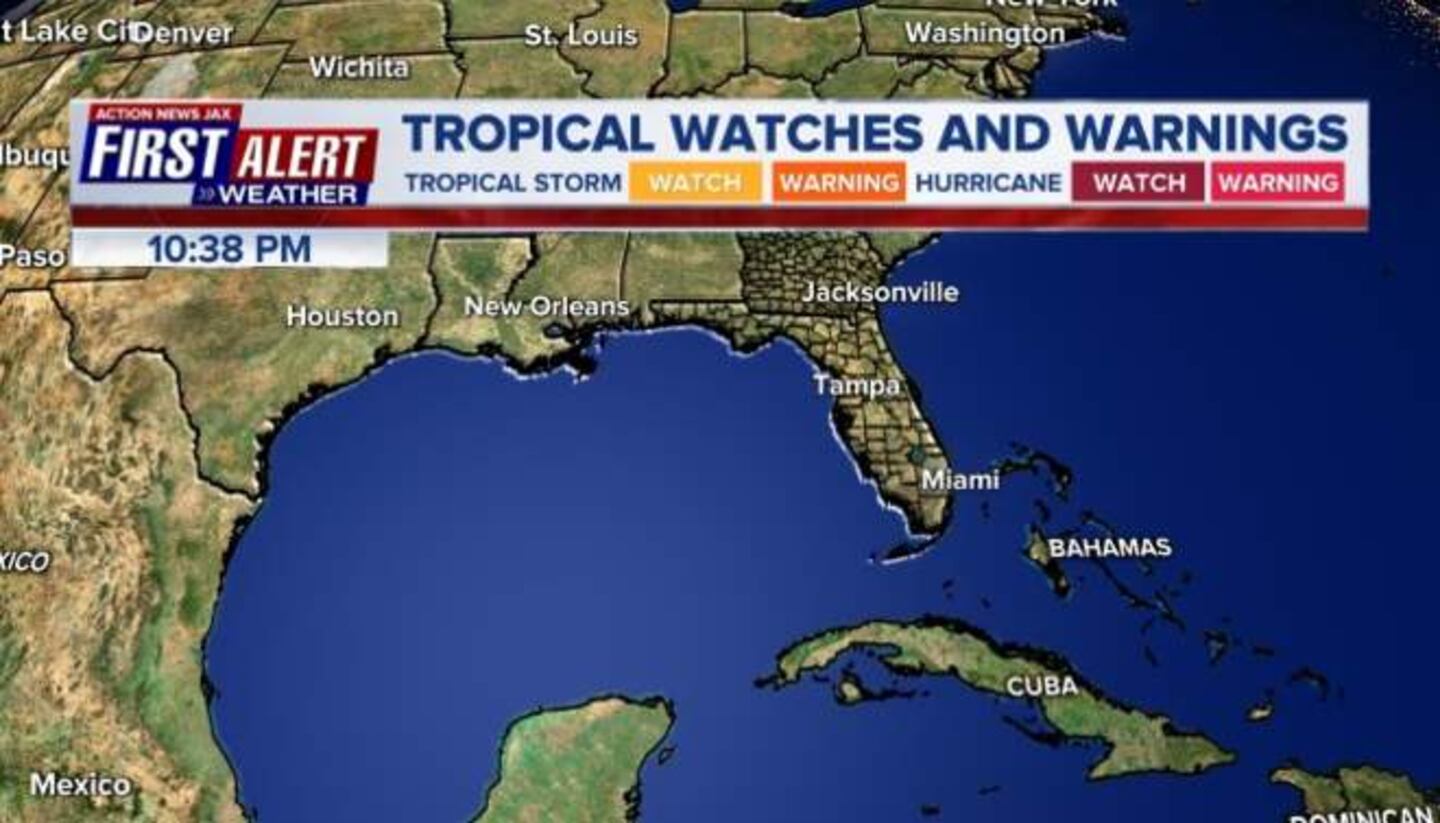
LOCAL - JACKSONVILLE & VICINITY - FLORENCE IMPACTS:
*An easterly swell at our beaches from distant Florence which will include a heightened rip current risk through Wednesday.
* Thereafter - Thu./Fri./Sat. - primary impacts look to be a breeze & very rough seas/surf & rip currents
* Stay up to date on the latest & potentially changeable forecasts. On the forecast track, Florence locally will primarily affect the beaches & ocean. All boaters should stay in port beginning Wed.
* Despite the wide span of Florence's winds & rain, no rain bands will directly affect NE Fl./SE Ga.... & - in fact - skies will be relatively sunny late in the week.
Everyone up & down the east coast of the U.S. - particularly the Carolina's - needs to stay vigilant regarding the latest forecasts...
If you have - or will purchase - a generator, make sure you understand the "in's & outs" - click here.


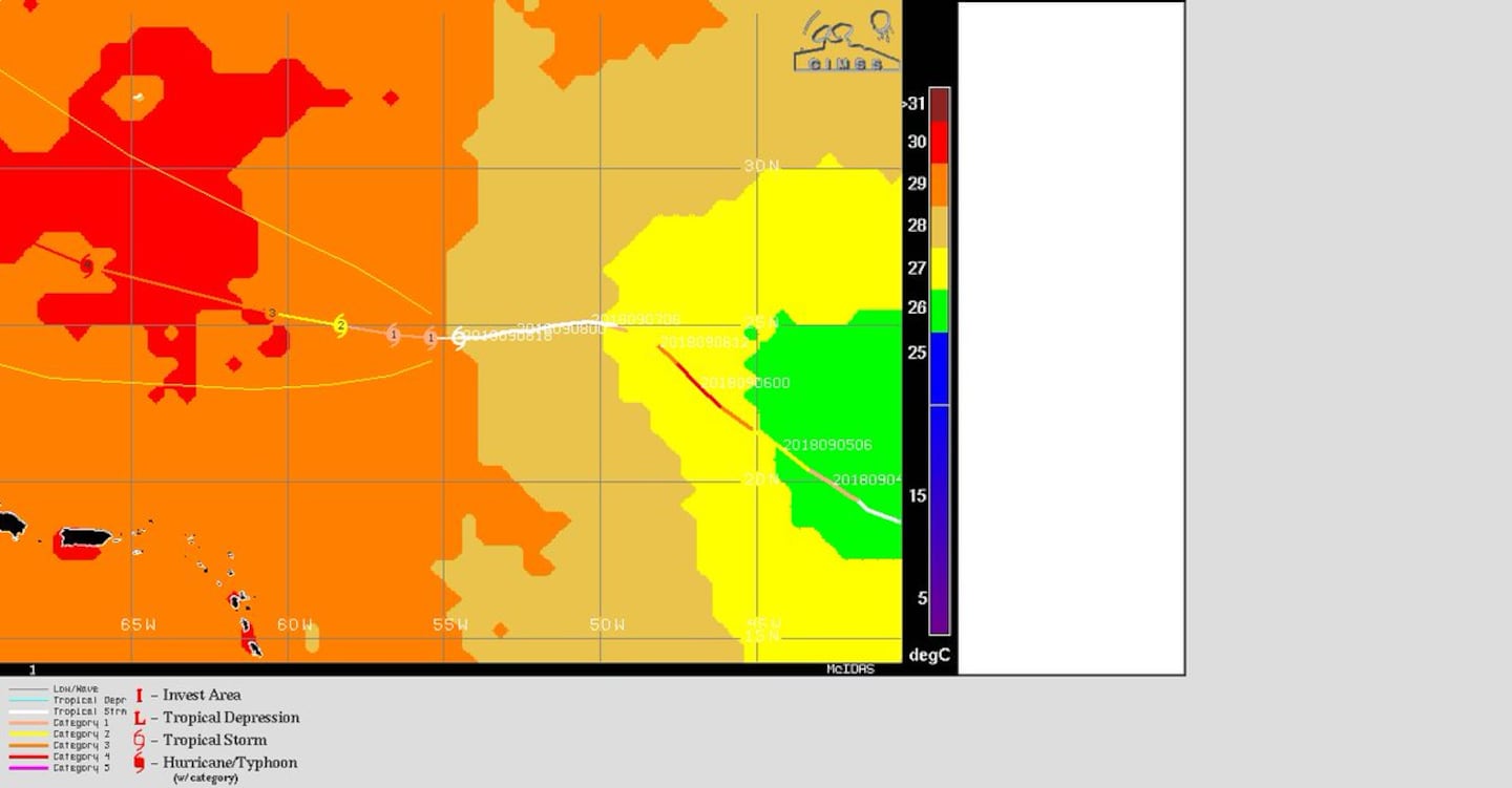
"Florence" which became the 3rd hurricane of the '18 Atlantic season Tue.... went "major" (Cat. 3 then briefly Cat. 4) Wed. ... fell apart in the face of shear & dry air Thu. continues over the Central Atlantic & has made the expected comeback reaching Cat. 4 strength again Mon. The tropical cyclone has - importantly - started to make the turn west/northwest & will accelerate while turning more northwest by late Tue./Wed. as a mature, powerful hurricane over the W. Atlantic reaching Jacksonville's latitude - BUT hundreds of miles to the east - late Wed./Wed. night.
It is pretty clear that a hit on the U.S. east coast is likely. Major to severe, if not catastrophic impacts can be expected on the S. & especially N. Carolina coasts. Don't make the mistake of getting too caught up in individual run output of any particular model.... OR in what unreliable sources might be posting.... OR tracking just the center!
As for the forecast models, there was a notable shift north over the weekend but seemingly a recent stabilization pointing to the Carolina's. This could be because of the aircraft analysis that was ingested into the computer models Sat./Sunday. Virtually all reliable global models are - for now - pointing at or near the Carolina's - not far from or a little northeast of Myrtle Beach to Wilmington to Morehead City. The UKMET, European & GFS models - have come into decent agreement on a monster hurricane near the Gulf Stream mid to late week then moving into N. Carolina &/or Northeast S. Carolina. The GFS has recently consistently been on the eastern side of the tracks showing a stalling hurricane at the N.C. coast... the European has been farther west & more inland before stalling.... & the UKMET is generally about in-between. For now... research aircraft is scheduled to continue gathering input for forecast models through at least Tue. in addition to special atmospheric soundings across the eastern half of the U.S. (4 balloon releases instead of the standard 2). This data will be in the model initialization hopefully leading to an even more accurate long term track & intensity forecast.
Bottom line at this point: East Coast needs to stay alert & up to date & one should always be prepared for what mother nature might have in store.
The ultimate track now hinges on how strong high pressure will be across the N. Atlantic westward into the Northern U.S. All indications are that the high pressure will build in strongly - much has been the case in recent weeks. But the orientation of the high will be important for the exact track, & I am concerned that models may not be producing a strong enough high. If true then Florence's track may end up being at least somewhat farther south but still into the Carolina's. Once the steering currents collapse, Florence will flounder over or near the Carolina's pounding the beaches with wave action & dropping tremendous amounts of rain - most significant of these impacts will be north & northeast of the center.
So overall.... the ridge is building in north of Florence, & the track is becoming more straight forward. The critical point - the fork in the road - when Florence is between Bermuda & the U.S. coast is here. I continue to favor a scenario that takes Florence well north of Jacksonville - perhaps near/northeast of Myrtle Beach possibly as far north as near Wilmington to Morehead City, NC, BUT that's not to imply such a forecast is set in stone or that the forecast can't/won't change. STAY UP TO DATE! As Florence slows upon nearing the coast, flooding problems & beach erosion - especially north of the eye could be tremendous.... & will also make pinpointing landfall + the intensity extra problematic.
So review hurricane plans, kits & do some work on & around the house before any severe weather moves in (cleaning storm drains, gutters, etc.). It looks like direct impacts on the U.S. will be from approximately Sept. 13-16th or so. Easterly swells emanating west from the hurricane are arriving at Jacksonville & other east coast beaches which will coincide with an increasing dangerous rip current risk far in advance of any direct impacts.
Bottom line: Don't panic but always be prepared.....
On satellite imagery.... Florence is well organized with good symmetry, good upper level outflow allowing for a rapid intensification cycle Mon. There are indications that the "wing span" of Florence will increase with time so stronger winds & rough seas/surf will occur far from the center. It also appears an eyewall replacement cycle occurred early Tue. which usually results in some weakening followed by another intensification cycle as long as the replacement cycle is not interrupted.


The map below is a mirror of the above spaghetti plots but shows an ensemble of all the model runs. DEFINITION OF ENSEMBLE MODELING: A set of forecasts that present the range of future weather possibilities. Multiple simulations are run, each with a slight variation of its initial conditions and with slightly perturbed weather models. These variations represent the inevitable uncertainty in the initial conditions and approximations in the models. They produce a range of possible weather conditions.
It's worth noting that there are a majority of model runs all the way to the U.S. There has been a definite trend west & - recently - north the last several days.
0
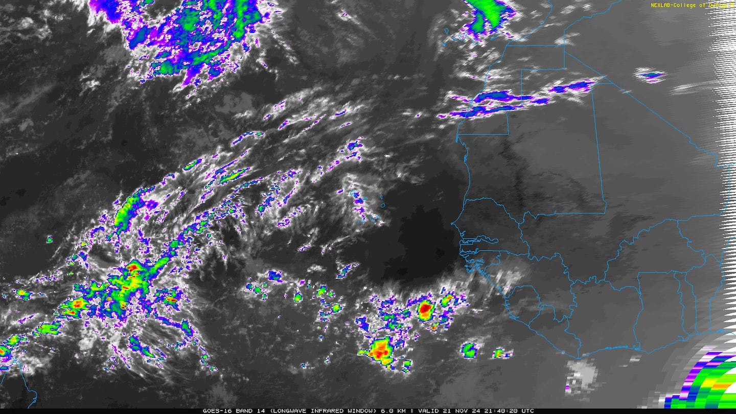
The Saharan dust (courtesy CIMMS) imagery shows just how dry the air is over the Central & Eastern Atlantic making Florence's rapid strengthening Wed. all the more remarkable. Some of that dry air was been ingested by Florence which took a while to "shake" out. But overall, the atmosphere is more moist, the shear less & the ocean water very warm to the west of Florence. Note Helene & Isaac will be up against the dry air as the systems move west &/or northwestward.
1
Florence will be traversing some very warm water:

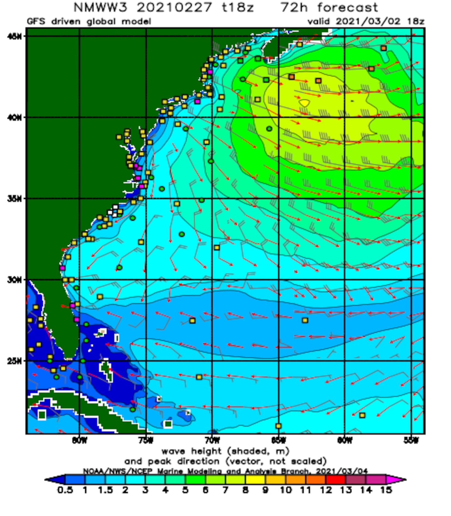
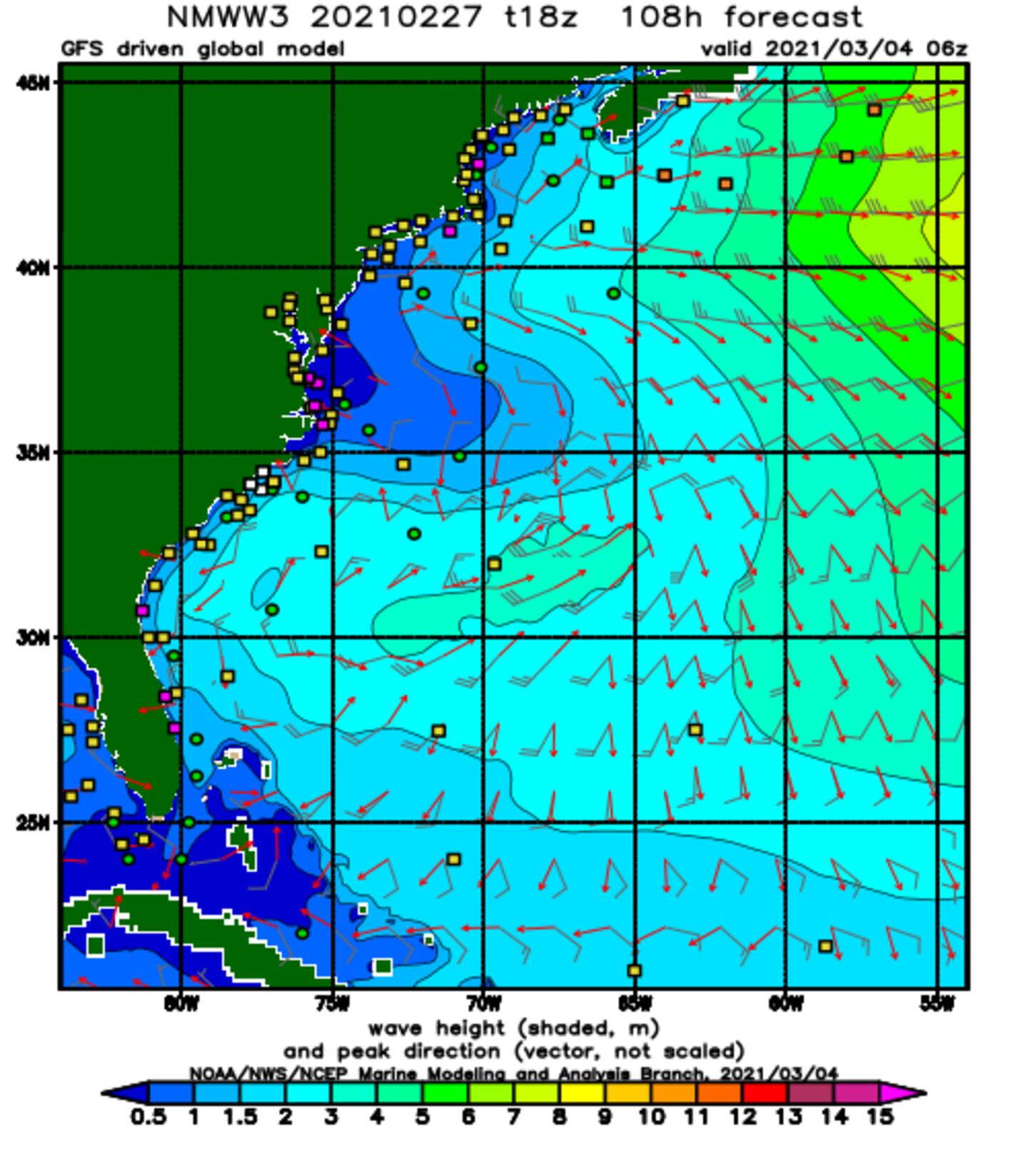
Wave height model (GFS) forecast... European model a little more south & west which - if verifies - wave heights would be higher for NE Fl./SE Ga. but still much more significant for the coastal Carolina's north to Chesapeake Bay:

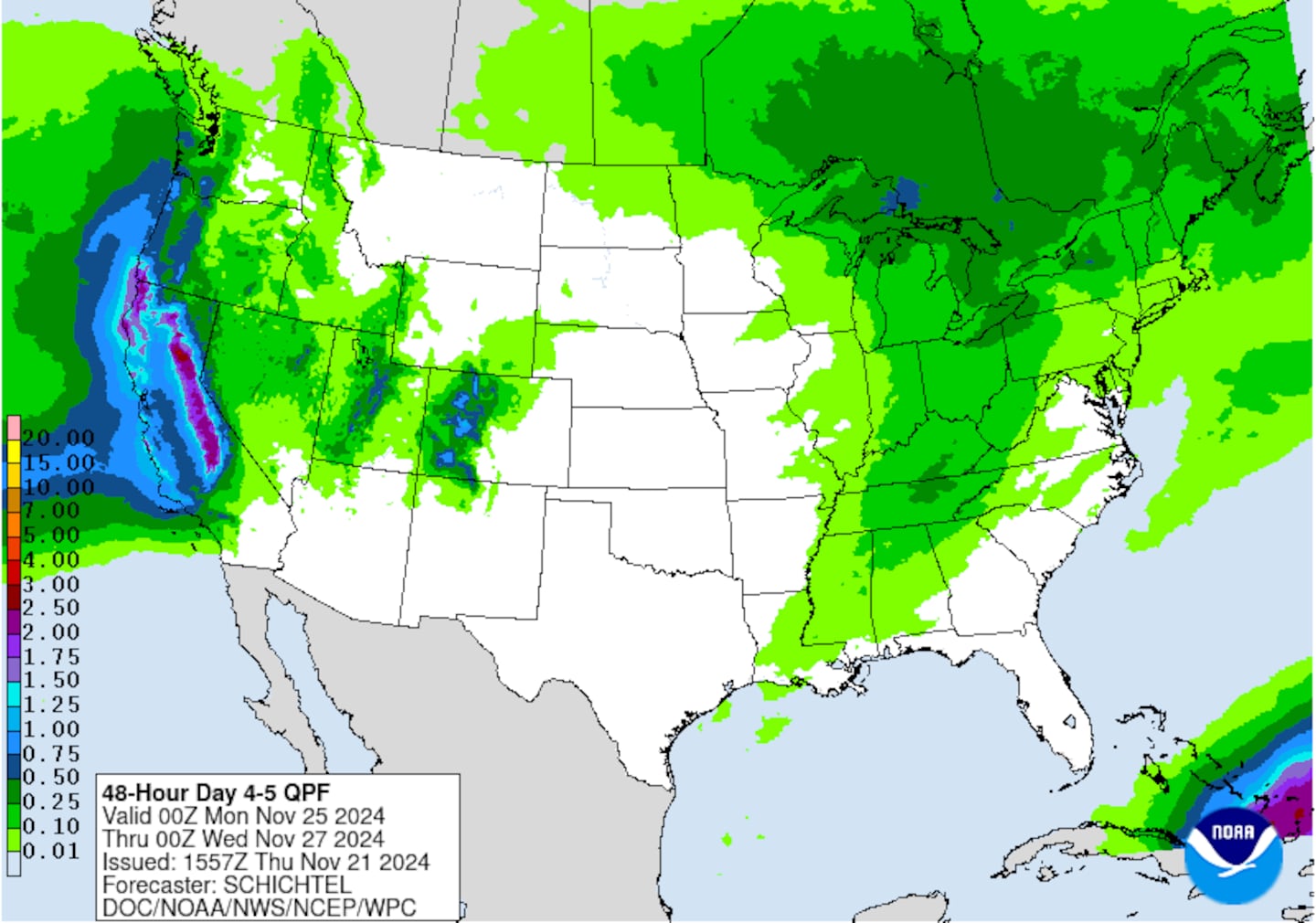
Heavy rain by late week middle east coast. Rainfall over parts of N. Carolina & Virginia may exceed 1-2 feet!:

Wide view of the busy Atlantic Basin. This is only the 11th time since 1851 that there have been at least 3 active hurricanes over the Atlantic at the same time (Klotzbach) though Isaac weakened back to a tropical storm Mon. evening.....

Helene & Isaac are over the far Eastern Atlantic. Isaac will move farther west over the Atlantic as high pressure tries to assert itself across parts of the Central/Northern Atlantic & underneath Florence. Just how strong the Bermuda high is - or is not - will go a long ways in determining whether or not Isaac makes it into the Caribbean though such a track seems to be likely with the question being intensity. Shear looks to stay strong over the Caribbean in the long run which should cause Isaac - a small tropical cyclone - to weaken pretty quickly. The GFS & European models are very similar in this regard while the UKMET model is more north which would have implications for some of the Greater Antilles as well as on intensity. Issac should be approaching the islands of the Lesser Antilles by Thu./Fri. - possibly as a hurricane but past its peak.
Helene, on the other hand, looks like a full recurve over the Central/ E. Atlantic as a powerful hurricane at times in its own right. Helene might interact with another system that will be developing over the N. Atlantic.... a system that could become subtropical or even tropical. Both, however, stay far to the east over the open Atlantic.
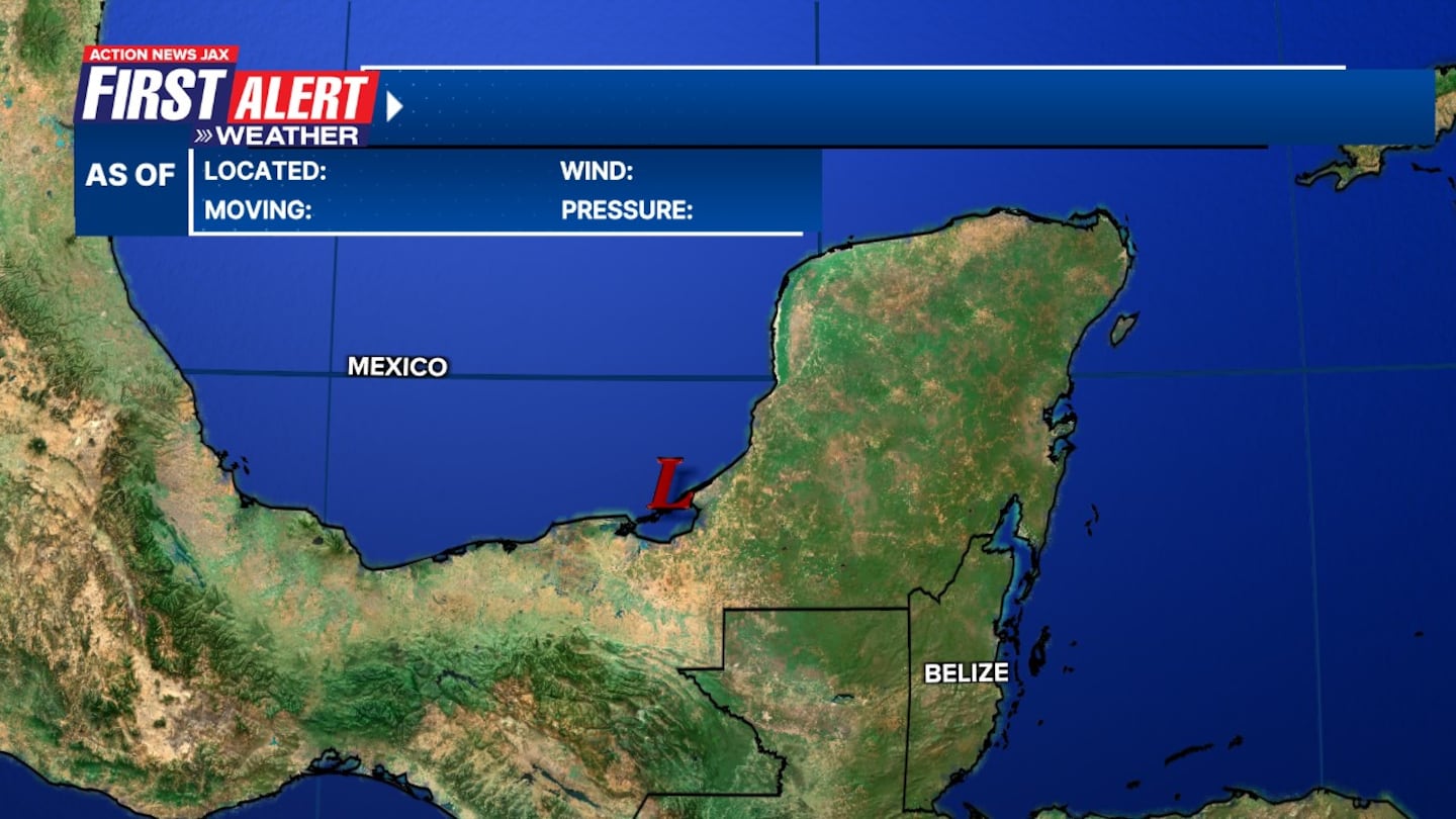
I'm also keeping an eye on the NW Caribbean &/or Gulf of Mexico for possible tropical development. There has been a persistent area of t'storms over the W. Caribbean - something to watch. Movement will be west/northwest, so this will be a Western Gulf "thing" & not a problem for Florida.

Isaac & Helene over the E. Atlantic:
Isaac:


Helene:


Mid & upper level wind shear (enemy of tropical cyclones) analysis (CIMMS). The red lines indicate strong shear. Note weaker shear in the path of Florence over the W. Atlantic while there's much stronger shear over the Caribbean......

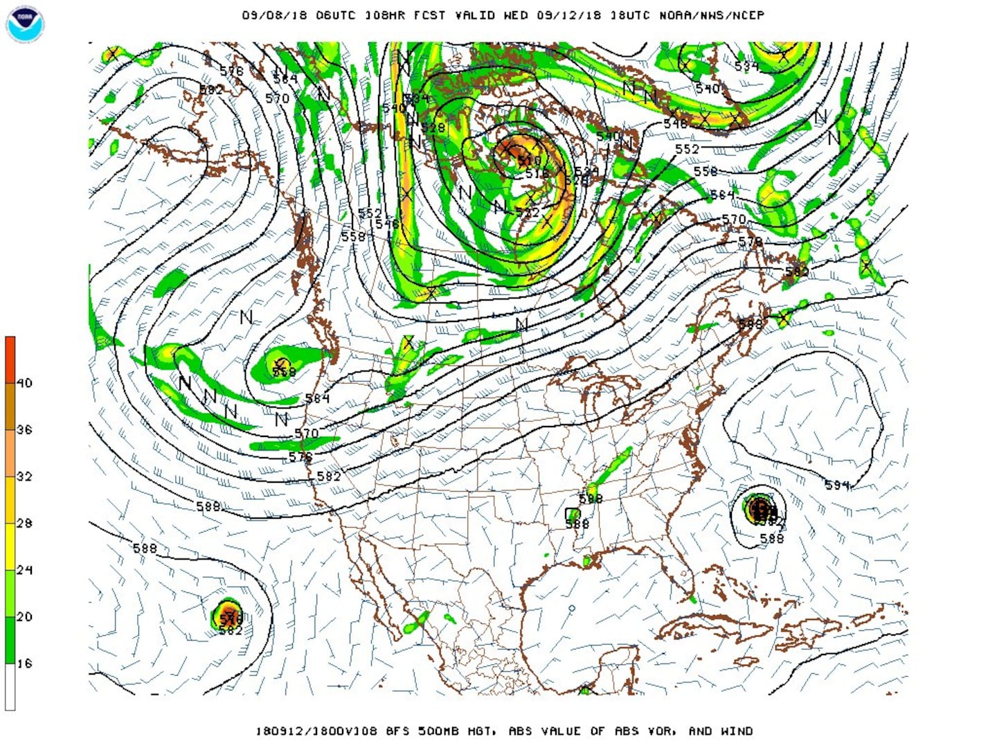
As a whole.... the well advertised Atlantic changes - regarding potential storm development, a mini hyper season of sorts - are underway & should continue into the middle of Sept. The uptick in activity coincides with a very persistent pattern of surface & upper level high pressure anchored over or near the N. Atlantic which implies lower pressures to the south (the ol' what goes up, must come down postulate). The upper level map below from the GFS model for Wed., Sept. 12th shows the upper level trough way too far north to pull Florence north, so the storm will move west or west/northwest underneath. The orientation, position & strength of high pressure ridges will help determine how far west Florence & other tropical systems might go. Combine this set-up with the approach of the peak of the season, less shear overall, warm ocean temps., lots of moisture & a MJO pulse, & you get an active period in the tropics/Atlantic Basin.
p>The Atlantic Basin....

Caribbean:
Gulf of Mexico:
Water vapor imagery (dark blue indicates dry air) - notice the dry air right up against Florence:
6
Deep oceanic heat content is seasonably high over the Caribbean, Gulf of Mexico & SW Atlantic as one would expect now that we're near the peak of the hurricane season....
7
Sea surface temp. anomalies show a general recent warming over a good portion of the Atlantic Basin including rather dramatic warming east of the Caribbean & near the NE coast of S. America ....

SE U.S. surface map:

Surface analysis centered on the tropical Atlantic:

Surface analysis of the Gulf:

Caribbean:

The E. Pacific remains a busy basin. Olivia is moving westward & will be near or over Hawaii - possibly as a tropical storm - by the middle of the week. A tropical storm WARNING is in effect for many of the islands. "Paul" follows over the Eastern Pacific but is not expected to threaten any land areas.
Olivia:


Cox Media Group