Here’s what the First Alert Weather Team said you can expect for the forecast:
- This morning is mild, with temperatures in the 70s under partly cloudy to mostly clear skies.
- Today will be hot with highs in the low to mid-90s.
- Feels-like temperatures will be 100-105 during the Jags game.
- The morning will remain dry, and the early afternoon will too. By the second half of the Jags game, a few widely scattered showers and storms may develop across northeast Florida.
- Storm coverage likely won’t be as great as Saturday, but storms will still be capable of producing brief heavy rain, frequent lightning strikes, and gusty winds.
- A few more storms are possible Monday before onshore winds develop late Monday night through the rest of the week.
- Highs will drop into the 80s Tuesday onward, with a few occasional heavy showers coming onshore.
WATCH THE FORECAST | DOWNLOAD THE APPS
TODAY: Partly cloudy and HOT, a few afternoon/evening storms. HIGH: 92 (Feels like 100-105F)
TONIGHT: Rain ending, then partly cloudy. LOW: 75
MONDAY: Partly cloudy and hot, a few afternoon storms. 75/92
TUESDAY: Partly cloudy and breezy, a few coastal showers. 74/88
WEDNESDAY: Partly cloudy and breezy, coastal shower. 75/88
THURSDAY: Partly cloudy and breezy, a few showers. 73/86
FRIDAY: Partly cloudy with a few showers. 73/87
SATURDAY: Partly cloudy with a few showers. 72/87

Follow Action News Jax Meteorologists on Twitter for updates:
Mike Buresh | Garrett Bedenbaugh | Corey Simma | Trevor Gibbs
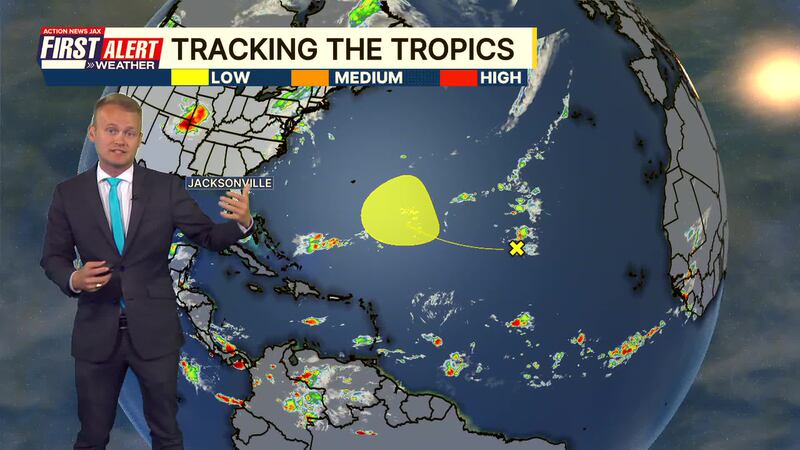
TROPICS:
- An area of low pressure may organize in the Central Atlantic that could gradually develop into something tropical. No threat.
- The next name is FAY.
ALLERGY TRACKER: See what the pollen counts look like in our area
LISTEN: Mike Buresh ‘All the Weather, All the Time’ Podcast
INTERACTIVE RADAR: Keep track of the rain as it moves through your neighborhood


