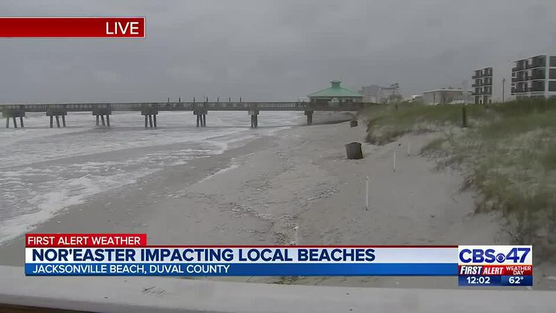
JACKSONVILLE, Fla. — Action News Jax’s First Alert Weather Team announced that Monday is a First Alert Weather Day as a nor’easter continues through Northeast Florida.
UPDATE 12:50 p.m.- Tides are beginning to come in as mid-day high tide nears on Northeast Florida beaches.
UPDATE 11:46 a.m.- An Action News Jax news crew is at Vilano Beach and report that one lane is closed while crews work to prevent water from going over the roadway. Workers are using bulldozers to make a sand dam.
UPDATE 9:50 a.m.- Several ramps closed at St. Johns County beaches due to flooding.
Ramps at A Street, Ocean Trace, Dondanville, Matanzas Avenue, Mary Street, and Crescent Beach are temporarily closed due to tidal flooding.
— SJC Beaches (@SJCBeaches) April 10, 2023
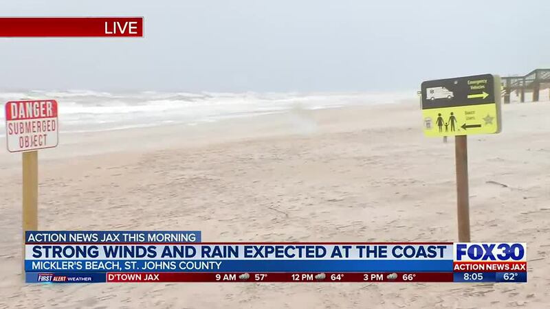
UPDATE 8:30 a.m.- There is a rip current warning at most Northeast Florida beaches, including Micklers Beach.
Action News Jax’s meteorologist Trevor Gibbs provided the following information in his early morning forecast:
- A strong nor’easter continues with its greatest impacts along the St. Johns River and Atlantic Beaches.
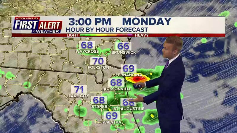
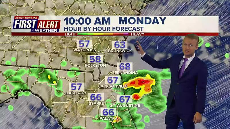
- Wind gusts reaching 30-45 mph are expected to continue throughout the day at the beaches. Gusts reaching 20-30 mph are expected inland.
- Locally heavy rains are expected, which will produce areas of flooding. Rain totals of 1-3″ expected in many spots east of I-95. The rain will taper off as it moves inland.
- Coastal flooding is possible with the mid-day high tide cycle and tonight’s high tide cycle.
- Tide gages across the area recorded last night’s high tide at 2 to 3 feet higher than normal, so this is the general expectation for today.
- Beach erosion remains likely around high tide due to high surf.
Action News Jax’s First Alert Weather Team will continue to track the storm and will update you throughout the day.
4:15 AM: Bands of heavy rain are advancing toward the St. Johns and Duval Co. coasts this morning. Along with gusty winds, prepare for a slower commute. @ActionNewsJax #firstalertwx #flwx pic.twitter.com/ocn6Ixs4ug
— Trevor Gibbs (@TrevorsWeather) April 10, 2023

©2023 Cox Media Group


