JACKSONVILLE, Fla. — The Action News Jax First Alert Weather Team has declared Saturday and Saturday evening a “First Alert Weather Day.”
Widespread showers and even a few strong storms are likely for the start of the weekend. Much of the severe threat depends on where a warm front setups and moves through the day. If Jacksonville sees more warm and dry hours than wet, the severe threat increases. If we see cloudy and rainy conditions, the severe threat drops a bit.
STORY: Moldovan prime minister resigns, government collapses
Here are some bullet points that may help you out:
- When: Saturday and Saturday night
- Morning: Numerous showers and a few heavy downpours likely
- Afternoon: Potential for a few strong to severe thunderstorms moving west to east across Northeast Florida.
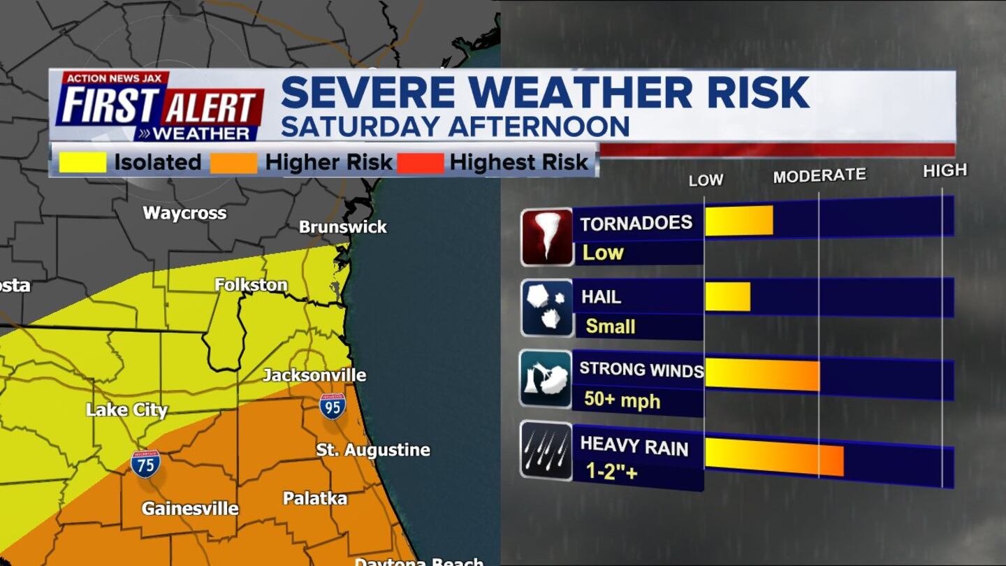
- Highest threat for strong storms appears to be along and south of I-10 in the afternoon
- Severe risks: Gusty winds of 50+ mph, isolated tornado
- Evening: Storm threat begins to lower with the loss of heating after sunset and an area of low pressure, and it’s associated cold front moves east-northeast of Jacksonville
- Overnight: Only a lingering shower as winds switch to out of the northwest at 10-15 mph
- Rain totals: Southeast Georgia 3-4″, Northeast Florida 1-2″ possible
STORY: Valentines day deals, restaurant specials Around Jax
We will drop to the upper 40s by Sunday morning and begin to clear out our sky. The Super Bowl watch parties will be dry, breezy and cool. Highs Sunday will only be in the upper 50s.
Chief Meteorologist Mike Buresh will provide an update later today in the evening.

©2023 Cox Media Group


