Dec. 1, 2017 — Photos: Must-see photos of Irma damage in Jacksonville area .... hurricane Irma recap
The "Buresh Bottom Line": Always be prepared!..... City of Jacksonville Preparedness Guide... Georgia Hurricane Guide.
The 2017 Atlantic Basin hurricane season will go down as the most costly ever - $202.6 billion... the most active since 2005... & the most U.S. landfalls since 2005.
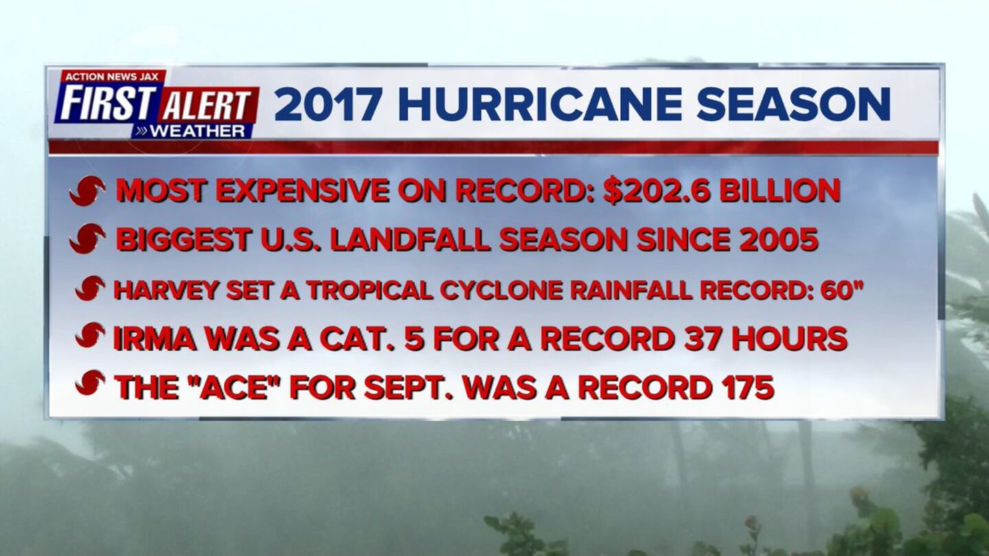
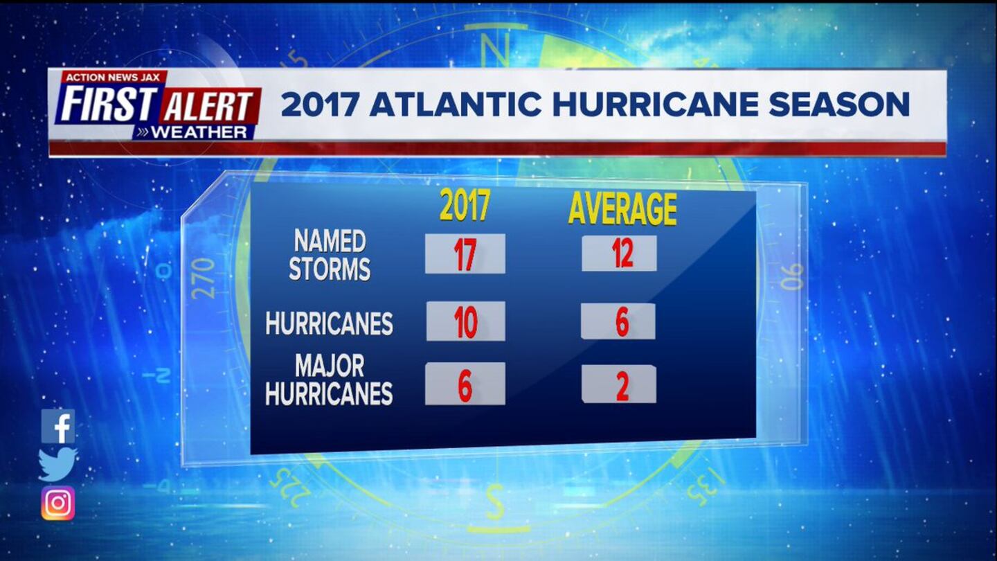
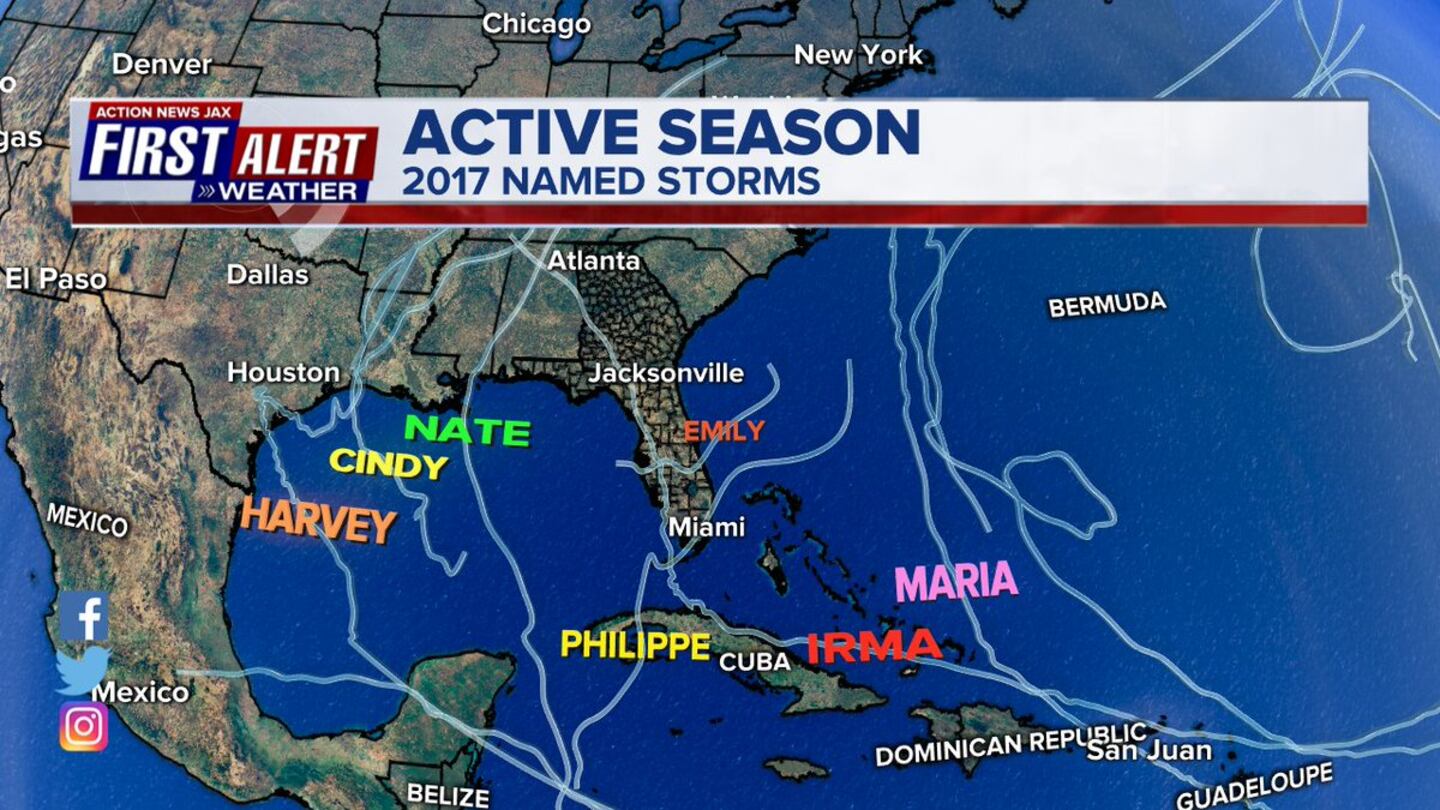
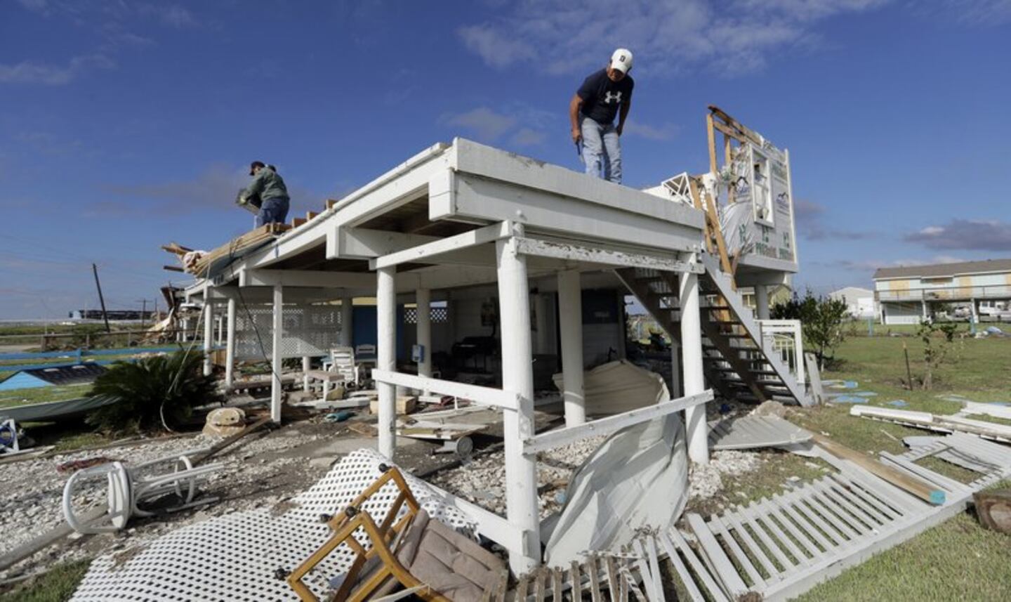
In all: 17 named storms (that began with distant tropical storm "Arlene" over the far E. Atlantic in April).... 10 hurricanes... 6 "major" (Cat. 3+). In Jacksonville... the season will be remembered for hurricane Irma - a September storm that moved up - north - very near & just west of the spine of Florida resulting in the greatest flood ever recorded along the St. Johns River in downtown Jacksonville. The combination of flooding, high winds and tornadoes resulted in millions of dollars in damage that will take months if not years to rebuild. For a detailed (nerdy! :) ) recap of Irma including the forecast, damage & records, click - here.
There were two other severe hurricanes that made landfall resulting in devastating damage - Harvey hit SE Texas in late Aug. & Maria decimated Puerto Rico in mid Sept.
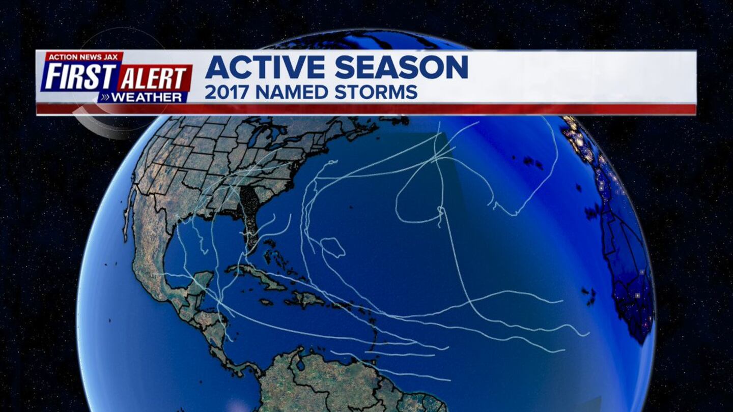
The eye-opening map from Erik Pindrock below shows just how extensive the hurricane & especially tropical storm force winds were for the ’17 season with virtually all of Fl., the Gulf Coast & the east coast as far north as N. Carolina experiencing sustained tropical storm force winds at one time or another.

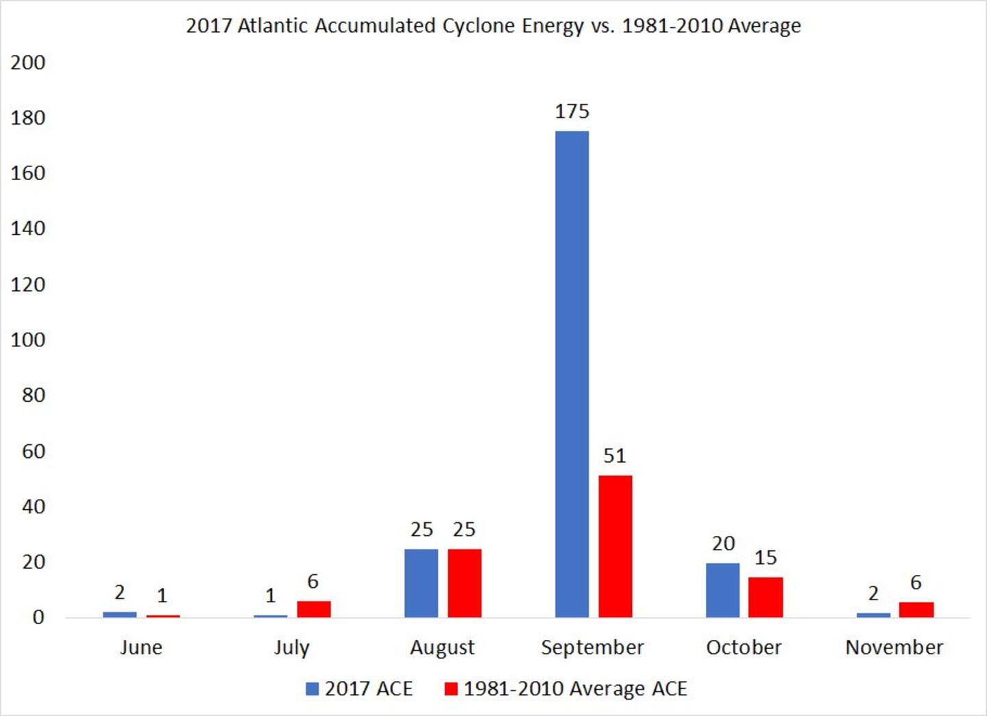
The accumulated cyclone energy (ACE) is another telling product showing the season to be just about “average” with the notable exception of Sept. which included powerful hurricanes Irma & Maria. Graph below courtesy Phil Klotzbach, CSU:
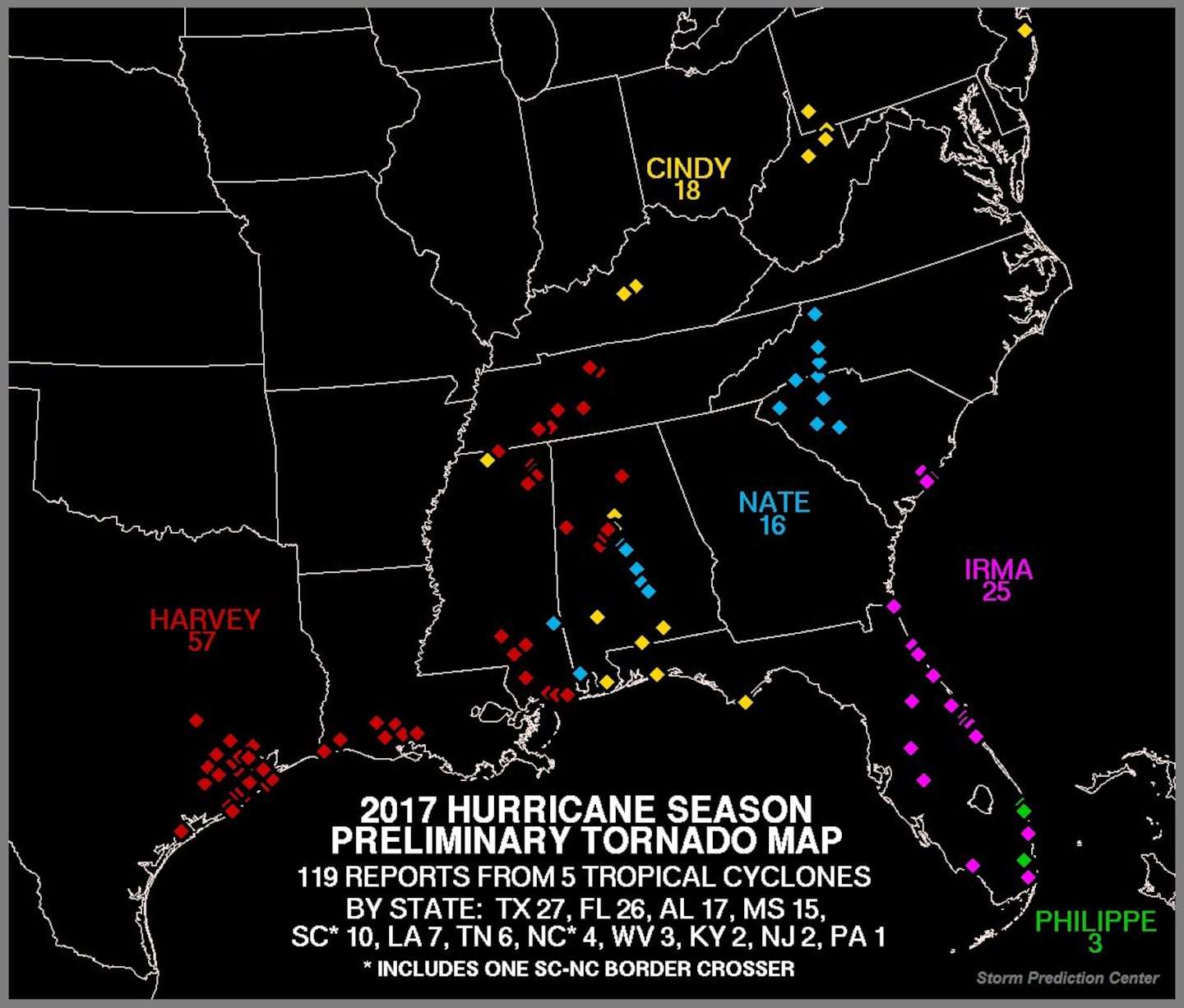
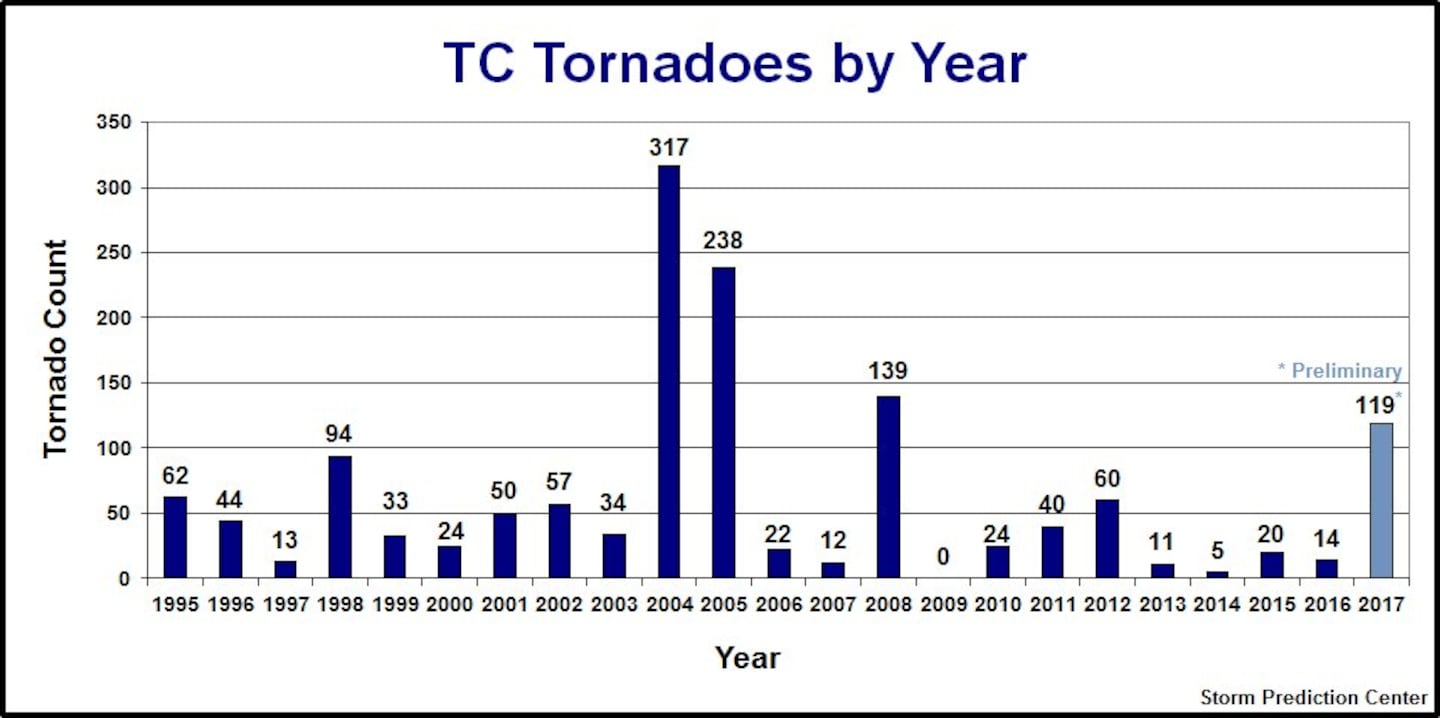
Another interesting map & graph provided by the Storm Prediction Center (SPC) shows the number of tornadoes in the Lower 48 spawned by tropical cyclones. It’s the most active since 2008. The 119 twisters (26 in Florida) ranks 4th since 1995 only behind 2008, 2005 & 2004. Month by month breakdown:
JUNE: The first month of the hurricane season included tropical storm Bret & Cindy.
Though BRET was a weak system in mid June, it was noteworthy because it was an unseasonably early African wave at a very low latitude for June that finally dissipated upon moving into the SE Caribbean. There was no significant damage though there was some flooding reported in the Southern Lesser Antilles & even the extreme northeast coast of Venezuela.
CINDY was more “traditional” for an early season storm developing over the Central Gulf of Mexico & making landfall as a relatively weak tropical storm over extreme SW Louisiana. Damage was generally minimal though the landfalling storm & its remnants did spawn 18 tornadoes from the Fl. Panhandle & coastal Alabama/Mississippi north through parts of the Tennessee & Ohio Valley’s & even as far northeast as New Jersey!
JULY: A quiet month.
T.D. #4 developed over the Central Atlantic early in the month but was overwhelmed by strong shear within a few days. However, this depression was again a sign of things to come as it was born from the unseasonably active African wave train.
Tropical storm DON was a mid month system that again developed from an African wave. This cyclone moved over the far Southern Lesser Antilles producing flooding & mudslides but then dissipated over the extreme Eastern Caribbean where wind shear remained strong.
AUGUST: As one would expect, a more active month with 1 tropical storm, 2 hurricanes & a major hurricane...
EMILY early in the month was a small & weak tropical storm that developed just west of Tampa over the extreme Eastern Gulf born from a wave of low pressure along a stalled front. The small but relatively tight circulation moved steadily east/northeast across Florida before dissipating over the W. Atlantic. No significant damage for Florida with no reports of sustained tropical storm force winds over land.
FRANKLIN - the first Atlantic Basin hurricane of the season - formed a few days after Emily over the Western Caribbean. Early interaction with land (Yucatan Peninsula) + strong shear limited development initially. But once over the very warm Bay of Campeche (far SW Gulf of Mexico), the cyclone quickly strengthened & became a hurricane before making landfall on the coast of Mexico well south of Texas.
GERT formed a few days after Franklin east of the Bahamas over the SW Atlantic. The storm moved north & became a hurricane then hooked (recurved) northeast far to the east of the U.S. & well west & north of Bermuda before becoming extratropical over the N. Atlantic. No land areas were impacted.
HARVEY formed from an African tropical wave on Aug. 17th just east of the Lesser Antilles. Strong shear + dry air limited overall development all the way across the Caribbean as the storm moved steadily W/NW with eventual degeneration into a tropical wave over the Central Caribbean within a few days. But once over the Bay of Campeche, Harvey restrengthened on the 23rd becoming a tropical storm once again while turning sharply northward. Within 60 hours, the tropical cyclone rapidly became a hurricane burgeoning into a Cat. 4 hurricane upon landfall on the mid Texas Coast on the evening of the 25th. This was the first “major” U.S. hurricane landfall since Wilma in Fl. in Oct., 2005. While damage was severe on the coast of Texas, Harvey will be remembered - & go down in history - as a tremendous rainstorm. Though not yet official, as much as 60” of rain poured down on metro Houston & nearby areas resulting in record flooding. The slow moving storm turned south & southeast while near Houston re-emerging over the Gulf of Mexico before turning northward again moving making one last landfall on the 30th on the southwest coast of Louisiana. Tremendous rainfall & flooding extended as far east as Beaumont & Lake Charles.
Photo below from the Associated Press:
SEPTEMBER: What is climatologically the peak of the hurricane season lived up to its "billing" in '17 with 5 named storms including 2 major long track hurricanes.
IRMA was a classic peak season long track Cape Verde major hurricane forming quickly from a tropical wave almost immediately upon leaving the coast of Africa on Aug. 30th.
0
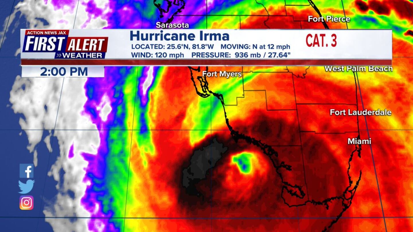
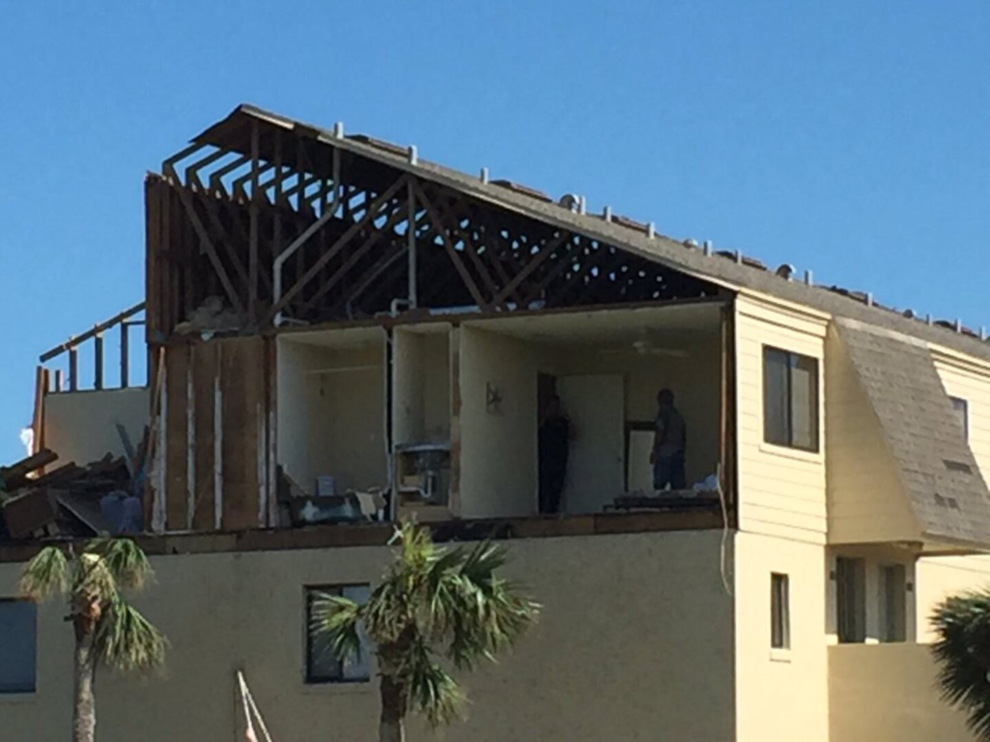
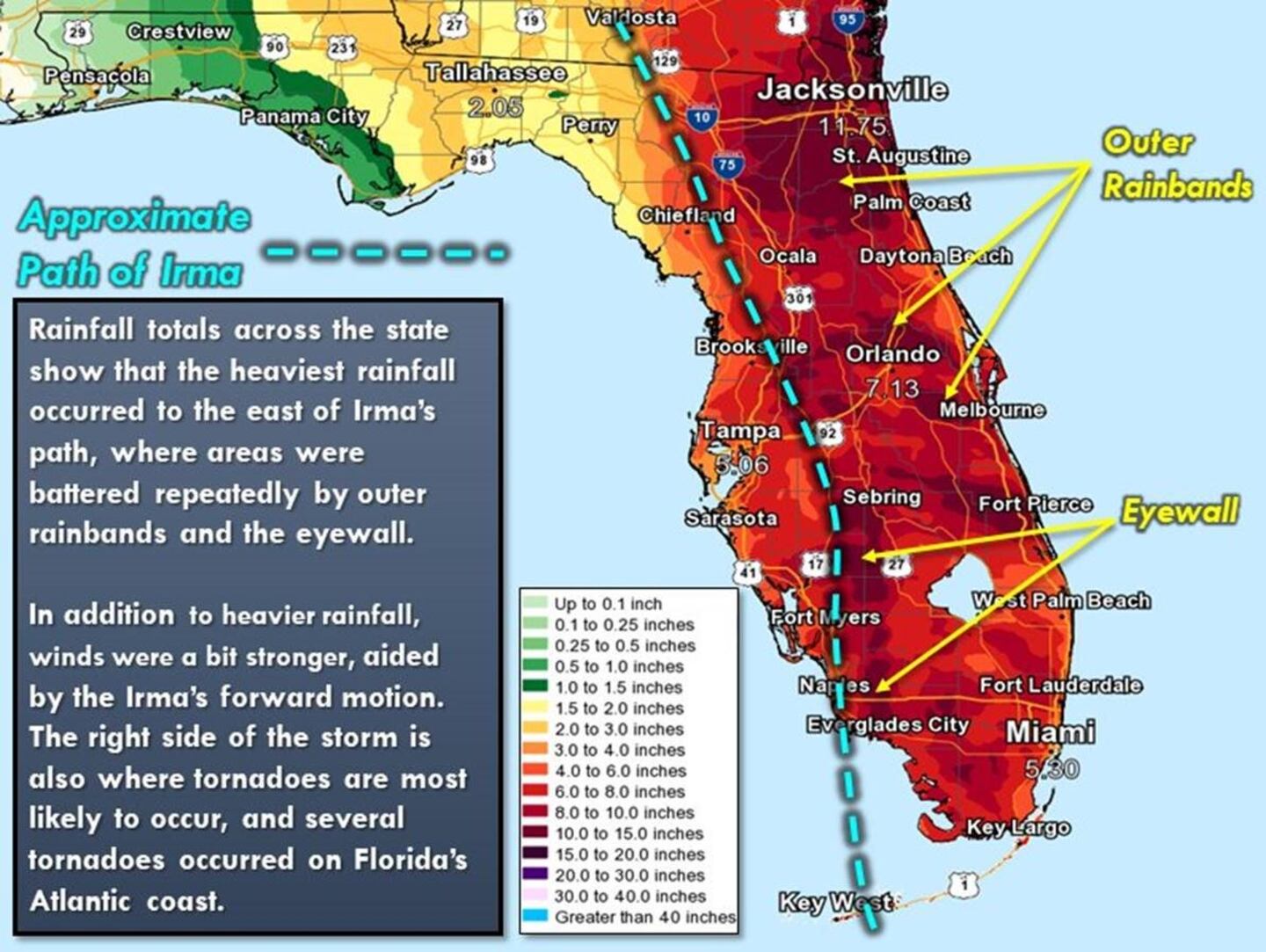
The storm went hurricane within a day - on the 31st then maintained hurricane strength all the way across the Atlantic through Sept. 10th! Find a very detailed recap of Iram - here. The first land interaction was a devastating Cat. 5 blow on the Northern Lesser Antilles & U.S. Virgin Islands on Sept. 5th. Irma then moved just north of Puerto Rico sparing the island the worst of the storm but "setting the table" for what would follow - hurricane Maria. Irma then continued west moving just north of Hispaniola before turning a little southwest & making a Cat. 5 landfall on the north coast of Cuba late on the evening of the 8th. This land interaction likely spared the Fl. Keys an even worse hit. As it was, Irma hit the Central Keys as a Cat. 4 on the evening of the 9th. Key West remained on the west of the circulation sparing the city the highest winds as well as the worst of the storm surge. The Central Keys were not so lucky, however, with sustained winds well above 100 mph & a storm surge that appears to have been limited to around 5 feet possibly due to the rapid reversal of winds from the S/SE to the west as the eye steadily moved north. The peak impacts from Irma for Jacksonville/NE Fl./SE Ga. were Sun. - Mon., Sept. 10-11. Many trees were toppled & the 10-15" of rain caused lots of flooding - largely because of saturated ground from an above avg. wet season. Several tornadoes were confirmed - one of the strongest of which was an EF-2 near Crescent Beach in St. Johns Co. A condominium complex was severely damaged by the tornado. Ironically the same complex was hit by a tornado in 2004 spawned by tropical storm Frances. Perhaps most noteworthy for the local area was epic flooding along the St. Johns River with downtown Jacksonville hit the hardest. It appears the "Irma flood" was the greatest in recorded modern history going back to the mid 19th Century. The culprit essentially came down to the track of the hurricane which was west of Jacksonville. The counter-clockwise circulation resulted in a strong southerly wind straight up the St. Johns River into downtown Jacksonville. The combination of heavy rain (fresh water), storm surge & strong winds piled up water right at the bend of the St. Johns River resulting in record flooding for San Marco & Riverside with a 6-8 foot storm surge! Action News Jax - CBS47 & Fox30 - went wall to wall with hurricane Irma coverage from Fri., Sept. 8th through Mon. night, Sept. 11th. WOKV News 104.5 was in continuous live coverage mode from Fri., the 8th through the entire following week! I commend the work of my peers on both news platforms.
Early morning of Sept. 5th:
1
Sept. 10th landfall at Marco Island:
Memorial Park, Downtown Jacksonville:

Crescent Beach EF-2 tornado damage:
NOAA:
Map below courtesy Hal Needham/NOAA Tides & Currents:

JOSE developed from another African tropical wave & was upgraded on Sept. 5th east of the Lesser Antilles. The cyclone sideswiped the U.S. Virgin Islands (still reeling from Irma)... made a loop southwest of Bermuda.... & then moved north before recurving over the N. Atlantic. Though quite a distance from the U.S. mainland, the combination of the hurricane to the southeast & a strong high pressure to the north created rough seas & surf + tropical storm force wind gusts along the New England coast. The last advisory was not issued until Sept. 22nd - 17 days after its formation.
KATIA developed over the Bay of Campeche/SW Gulf of Mexico Sept. 5th coming ashore as a hurricane on the Mexico coast (close to where Franklin made landfall in Aug.) Sept. 8-9th largely overshadowed by Irma which was raking parts of the Caribbean.
LEE formed from yet another African tropical wave on Sept. 14th becoming a hurricane east of Bermuda but remaining over the open Atlantic before becoming extratropical on the 30th.
MARIA also formed from an African wave - on the 16th - becoming a Cat. 5 upon approach to Puerto Rico after raking the Central & Northern Lesser Antilles. Maria was a Cat. 4 while it ravaged Puerto Rico on Sept. 20th. One of the most devastating hurricanes to ever hit Puerto Rico, the island nation will likely take years to recover. Maria turned rather sharply to the north after hitting Puerto Rico taking the cyclone harmlessly over the W. Atlantic between the east coast of the U.S. & Bermuda before taking an abrupt turn to the east over the N. Atlantic as the last advisory was issued on Sept. 30th. As of Nov. 30th, 34% of Puerto Rico was still without power with an island wide boil water advisory still in effect.


OCTOBER: As is usually the case, Oct. was quieter overall but still relatively active for so late in the season with the development of 3 named storms including 2 hurricanes.
NATE formed on the 4th over the W. Caribbean just east of Nicaragua. Land interaction with Central America limited development before the tropical cyclone emerged over the warm water of the NW Caribbean on Oct. 6th. Nate gradually intensified while navigating the Yucatan Channel before accelerating northward across the Gulf of Mexico reaching the Gulf Coast just east of New Orleans during the evening of Oct. 7th as a Cat. 1 hurricane. Nate did spawn 16 tornadoes from Mississippi & Alabama to the Western Carolina’s.
OPHELIA formed over the Central Atlantic on the 9th & was noteworthy for it’s strong intensity - Cat. 3 on the 14th - so far east & north so late in the season. As the storm became post-tropical on the 15th, it lashed Ireland with hurricane force winds.
PHILIPPE formed over the W. Caribbean on the 27th & struggled throughout its life cycle as a weak tropical storm while move some semblance of NE through parts of the Keys & S. Florida before dissipating north of the Bahamas & well southwest of Bermuda on the 29th. The storm did produce 3 S. Florida tornadoes.
NOVEMBER
RINA - the lone Nov. storm developed over the Central Atlantic far to the east of Bermuda moving just about due north as a tropical storm before becoming absorbed by a large extratropical low over the N. Atlantic. No land areas were impacted.
Cox Media Group