Oct. 8, 2018 — The "Buresh Bottom Line": Always be prepared!.....First Alert Hurricane Survival Guide... City of Jacksonville Preparedness Guide... Georgia Hurricane Guide.
STAY INFORMED: Get the (free) First Alert Weather app
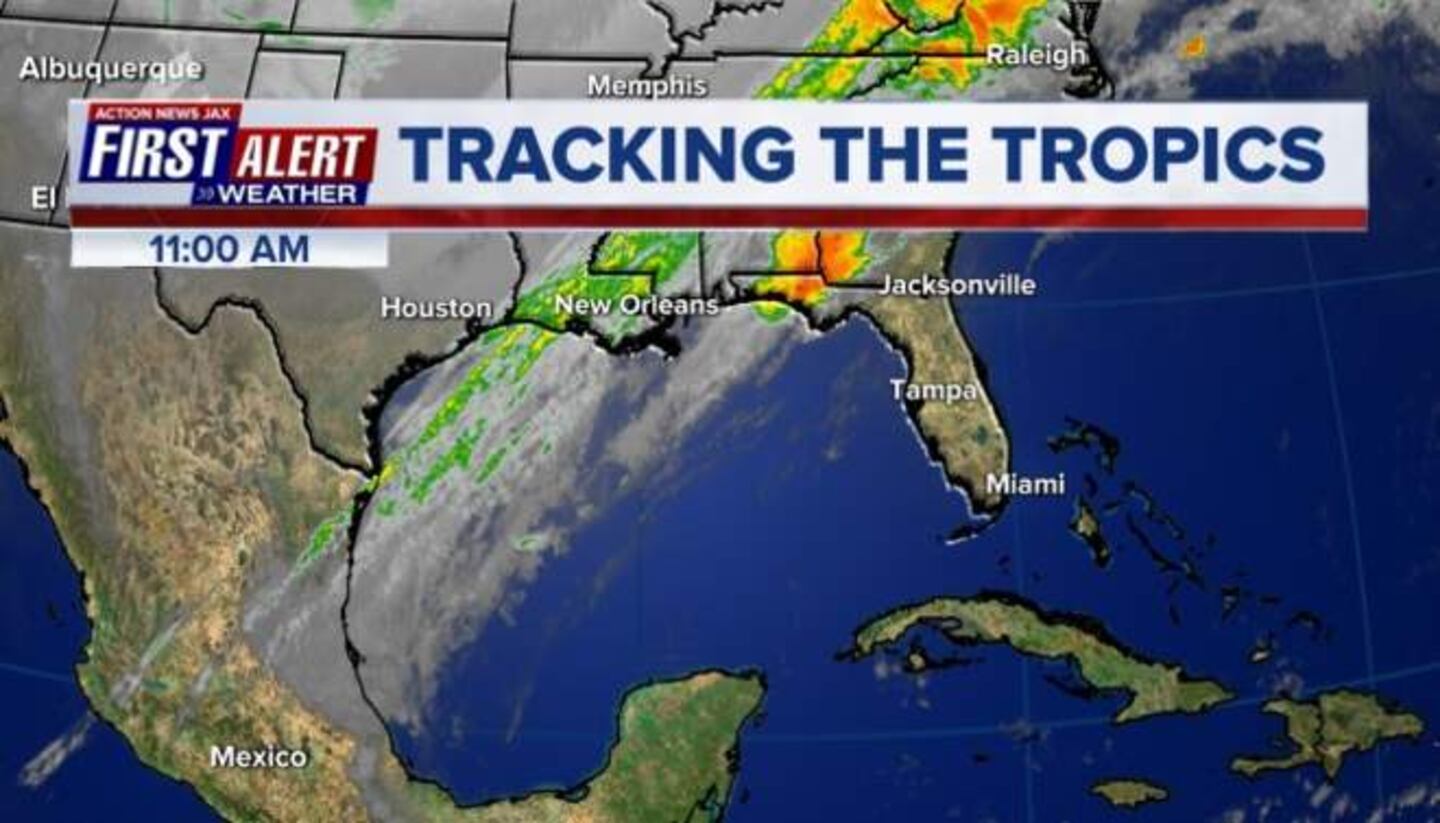
Eye on the Caribbean & Gulf of Mexico as "Michael" (not Buresh!) organizes, strengthens & becomes a hurricane. Forecast to hit the Fl. Panhandle as a "major" Cat. 3 hurricane later Wed. Here's hoping that Michael will not "Row The Boat Ashore" BUT....
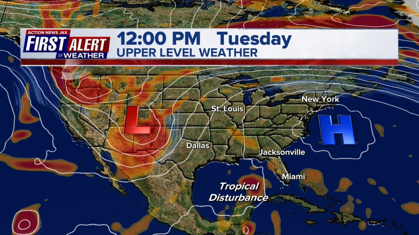
Given current forecast path - SUBJECT TO SOME CHANGES - between Mobile, Al. & the Big Bend of Fl. centered on the Panhandle, local impacts for Jacksonville, NE Fl. & SE Ga. are as follows:
* heavy rain in multiple bands from Mon. through Thu. with the potential for 1-3" of rain, more in some spots. Far more rain just offshore to the east & over NW Fl. & Panhandle into Ga. closer to what should be the center of Michael. More eastward track in the end would equal more rainfall. Looks like a relative lull in the rain Wed. due to dry slot pivoting north around the eastern side of Michael's circulation.
* breezy winds - combination of "Michael" to the west & moderately strong high pressure to the north will result in brisk winds out of the SE increasing each day through Thu. averaging 15-25 mph with gusts 30+ mph. Again - more east track would result in higher winds, especially later Wed.-Thu. Strongest winds will be at the beaches & from near Lake City to Waycross closer to the Michael's center.
* isolated waterspouts &/or tornadoes, especially Tue. through Thu.
* high rip current risk at area beaches
* minor to possibly moderate flooding - especially at times of high tide - along the coast, intracoastal & St. Johns River & its tributaries due to a combination of strong/persistent onshore flow, occasional heavy rain & an astronomical boost due to the new moon phase.
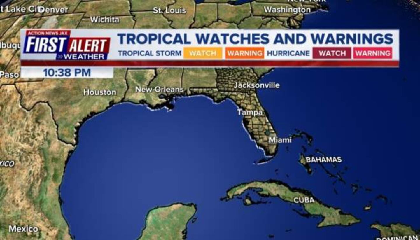
*** More significant impacts for the Fl. Big Bend, Panhandle, coastal Alabama & parts of Ga. Hurricane WATCH Fl. Panhandle & Big Bend... Storm Surge WATCH & Tropical Storm WATCH as far south as Tampa Bay .... WARNINGS likely to be issued later today ***
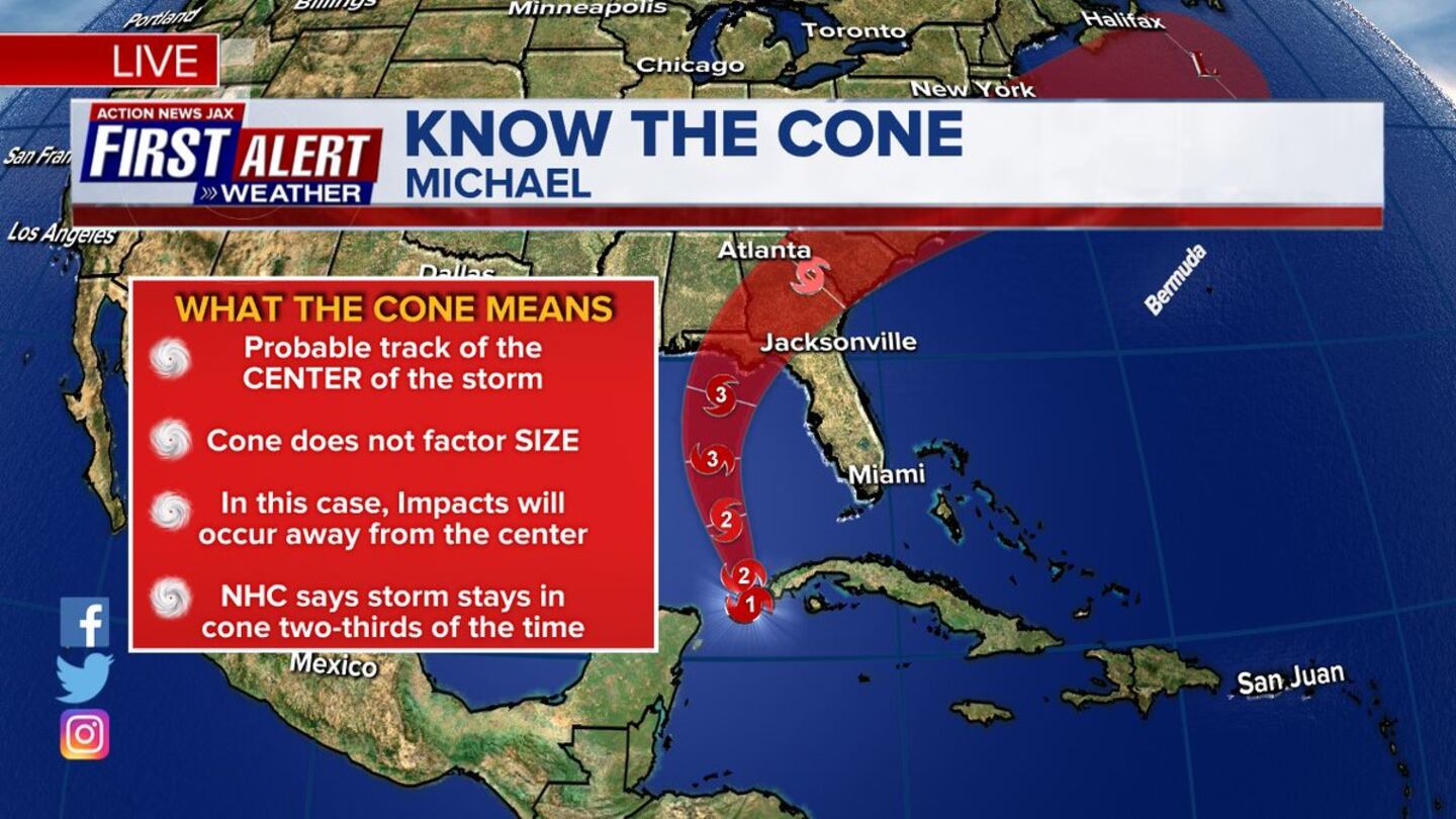
REMEMBER: the "cone of uncertainty" is simply & only forecast error & has nothing to do with potential damage or damage swath. Do not get too caught up in exactly where the center might be going. Keep in mind that a more narrow cone simply means a higher confidence forecast.
History - going back to about the mid 1990s - shows we should be wary of Oct. hurricanes given certain conditions which are in place right now - see "Buresh Blog" - Matthew (Fl.) 2 years ago (Sun., 10/07!)... Joaquin (Bahamas & El Faro) in 2015... Sandy (NY, NJ) in 2012.... Wilma (Yucatan &Fl.) in 2005... Mitch (Central America & Fl.) in 1998... Opal (Fl.) in 1995.
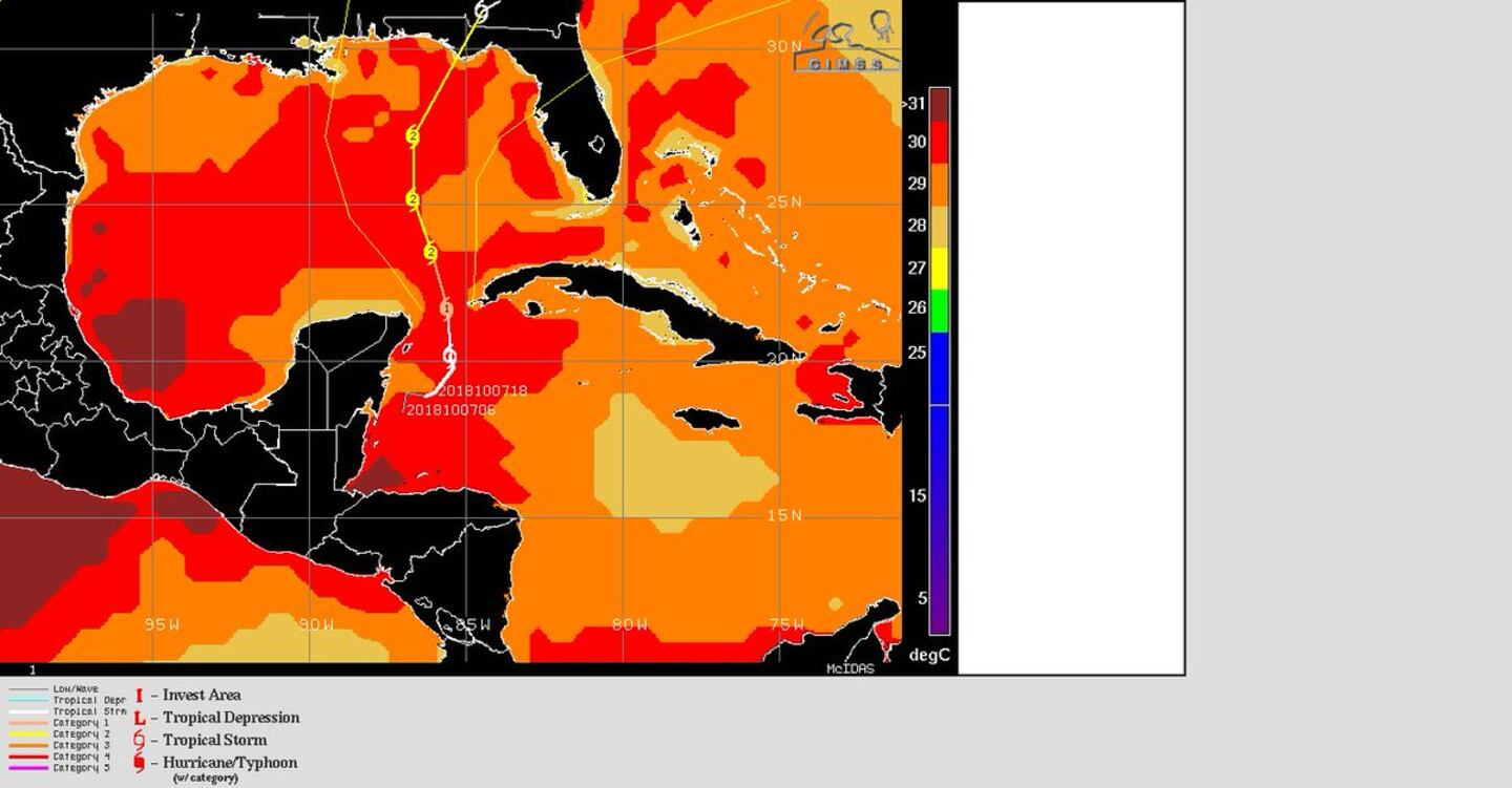
Michael has steadily become more organized/symmetrical while moving through the Yucatan Channel despite a good deal of mid & upper level shear. The center has still been "jumping" a bit east which is common in developing tropical cyclones as the center is "pulled" underneath the stronger, more persistent convection that's being sheared to the east. This so-called re-centering should be completed as the core becomes well established & intensification continues.
Global forecast models have come into good agreement on Michael's intensity - a hurricane - & have come into much better agreement on track - Fl. Panhandle BUT with timing differences. I would expect models to become more consistent within the next day or so. The GFS remains the fastest & farthest west - coming ashore Wed. afternoon/evening over the Central/Western Fl. Panhandle, give or take. The European model is a little more east but a good 12-18 hours slower - landfall during the day Thu. The UKMET can sometimes be a good compromise & has shifted "nicely" to the west to join most of the rest of the modeling bringing Michael ashore Wed. night - just about half way between the GFS & European solutions. So it looks like the stubborn upper level high pressure that's been a mainstay the last 6 weeks or so near Jacksonville will essentially protect Jacksonville/NE Fl. & SE Ga. from a potentially major hurricane .... BUT stay up to date!!..... AND there will still be potentially significant fringe effects for the local area.
In any case... Michael looks to be a fairly swift moving tropical cyclone which means dangerous impacts will extend well inland. Everyone from Florida to New Orleans should "hurricane prepare"..... & depending on where landfall is.... flooding & tornadoes could occur far inland over parts of Alabama, Ga., Fl. & the Carolina's (potentially bad news for Florence - wary Carolina residents).
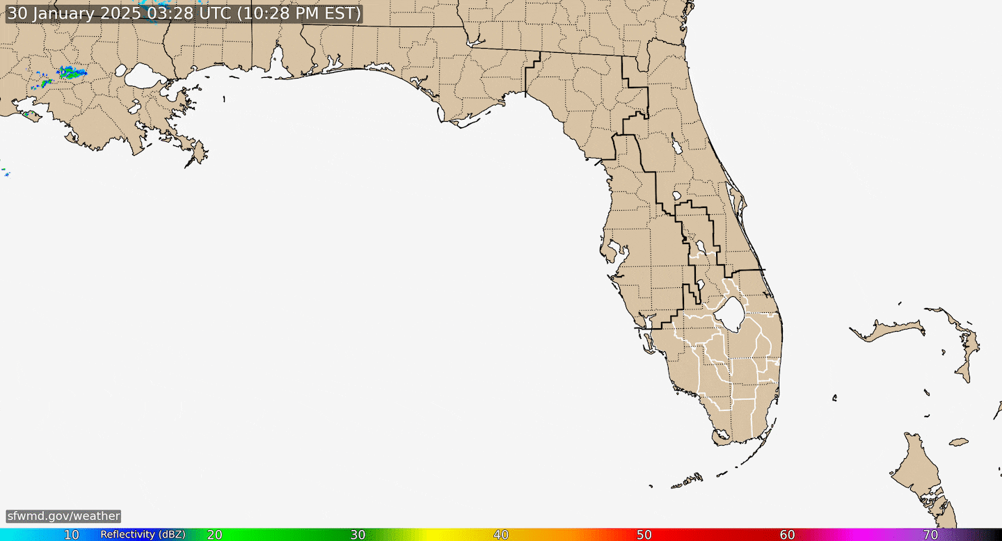
Radar imagery below courtesy South Fl. Water Management District (magenta line indicates NHC Michael forecast track):

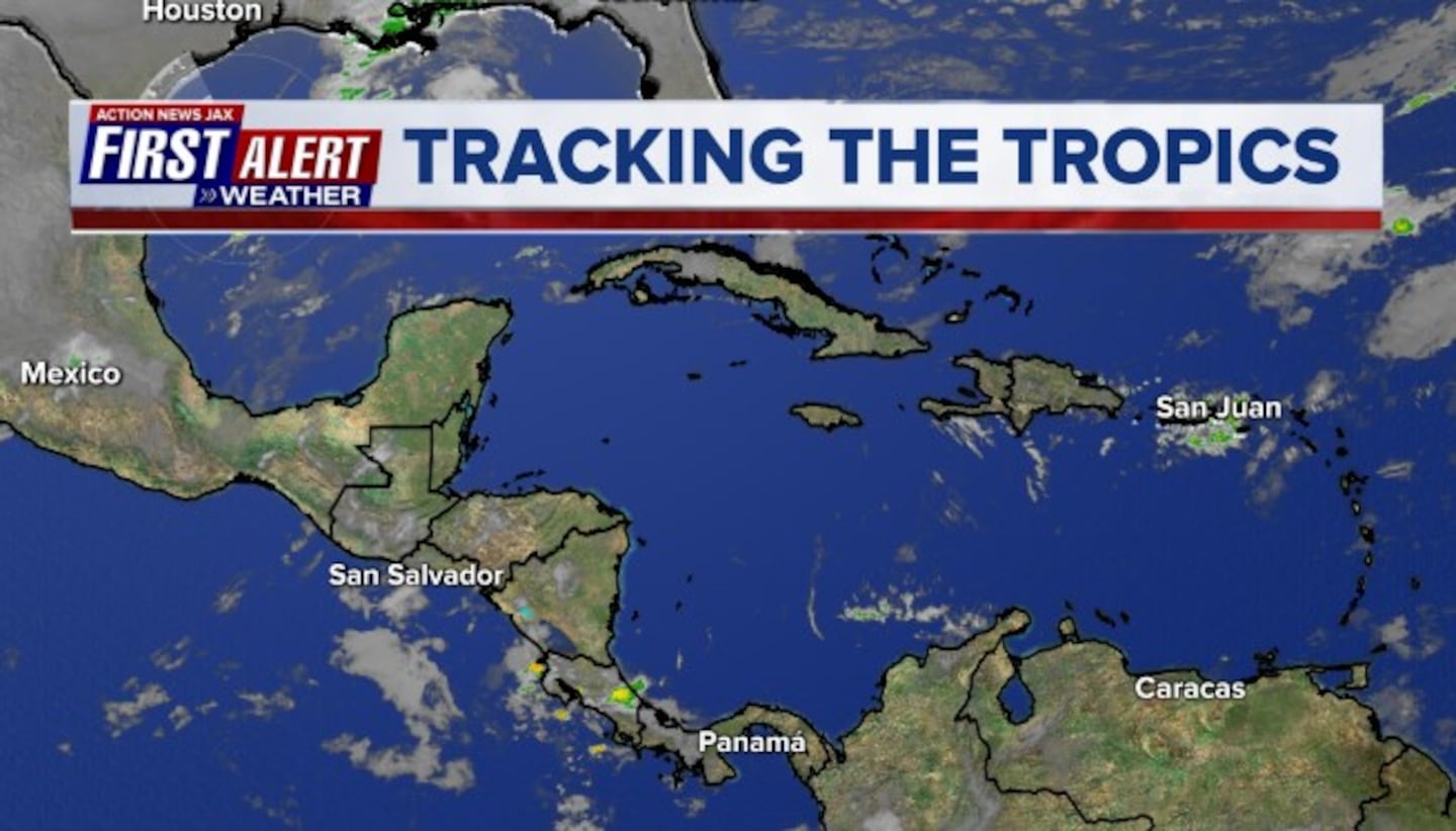
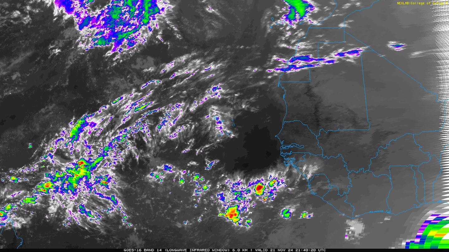
Caribbean:
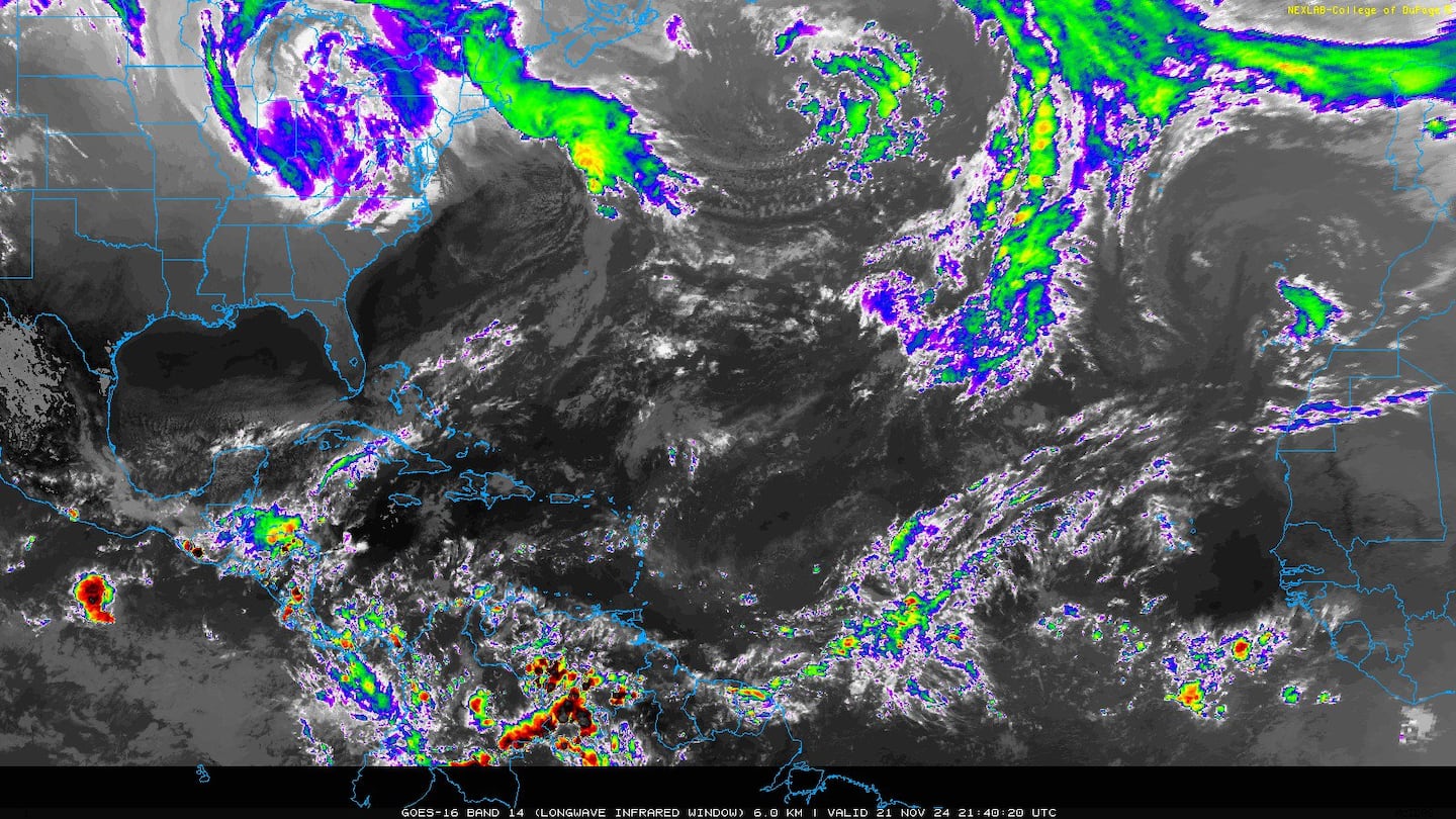
Gulf of Mexico:


Spaghetti plots for Michael:
0
Ensemble spaghetti model plots give us a good idea of the uncertainty & the array of possible outcomes in the coming days:
1
"Bath water" over parts of the Gulf:
As for movement..... the long lasting Bermuda high summer-style system over or near the Southeast U.S. - that has brought an extend summertime weather pattern of heat & dry weather to Jacksonville - will be a major player regarding the ultimate track of Michael. At the same time, a deep upper level trough will dig into the Western U.S. Given additional upstream "energy" that has yet to become a part of this trough + the stubbornness of the eastern ridge the last 6-7 weeks, I have a tendency to favor a more western track. Forecast models have generally come around to the solution bringing Michael to the Panhandle then turning NE as the upper level trough becomes more dominant & the ridge breaks down some.
As for timing... Wed./Thu. is when Michael will make landfall with the GFS earliest & farthest west... the UKMET Wed. night.... & the European early to midday Thu. but a littler faster than previous model runs. From there, models are pretty decent agreement on a piece of the western trough extending far enough south to fully pick up the system & that Michael will be absorbed by the westerlies & upper level trough so as to not hang around any one location for too long while moving northeast. That's a two-edged sword: the tornado & wind threat will extend well inland but rainfall - while heavy - will not be as extreme as with a slow moving storm.
So still some question marks as one would expect at this point but clarity is evolving - everyone from Florida to Louisiana & - even on the east coast - should stay up to date on the latest forecasts.

Map below is upper levels (500mb) - European model - noon Tue. showing the stubborn & important high pressure just off the east coast vs. the deep trough over the Western/Central U.S:
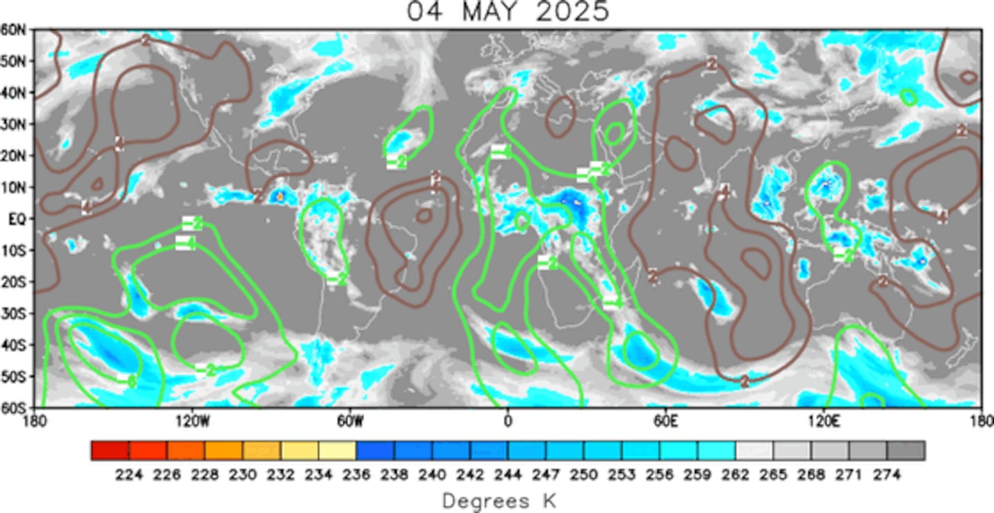
The overall pattern through the first 2+ weeks of Oct. favors tropical development over the Atlantic Basin. The velocity potential anomaly map below indicates expansive green lines - upward motion - spreading from the E. Pacific into the Atlantic Basin, part of a MJO (Madden-Julian Oscillation) pulse.
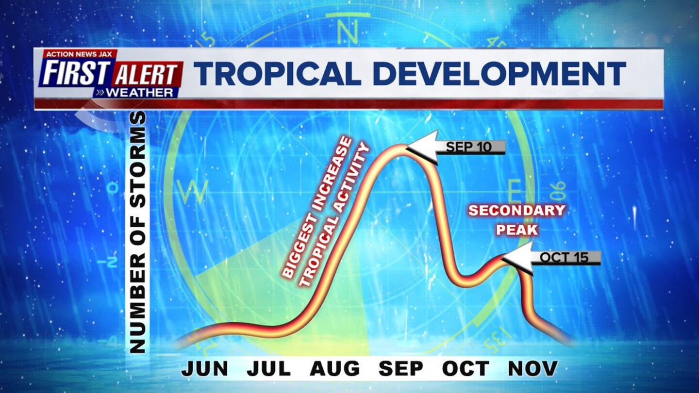
Note the secondary peak of the hurricane season in mid Oct.:

Meanwhile... Leslie continues to crawl over the Central Atlantic. Leslie will stay far away from any land areas as the tropical cyclone turns sharply eastward, even south/southeast & moves from the Central into the Eastern Atlantic & could have some impact on the Azores late in the week/weekend.

Atlantic Basin... a strong wave has moved off the coast of Africa but is not likely to be trans-Atlantic....

E. Atlantic:


Mid & upper level wind shear (enemy of tropical cyclones) analysis (CIMMS). The red lines indicate strong shear:

The Atlantic Basin.....

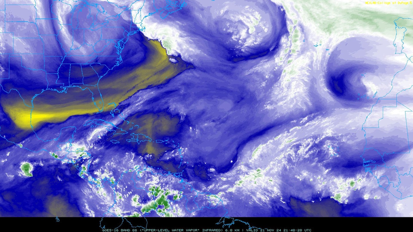
Water vapor imagery (dark blue indicates dry air):
Deep oceanic heat content is seasonably high over the Caribbean, Gulf of Mexico & SW Atlantic as one would expect early in the fall....

Sea surface temp. anomalies:

SE U.S. surface map:

Surface analysis centered on the tropical Atlantic:

Surface analysis of the Gulf:

Caribbean:

The E. Pacific remains active....
"Sergio" has become an annular hurricane well offshore of Mexico with an eye that is some 100 miles across! far to the south/southwest of the Baja but is putting on the brakes & will turn sharply northeast. Eventually the tropical cyclone - or its remnants - may affect parts of Mexico, the Baja & Southwest U.S. late in the week when a deep upper level trough sets up shop over the Western U.S. & accelerates Sergio to the northeast.

6
Cox Media Group