Oct. 10, 2018 — The "Buresh Bottom Line": Always be prepared!.....First Alert Hurricane Survival Guide... City of Jacksonville Preparedness Guide... Georgia Hurricane Guide.
STAY INFORMED: Get the (free) First Alert Weather app
FREE NEWS UPDATES, ALERTS: Action News Jax app for Apple | For Android
Hurricane Michael went through a rapid intensification cycle - as feared - & appears destined to be a "once in a generation" type landfalling hurricane for the Panhandle. This will surpass hurricane Ivan in 2004 as the most severe Panhandle hurricane as well as hurricane Opal in Oct., 1995 & - arguably - since historic Camille in Aug., 1969 which was a much more compact hurricane.
Michael hit the Fl. Panhandle as a "major" near Cat. 5 hurricane a little before 2pm EDT 20 miles southeast of Panama City near Mexico Beach.
Given the straight forward path - centered on the Central Panhandle - local impacts for Jacksonville, NE Fl. & SE Ga. remain as follows (primarily fringe for Jax/NE Fl. but more impactful for SE Ga.):
* brief heavy rain in multiple bands through Thu. with only about a half inch to an inch of rain, more in some spots of Georgia. More rain just offshore to the east & over NW Fl. & Panhandle into Ga. closer to what should be the center of Michael. A few isolated storms Wed. night will be capable of producing isolated tornadoes. Remember a WATCH means conditions are favorable for severe weather; a WARNING means you need to take action if you're in the warning area.

* breezy winds - out of the south then southwest, becoming west Thu. averaging 15-25 mph with gusts 30+ mph diminishing Thu. afternoon & night. Strongest winds will be at the beaches - gusts up to 30 mph.... & from near Lake City to Waycross to Brunswick, Ga. closer to Michael's center where gusts of 40-50 mph or more will be possible Wed. night into Thu. The offshore winds - out of the west - late Thu. into Fri. - will be a surfer's delight but be careful - rip currents!
* isolated waterspouts &/or tornadoes into early Thu. morning.
* high rip current risk at area beaches
* minor flooding - especially at times of high tide - along the coast, intracoastal & St. Johns River & its tributaries due to a combination of strong/persistent onshore flow the last several days, occasional heavy rain & an astronomical boost due to the new moon phase. No significant storm surge is expected for NE Fl. & Jacksonville & SE Ga. with this track scenario whether at the beaches, intracoastal or along the St. Johns River & its tributaries. Some of the water will be pushed back out Thursday thanks to the offshore winds.
* I would expect highways, airports, every day businesses & overall infrastructure to not be harshly impacted by Michael in Jacksonville/NE Fl. & most of SE Ga. Ahy power outages should only be sporadic & not terribly long lasting. Of course, a much different story for parts of the Carolina's, Georgia & the Fl. Panhandle & Big Bend where travel will be severely hampered & power may be out for days if not weeks.
While virtually all weather is complicated & difficult to forecast, a tropical cyclone's decay over land is even more problematic. But at this point, the fast moving powerful & large hurricane will likely maintain hurricane status past I-75 in Ga.... & tropical storm status all the way to the coast of Carolina's before exiting back over the water of the W. Atlantic.
History - going back to about the mid 1990s - shows we should be wary of Oct. hurricanes given certain conditions which are in place right now - see "Buresh Blog" - Matthew (Fl.) 2 years ago (Sun., 10/07!)... Joaquin (Bahamas & El Faro) in 2015... Sandy (NY, NJ) in 2012.... Wilma (Yucatan &Fl.) in 2005... Mitch (Central America & Fl.) in 1998... Opal (Fl.) in 1995.
Michael rapidly organized & strengthened over Gulf of Mexico as shear as relaxed, upper level ventilation & therefore outflow has improved over very warm water. The eye became centered underneath the stronger, more persistent convection that was being sheared to the east.
So it looks like the stubborn upper level high pressure that's been a mainstay the last 6 weeks or so near Jacksonville essentially protect Jacksonville/NE Fl. & most of SE Ga. from a major hurricane .... with mainly fringe effects for the local area.
Michael will be a swift moving tropical cyclone which means dangerous impacts will extend far inland. Everyone from Florida to Pascagoula should "hurricane prepare"..... flooding, high winds & tornadoes will occur far inland over parts of Alabama & especially Ga., NW Fl. & the Carolina's (potentially bad news for Florence - wary Carolina residents).
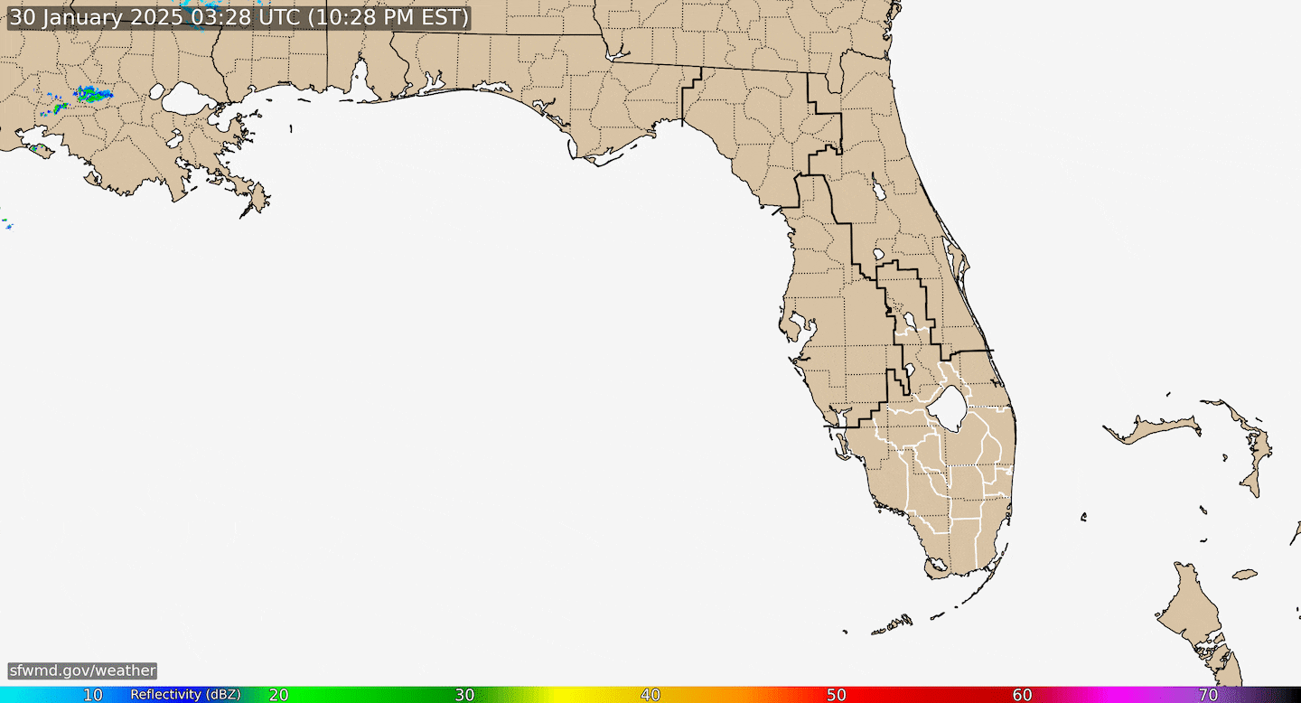
Radar imagery below courtesy South Fl. Water Management District (magenta line indicates NHC Michael forecast track):
Microwave energy courtesy CIMSS:


Spaghetti plots for Michael show big time clustering giving increased forecast confidence (it's one of the reasons the cone is so narrow!):

Ensemble spaghetti model plots give us a good idea of the uncertainty & the array of possible outcomes in the coming days:
0
"Bath water" over parts of the Gulf:
1
Rainfall will be heavy but not necessarily excessive as Michael speeds northeast:

The overall pattern through the first 2+ weeks of Oct. has favored tropical development over the Atlantic Basin. The velocity potential anomaly map below indicates expansive green lines - upward motion - spreading from the E. Pacific into the Atlantic Basin, part of a MJO (Madden-Julian Oscillation) pulse.
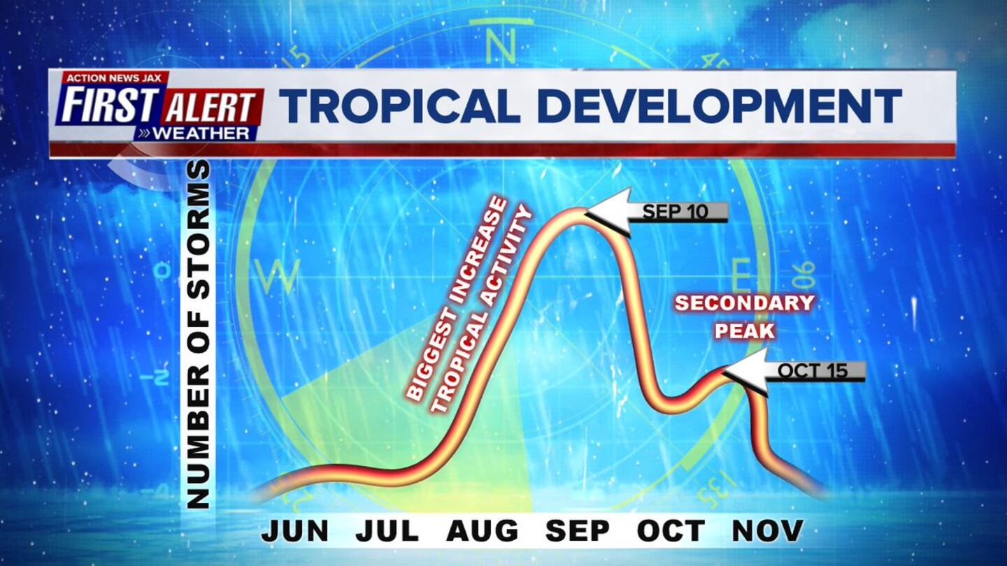
Note the secondary peak of the hurricane season in mid Oct.:

Meanwhile... Long-lived Leslie continues to crawl over the Central Atlantic & has again become a hurricane(!). Leslie will stay far away from any land areas as the tropical cyclone turns sharply eastward moving into the Eastern Atlantic where the storm could have some impact on the Azores late in the week/weekend as Leslie finally becomes post-tropical.
AND(!).... tropical depression #15 has become tropical storm "Nadine" over the far E. Atlantic courtesy a strong tropical wave that's moved off the coast of Africa. Dr. Phil Klotzbach says this is the farthest east that a tropical storm has formed so late in the season. This system has virtually no chance to make it across the Atlantic & will soon encounter strong shear causing pretty fast weakening while peeling off to the west over the Central Atlantic steered then by the more shallow trade winds.

Atlantic Basin "tri-fecta": Michael, Leslie & Nadine. In addition... a tropical wave is forecast to develop into an area of low pressure over the W. Caribbean late in the week/weekend with some tropical development possible as the low moves west eventually into Central America. Looks like this system would stay far south of the U.S.

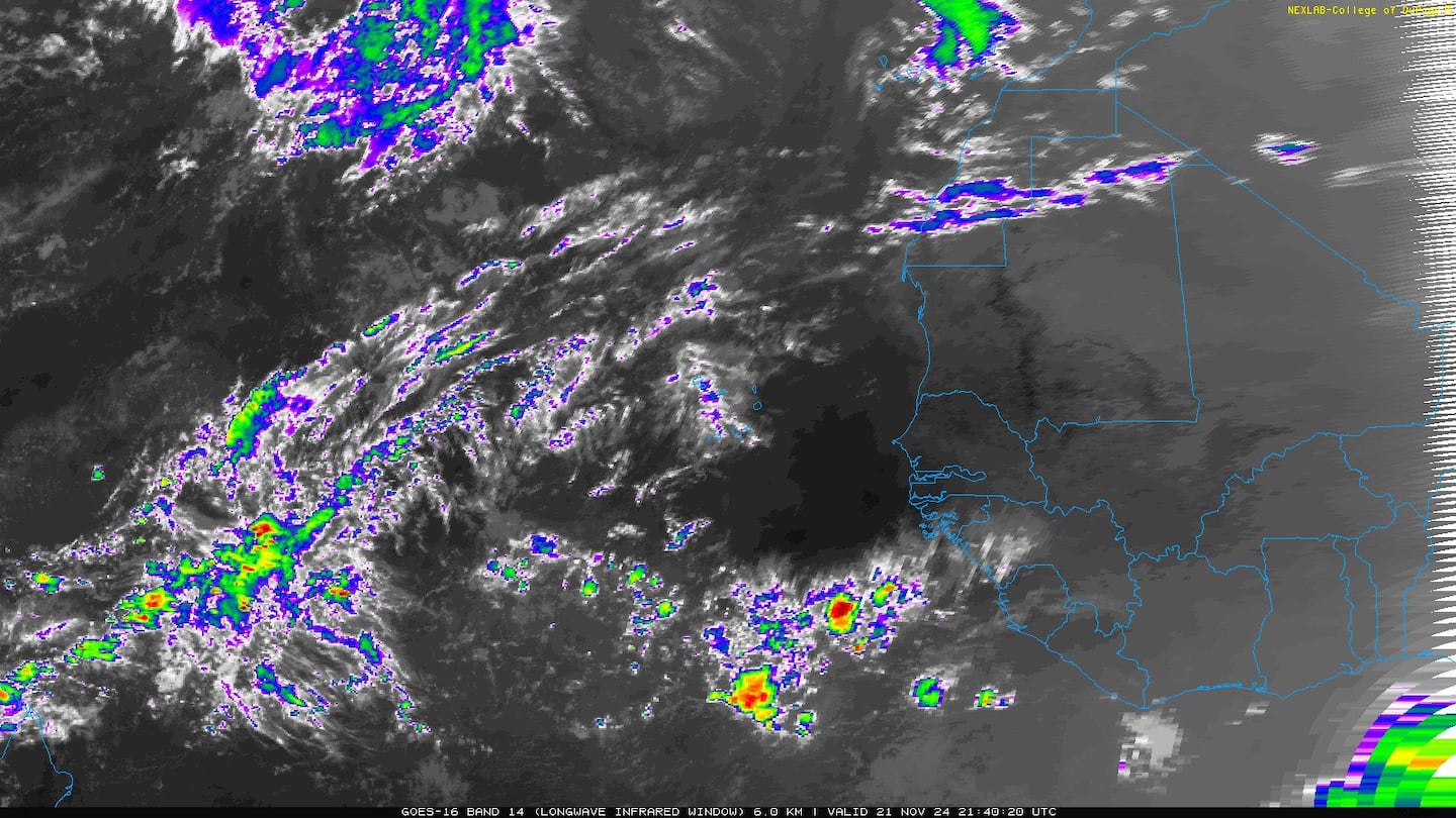
E. Atlantic:


Mid & upper level wind shear (enemy of tropical cyclones) analysis (CIMMS). The red lines indicate strong shear:

The Atlantic Basin.....

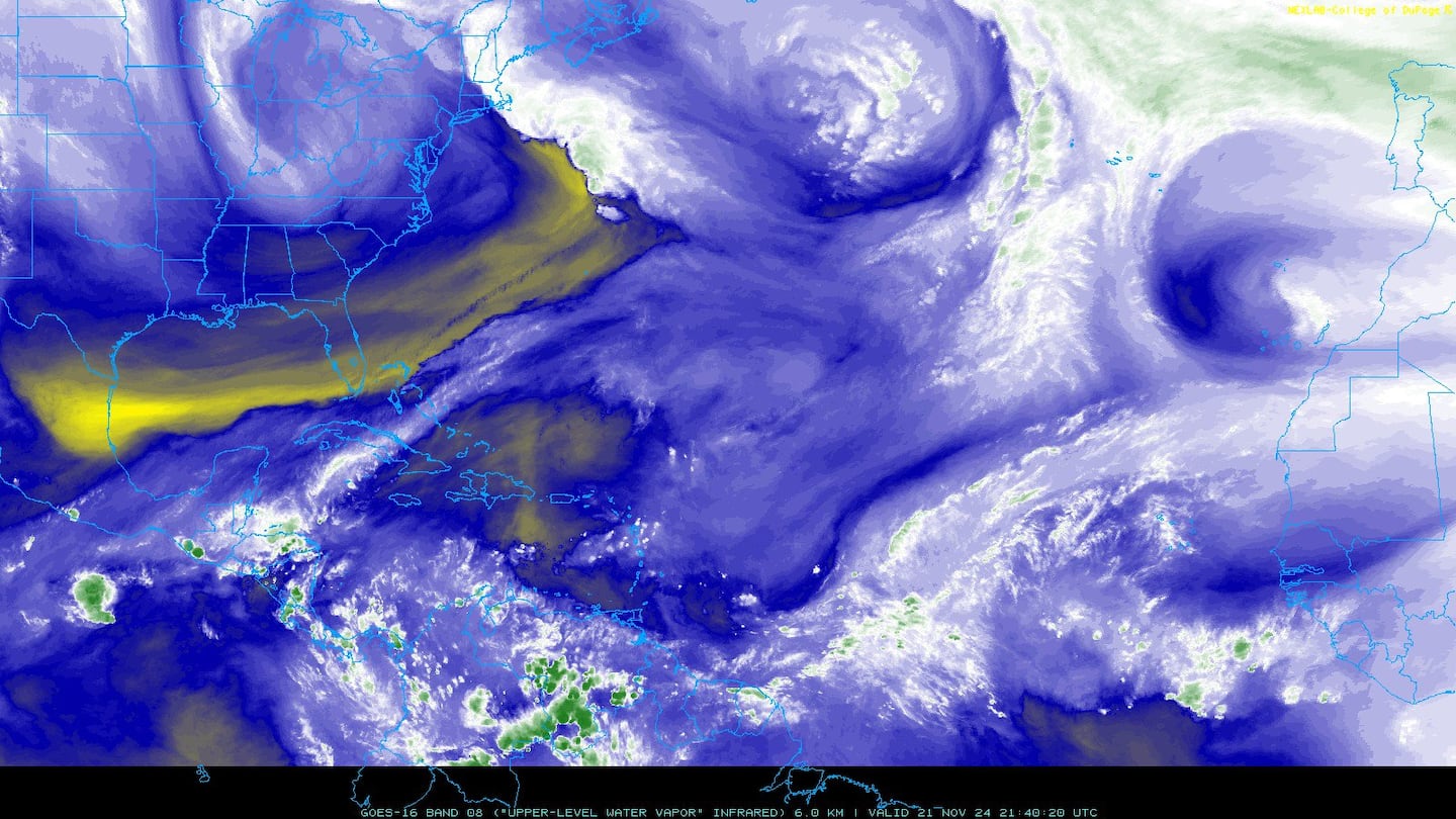
Water vapor imagery (dark blue indicates dry air):
Deep oceanic heat content is seasonably high over the Caribbean, Gulf of Mexico & SW Atlantic as one would expect early in the fall....

Sea surface temp. anomalies:

SE U.S. surface map:

Surface analysis centered on the tropical Atlantic:

Surface analysis of the Gulf:

Caribbean:

The E. Pacific remains active....
After becoming annular, hurricane Sergio - still with a broad eye - is gradually giving in to increasing shear & cooler sea surface temps. Having put on the brakes, Sergio has turned sharply northeast & will accelerate. Eventually the tropical cyclone - or its remnants - may affect parts of Mexico, the Baja & Southwest U.S. late in the week/weekend when a deep upper level trough sets up shop over the Western U.S. & shoots Sergio to the northeast.


Cox Media Group