
The "Buresh Bottom Line": Always be prepared!.....First Alert Hurricane Survival Guide... City of Jacksonville Preparedness Guide... Georgia Hurricane Guide.
STAY INFORMED: Get the * FREE * First Alert Weather app
FREE NEWS UPDATES, ALERTS: Action News Jax app for Apple | For Android
WATCH "Surviving the Storm"
READ the First Alert Hurricane Center "Survival Guide"
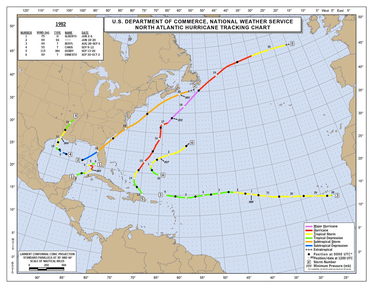
There have been no named storms over the Atlantic Basin from July 15th through Aug. 19th. The last time that happened was 1982 - a season with only 6 named storms.
But low & behold "Chantal" has developed over the N. Atlantic from a low pressure system that originally developed near Jacksonville over the weekend. The compact "satellite storm" will move east then turn southward west of the Azores Islands & well east of Bermuda. No impact on the U.S.
The velocity potential anomaly map below shows rising vertical velocities (green lines) overspreading the Pacific Basin. This should help with some tropical development in the short term over the Eastern Pacific & eventually - by late Aug. - over parts of the Atlantic Basin. And could help get something going this week over the Gulf of Mexico.

Meanwhile.... weak upper level "energy" persists along the Gulf Coast stretched out from the Northern Gulf to near the Fl. Panhandle into the Tennessee Valley. No significant surface reflection (low pressure) is expected to form but heavy rain will continue along the Gulf Coast this week.
An area to watch late week into the weekend will still be the Western Gulf of Mexico. A pretty decent tropical wave (tied to "disturbed" weather over the NW Caribbean) & upper level disturbance will work northward into & over the Western Gulf by mid to late week. While models show only weak surface development - if any at all - this will be an area to watch for "sneaky" development in an area - historically speaking, the Western Gulf - that is highly favored in mid to late Aug.

p>


An examination of dust over the Central & Eastern Atlantic shows a continuation of a good deal of dust over the Central & Eastern Atlantic as well as parts of the Caribbean. While such dry air can inhibit tropical development initially, once any waves are farther west or if the wave can stay a little south & out of the dust "cloud" - & IF all other conditions are equal - organization/strengthening can occur. The 2005 hurricane season stands out (along with several other seasons) as a "dusty" Eastern Atlantic but disturbances simply waited to get out of the dust - further to the west - to develop & then "make history".

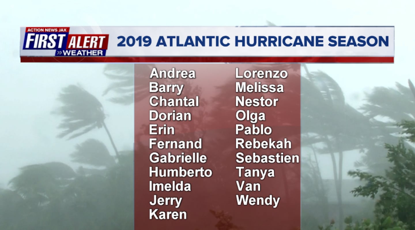
2019 names..... "Chantal" is next on the Atlantic list (names are picked at random... repeat every 6 years... historic storms are retired (Florence & Michael last year):
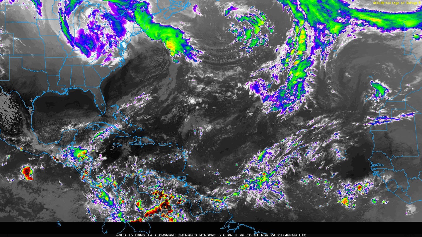
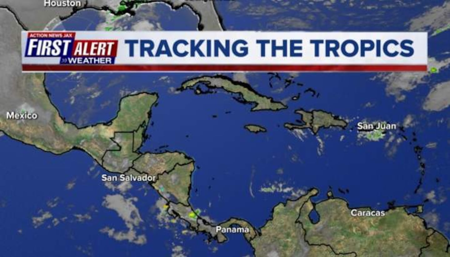
Atlantic Basin today:

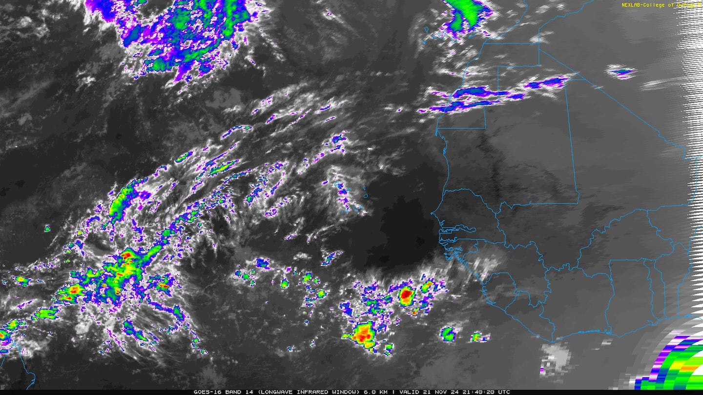
East Atlantic:


Mid & upper level wind shear (enemy of tropical cyclones) analysis (CIMMS). The red lines indicate strong shear of which there is plenty across the Atlantic at the moment:

The Atlantic Basin:

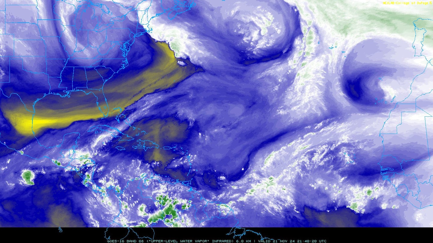
Water vapor imagery (dark blue indicates dry air):
Deep oceanic heat content:

Sea surface temp. anomalies show a warm Gulf of Mexico, Central & Northwest Atlantic while the "Main Development Region" (MDR) remain cooler than avg. along with parts of the Central Caribbean.....

SE U.S. surface map:

Surface analysis centered on the tropical Atlantic:
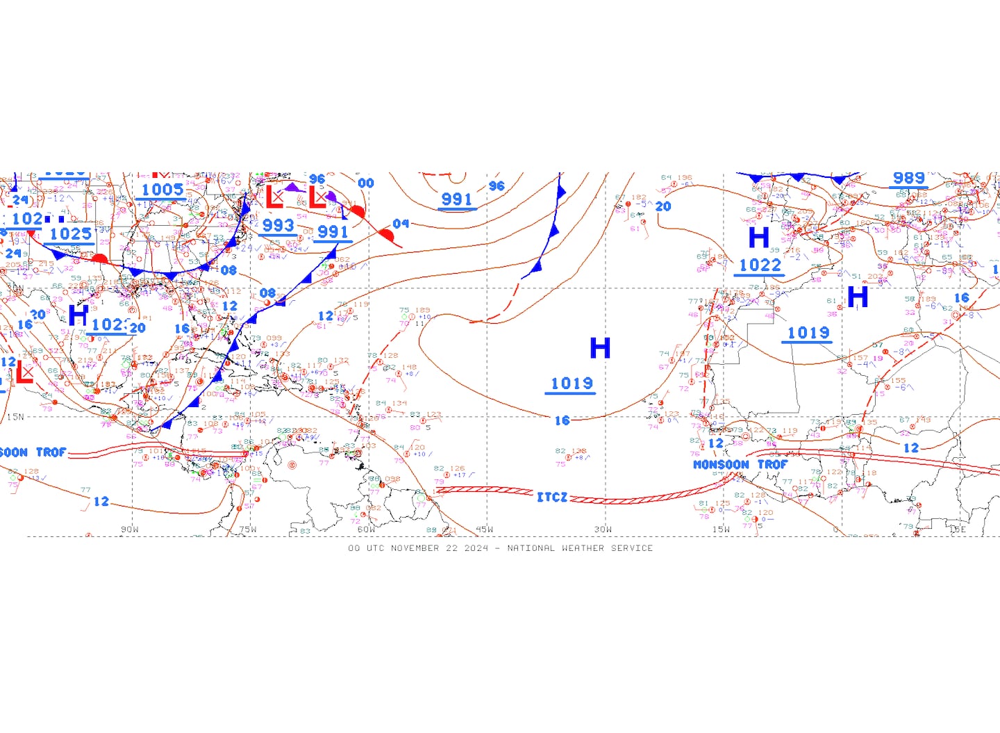
Surface analysis of the Gulf:

Caribbean:

Cox Media Group


