Aug. 28, 2017 — Disturbance ('potential tropical cylone #10) NE of Jacksonville could become tropical storm Irma - tropical storm WATCH for the Carolina's...Harvey still hammering Texas & Louisiana...... potential development East Atlantic.......
A catastrophe continues to unfold for Texas & even Louisiana.... but - first - closer to home (Jacksonville, Fl)....
A complex combination of an upper low & the ol' remnants of tropical wave - '92L' [potential tropical cyclone ten] - in the form of a weak surface low are situated east/northeast of Jacksonville. While development - especially initially - will be slow due to marginal conditions (strong shear out of the west) for intensification not to mention proximity to land, the system could become tropical cyclone "Irma". The "Buresh Bottom Line" is: stay tuned!... Always be prepared!
The most likely scenario is one where the system becomes a tropical depression or tropical storm southeast of the Carolina's & northeast of Jacksonville over the far W. Atlantic then slowly moves north/northeast very near the coast to just southeast of Chesapeake Bay. Then there should be at least a little more of a turn to the northeast upon merging with a cold front & then accelerates northeast while strengthening (helped out by some nontropical processes) over the N. Atlantic when picked up by an upper level trough in a few days (the same upper trough that is missing Harvey).
Locally - for Jacksonville/NE Fl./SE Ga - the main impacts will continue to be quite minor: bands of heavy rain into Mon. along with gusty winds out of the northeast & a significant rip current risk at area beaches. Conditions will slowly improve later Monday into Mon.night while conditions worsen for the coastal Carolina's & beaches with dangerous beach conditions as far north as at least New Jersey.

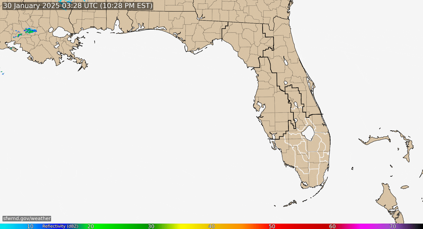
Radar imagery courtesy S. Florida Water Management District:


Model plots:

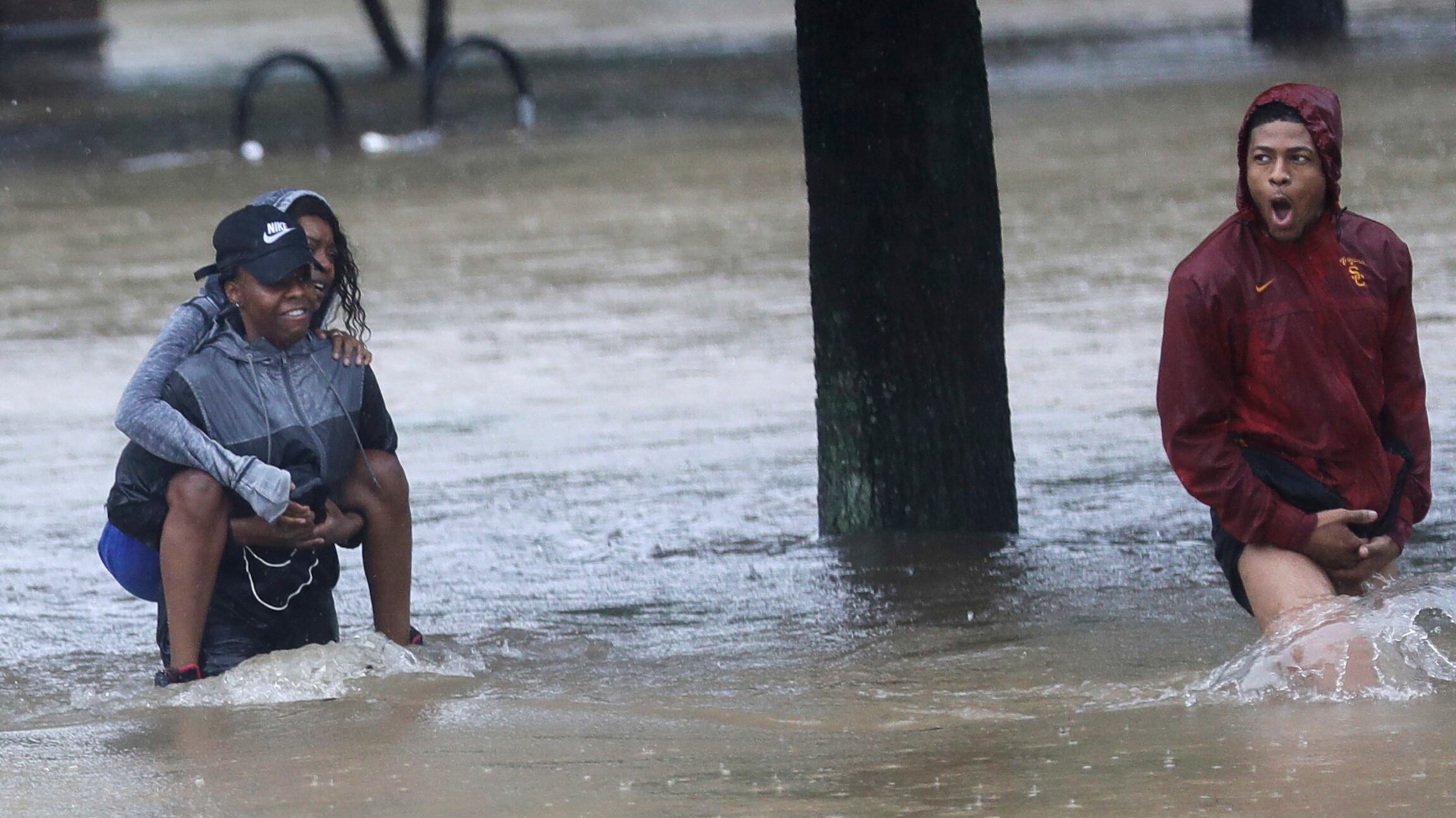
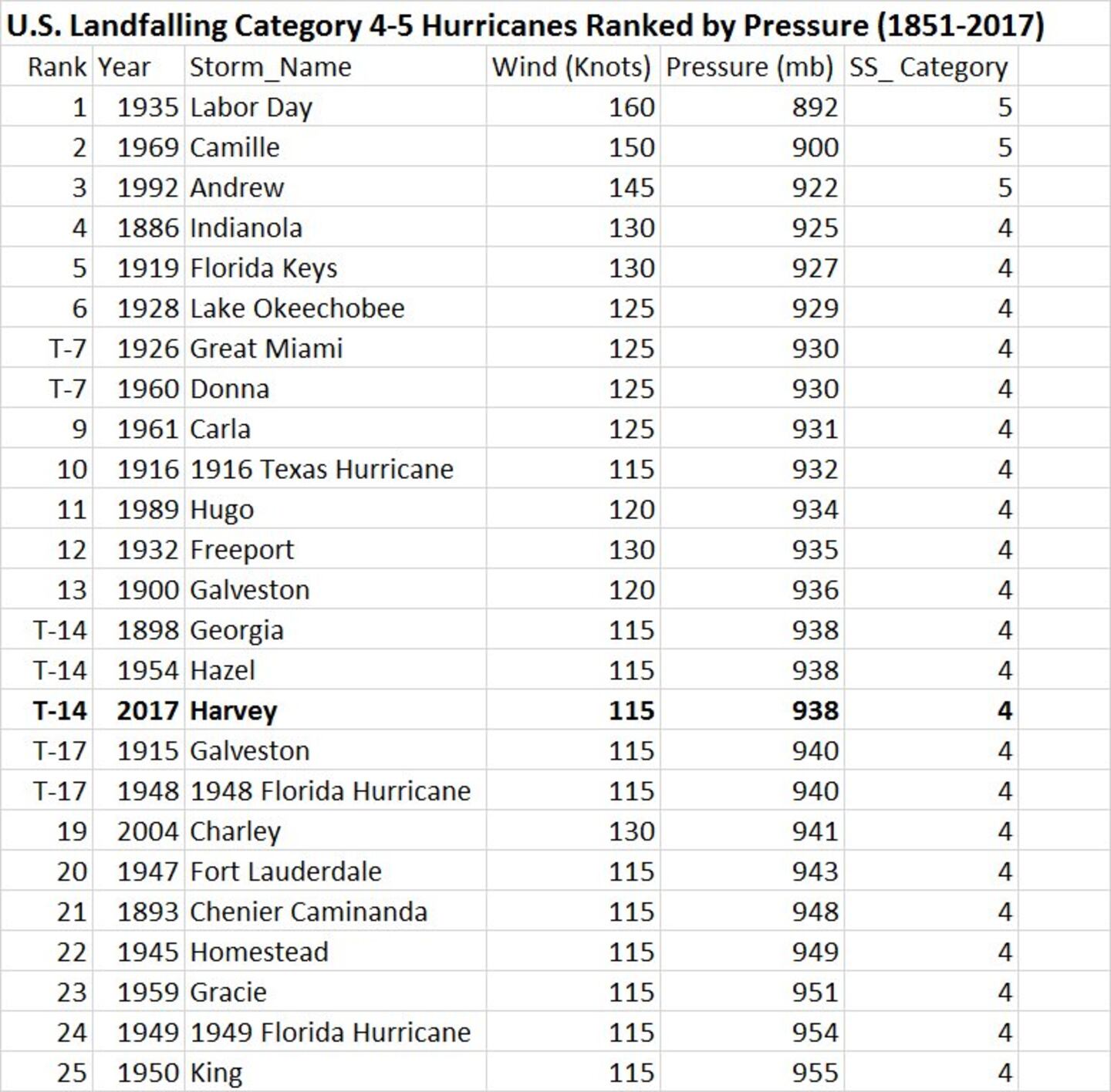
Horrible & historic "Harvey" roared ashore as a powerful Cat. 4 hurricane Fri. evening about 11pm EDT near Rockport about 30-35 miles NE of Corpus Christi. This track spared Corpus Christi from extreme damage but much of the rest of the coast + SE Texas has not/is not/ & will not be as fortunate. Harvey was the first "major" U.S. landfalling hurricane since Cat. 3 "Wilma" slammed South Florida in Oct., 2005 - that's longest such stretch on record.... & was the first U.S. Cat. 4 landfall since "Charley" in 2004 which hit the west coast of Florida (Punta Gorda). The 938mb pressure is the 6th lowest on record for a Texas landfalling hurricane (Klotzbach). It is my humble opinion that while the death toll may not end up as high as hurricane Katrina in 2005.... nor was the storm surge as severe, most other measurements (meteorologically, property damage) will exceed Katrina.
Tables below were compiled by Dr. Phil Klotzbach, CSU showing preliminarily how "Harvey" stacks up against other intense hurricane:

Harvey has - as feared - simply lumbered over South & SE Texas which will result in more than 3 feet of rain & possibly as much as 50"+!!! (more than the avg. annual [yearly] rainfall for Houston). The center will move erratically & is destined to re-emerge over the extreme NW Gulf of Mexico through Tue. before shifting northward & inland again. The core of the tropical cyclone has been severely degraded due to the 2 1/2 days over land so significant restrengthening seems unlikely. But if the center manages to get more to the east of where it came ashore, the water is warmer + there would be more time over water, so we'll have to carefully monitor for this possibility. Unfortunately it looks like an upper level trough will miss Harvey resulting in the storm &/or its remnants lingering over or near Texas at least through Wed., possibly as long as Friday! before finally lifting to the northeast & weakening. Some of the torrential rain will extend at least as far east as Louisiana.
"Harvey" will stay far to the south & west of Florida so no impacts on Jacksonville or any of Fl.
While the exact death toll is still not known (would have been thousands dead years ago).... It should be noted that the NHC & local NWS offices in Texas & Louisiana should be commended on excellent forecasts & warnings well in advance of "Harvey" including as the storm moved off the Yucatan Peninsula when the system looked so minor & meager. I believe this might be one of the best, most accurate forecasts in modern history regarding a big hurricane that hit the U.S. - especially considering the system was little more than a wave/weak low pressure system when moving off the Yucatan Peninsula .... offering us some hope when it comes to the ever perplexing tropical intensity forecast. Great job National Hurricane Center!
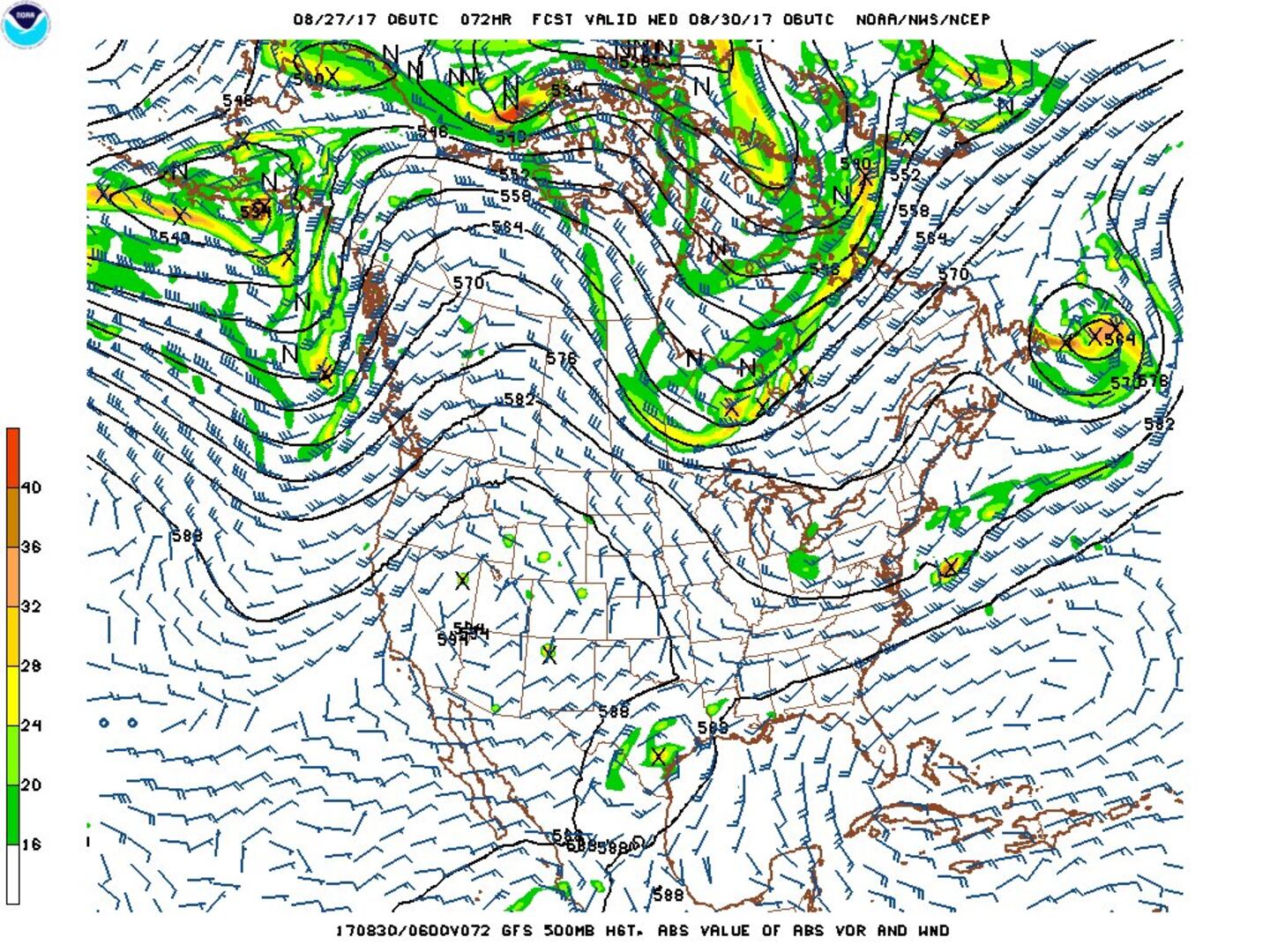
The map below is the GFS model in the upper levels (500mb) - for early Wed. - showing the trough near the Great Lakes failing to connect with "Harvey" which then leaves the storm behind over Texas.....

Corpus Christi NWS Doppler radar loop:
0
Houston Doppler radar loop:
1


Fascinating imagery(!) from CIMMS, University of Wisconsin, Madison - Microwave radar-simulated imagery... click here for full definition. Most importantly - watch "Harvey" wrap up....


Spaghetti plot for "Harvey":

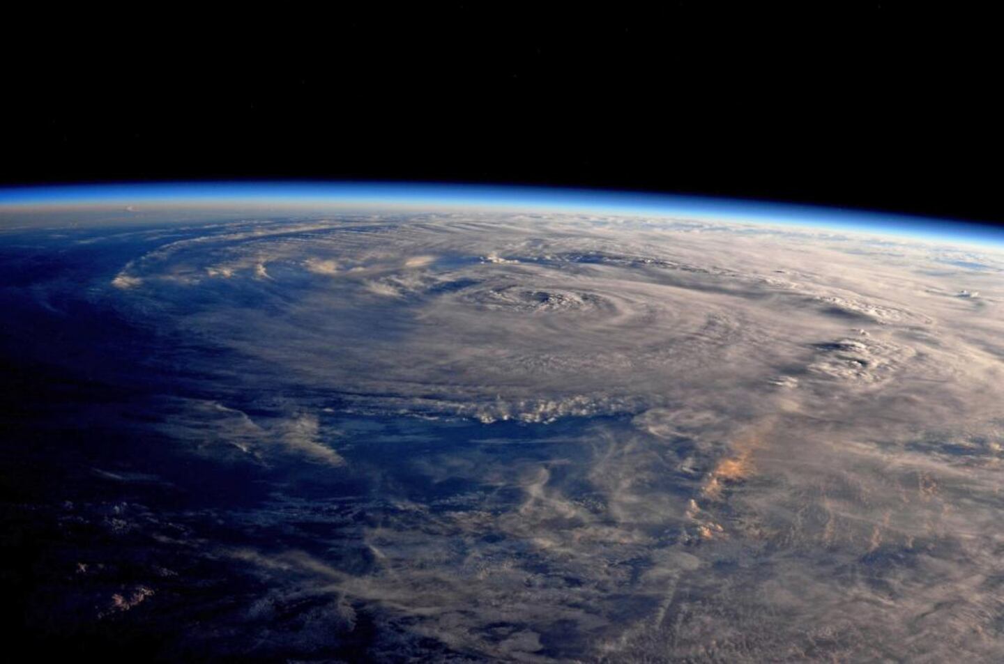
View of "Harvey" Fri. from the Int'l Space Station:
East Atlantic -- as we head into the peak of the Cabo (Cape) Verde season, waves are rolling west off Africa. There's a good chance for development with a wave that's just moved off the coast of Africa. The very early call on this one is a hurricane that recurves over the open West Atlantic but still a lot of time for steering currents to change. There are some long range global forecast models that this cyclone well into the W. Atlantic. And there may be another tropical system that follows. Any buidling/movement &/or strengthening of the Bermuda High makes recurvature more difficult.

Tropical cyclone formation probability over next 1 - 2 days:

Wind shear analysis (red is stronger shear):

Water vapor imagery:

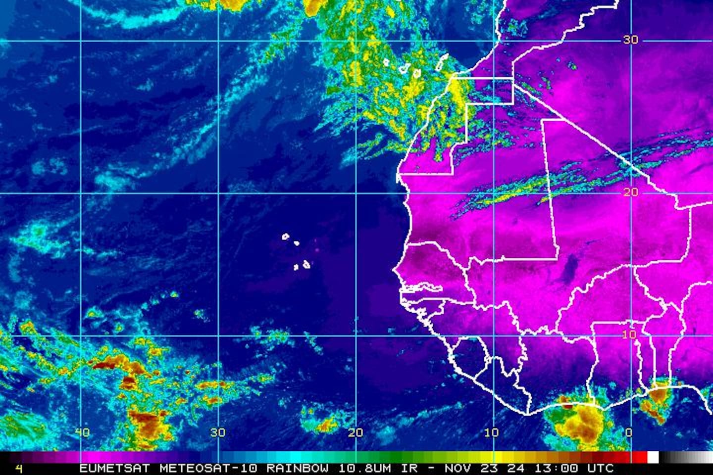
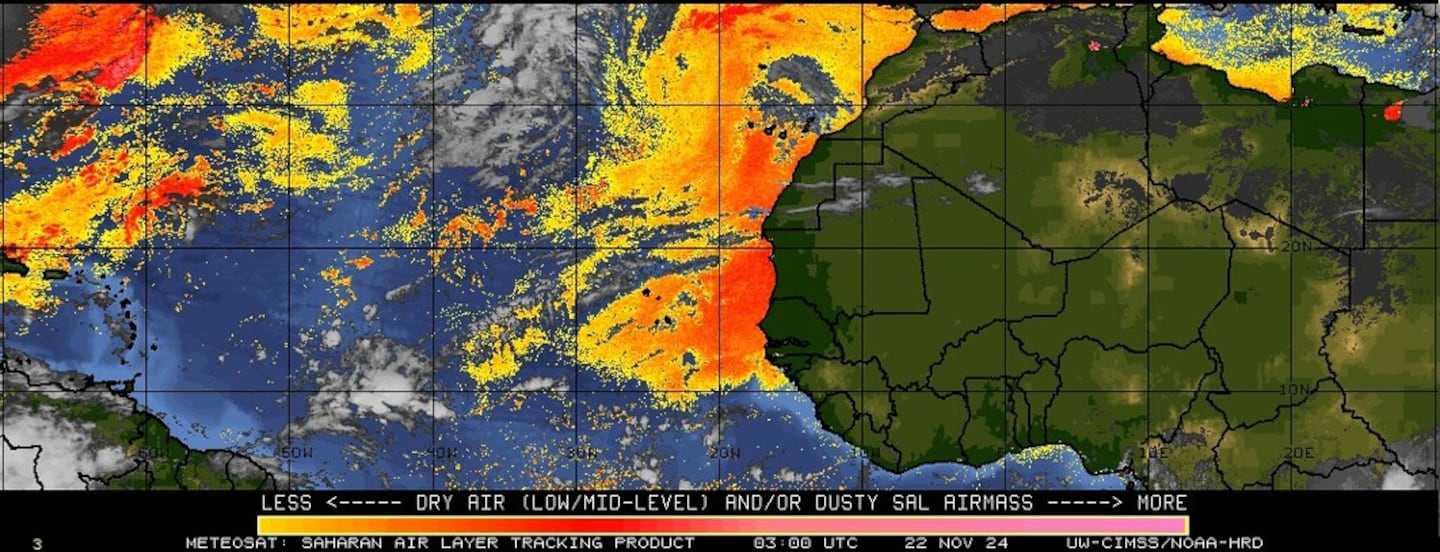
Imagery below courtesy CIMMS shows African Saharan dust (orange & red)....
SE U.S. surface map:


Surface analysis centered on the tropical Atlantic:

Surface analysis of the Gulf:

Caribbean:

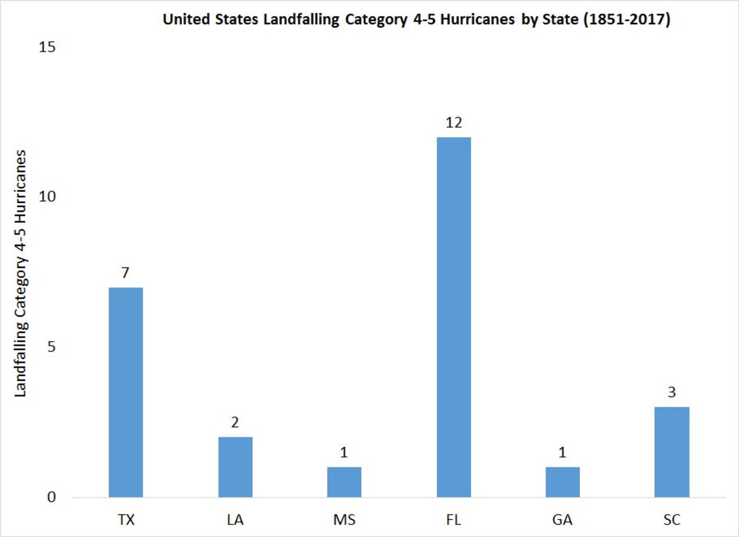
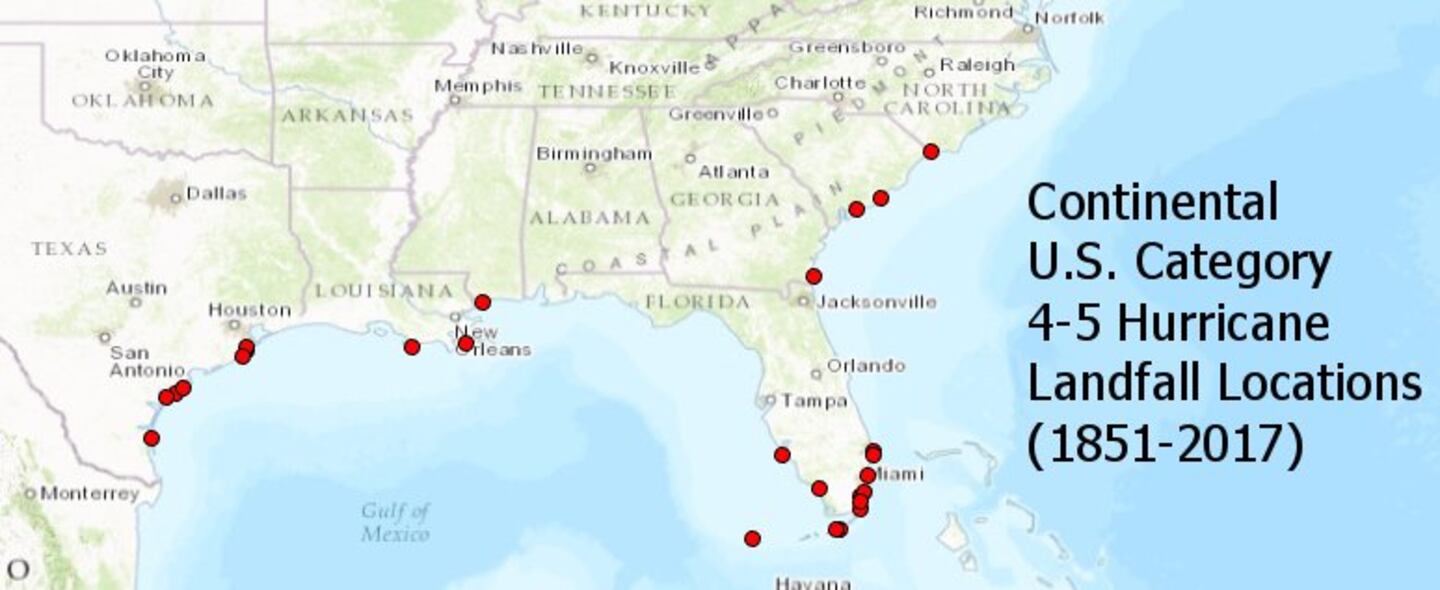
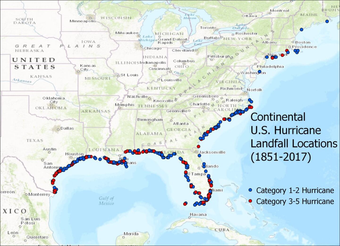
The 3 images below are courtesy Dr. Phil Klotzbach, CSU & take into account Harvey's landfall on the coast of Texas. Florida leads the way for landfalling Cat. 4 or 5 hurricanes... followed by all the U.S. cat. 4 or 5 landfalls since 1851... then any & all U.S. landfalling hurricanes since 1851.
Cox Media Group


