:quality(70)/arc-anglerfish-arc2-prod-cmg.s3.amazonaws.com/public/6IT5RSMUGJ2UNGE7FJMFV4CA4Y.jpg)
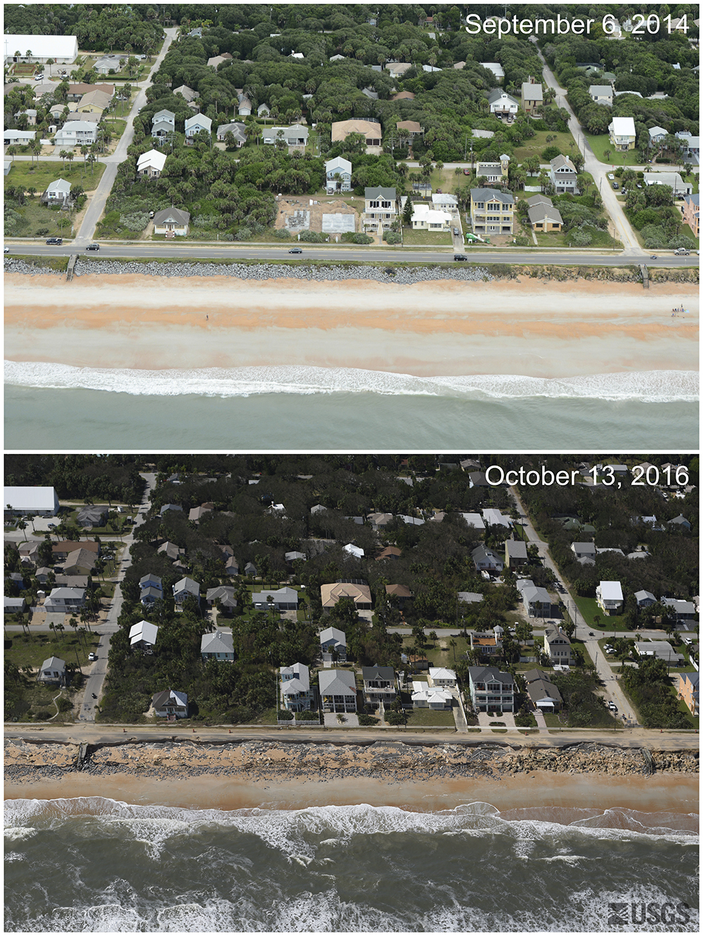
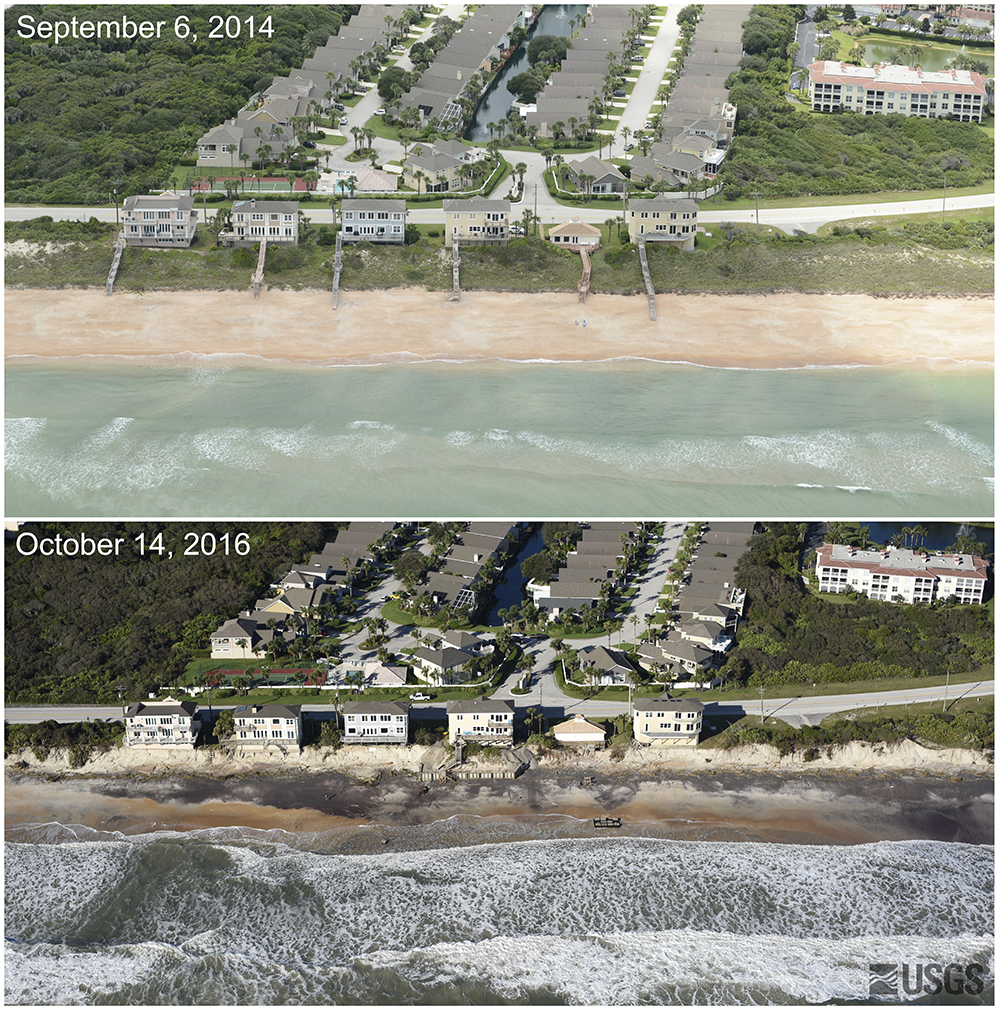
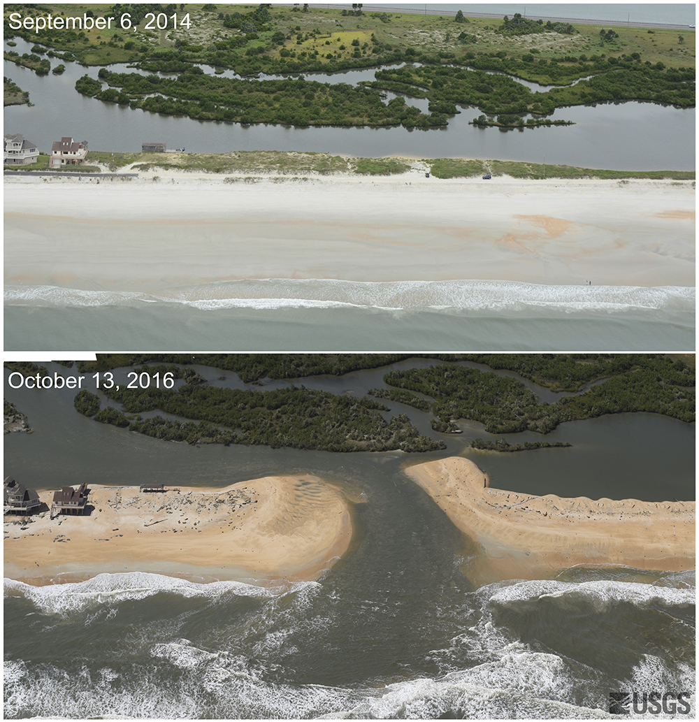
The United States Coast Guard released before and after photos of damage caused by Hurricane Matthew in Florida.
Photos: Interactive aerial images show Jacksonville area before and after Hurricane Matthew
Hurricane Matthew came up Florida's coast in early October.
The photos by the Coast Guard show a new storm-cut inlet and roads, dunes and structures lost because of the storm.
Hurricane Matthew videos from the Jacksonville area that you have to watch
 |
 |
 |
Download the Action News Jax News app and First Alert Weather app
#firstalertwx before & after "Matthew" from @USGS Flagler Beach, new inlet near Matanzas River & Vilano Beach @WOKVNews pic.twitter.com/4247RxqsOT
— Mike Buresh (@MikeFirstAlert) November 1, 2016
One of these alarming photos show a new inlet between the Atlantic Ocean and the Matanzas River in St. Johns County:
Posted by Action News Jax on Tuesday, November 1, 2016
Cox Media Group
:quality(70)/d1hfln2sfez66z.cloudfront.net/04-24-2024/t_d73855398dca4bf5a6e1eca4fedb0fdd_name_file_960x540_1200_v3_1_.jpg)
:quality(70)/cloudfront-us-east-1.images.arcpublishing.com/cmg/NGMKLAKH5NF27JQOAGV7JN25OU.jpg)
:quality(70)/cloudfront-us-east-1.images.arcpublishing.com/cmg/L342PNNGVBHUPJL5JRPUROQN2M.jpg)
:quality(70)/d1hfln2sfez66z.cloudfront.net/04-23-2024/t_8846f6a1613746e2863363cea1df0c34_name_file_960x540_1200_v3_1_.jpg)
:quality(70)/cloudfront-us-east-1.images.arcpublishing.com/cmg/PCJH5CN42RGZLB5S37NFAW2Y4U.jpg)