JACKSONVILLE, Fla. — Tracking a dry morning commute.
- Temperatures in the 70s this morning.
- Highs today in the lower to mid 90s.
- Feels like temperatures today: 100-103
- Isolated afternoon storms will develop on the sea breeze and move inland.
- Storms developing: 2 p.m. - 4 p.m.
- Storms should move well inland for evening plans around Jacksonville and the coast.
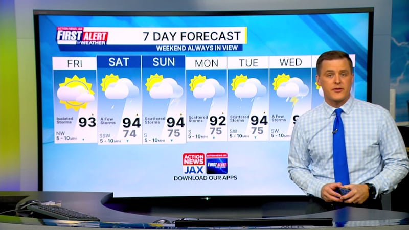
- A few afternoon storms on the way Saturday with scattered storms in the afternoon on Sunday.
- Highs remain in the mid 90s into the weekend.
TROPICS:
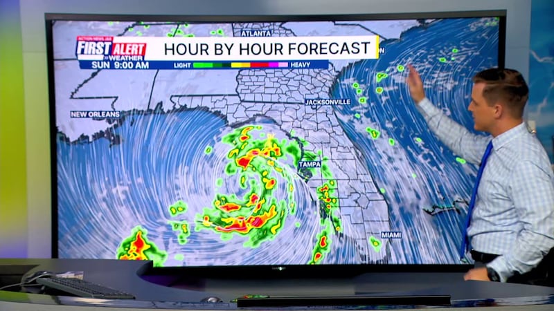
Quiet Atlantic Basin. Eye on the N/NE Gulf over next 5 days where low pressure may develop with a low chance for tropical development. Next name: Bertha. An active tropical wave moving off of Africa looks like it has little chance for long term development.
TODAY: Partly sunny. Hot and humid. Isolated afternoon inland storms. HIGH: 93
TONIGHT: Lingering inland shower/storm early. Partly cloudy and muggy. LOW: 74
SATURDAY: Partly sunny with a few afternoon storms. 74/94
SUNDAY: Partly cloudy with scattered afternoon storms. 75/94
MONDAY: Partly cloudy with scattered showers and storms. 75/92
TUESDAY: Partly cloudy with scattered afternoon storms. 75/94
WEDNESDAY: Partly sunny with a few afternoon storms. 74/95
THURSDAY: Partly cloudy with scattered afternoon showers/storms. 75/93
WATCH THE FORECAST | DOWNLOAD THE APPS
Follow Action News Jax Meteorologists on Twitter for updates:
Mike Buresh | Garrett Bedenbaugh | Corey Simma | Trevor Gibbs
ALLERGY TRACKER: See what the pollen counts look like in our area
LISTEN: Mike Buresh ‘All the Weather, All the Time’ Podcast
INTERACTIVE RADAR: Keep track of the rain as it moves through your neighborhood
SHARE WITH US: Send us photos of the weather you’re seeing in your area ⬇️


