JACKSONVILLE, Fla. — Tracking a dry bus stop forecast for back to school today.
- Temperatures in the 70s to low 80s.
- Heat advisory in effect for all of NE Florida and Coastal SE Georgia from noon - 7 p.m.
- Highs this afternoon will be in the lower to mid 90s.
- Feels like temperatures will top out at 105+.
- An isolated afternoon storm is possible this afternoon.
- The rest of this week will be HOT with highs in the mid 90s.
- Feels like temperatures will be 100-105 each afternoon.
- A few afternoon storms.
TROPICS:
- 3 areas to track over the Atlantic:
- Wave over the Central Atlantic that will reach the Caribbean late this week but unlikely to develop.
- Stronger wave over the far Eastern Atlantic that does have the potential to develop – likely to go north/northeast of the Caribbean in the long range while turning more northwest then gradually more north.
- Disturbance that was east of Jax Saturday Is moving across the North Atlantic away from the U.S. – unlikely to develop.
- Next name: “Cristobal”.

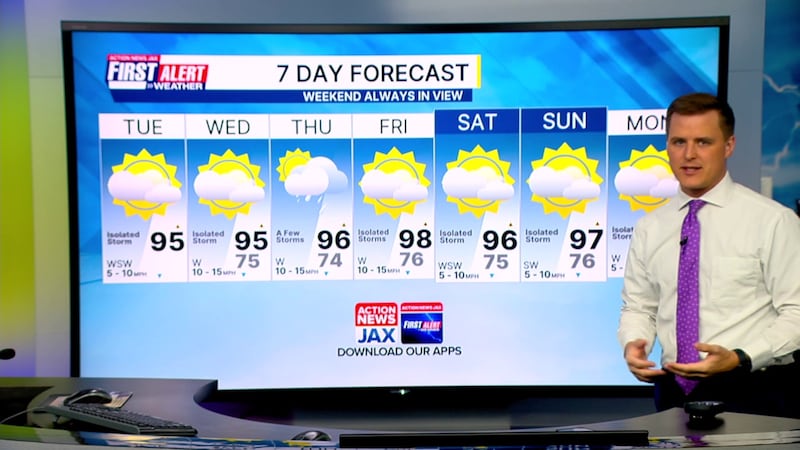
TODAY: Partly sunny with an isolated afternoon storms. HIGH: 95
TONIGHT: Partly cloudy and warm. LOW: 75
WEDNESDAY: Partly cloudy and hot, isolated afternoon storm. 75/95
THURSDAY: Partly cloudy and hot, a few afternoon storms. 74/96
FRIDAY: Partly cloudy and hot, isolated afternoon storm. 76/98
SATURDAY: Partly sunny and hot, isolated afternoon storm. 75/96
SUNDAY: Partly sunny and hot. Isolated afternoon storm. 76/97
MONDAY: Partly sunny and hot. Isolated afternoon storms. 76/96
WATCH THE FORECAST | DOWNLOAD THE APPS
Follow Action News Jax Meteorologists on Twitter for updates:
Mike Buresh | Garrett Bedenbaugh | Corey Simma | Trevor Gibbs
ALLERGY TRACKER: See what the pollen counts look like in our area
LISTEN: Mike Buresh ‘All the Weather, All the Time’ Podcast
INTERACTIVE RADAR: Keep track of the rain as it moves through your neighborhood