Highs today in the mid to upper 70s. A strong cold front will bring gusty winds, widespread beneficial rain, and a threat for an isolated thunderstorm mid to late morning and midday. — Tracking temperatures in the 60s this morning.
- Highs today in the mid to upper 70s.
- A strong cold front will bring gusty winds, widespread beneficial rain, and a threat for an isolated thunderstorm mid to late morning and midday.
- A few gusty winds are possible, and an isolated tornado can’t be ruled out
- Arrival times:
- Jacksonville will see this rain arriving between 10 a.m. to 11 am.
- Fernandina Beach to Middleburg: 10 a.m. to 11 a.m.
- Waycross to Lake City: 8 a.m. to 9 a.m.
- Brunswick to Starke: 9 a.m. to 10 a.m.
- St. Augustine to Palatka: 11 a.m. - Noon
- Rain is out of here by 1 p.m. to 2 p.m.
- The afternoon commute will be dry but breezy.
- Wind advisory until 7 p.m. tonight. Gusty winds of 30-40 mph possible this morning and afternoon.
- We turn much cooler by Thursday with highs in the mid 60s.
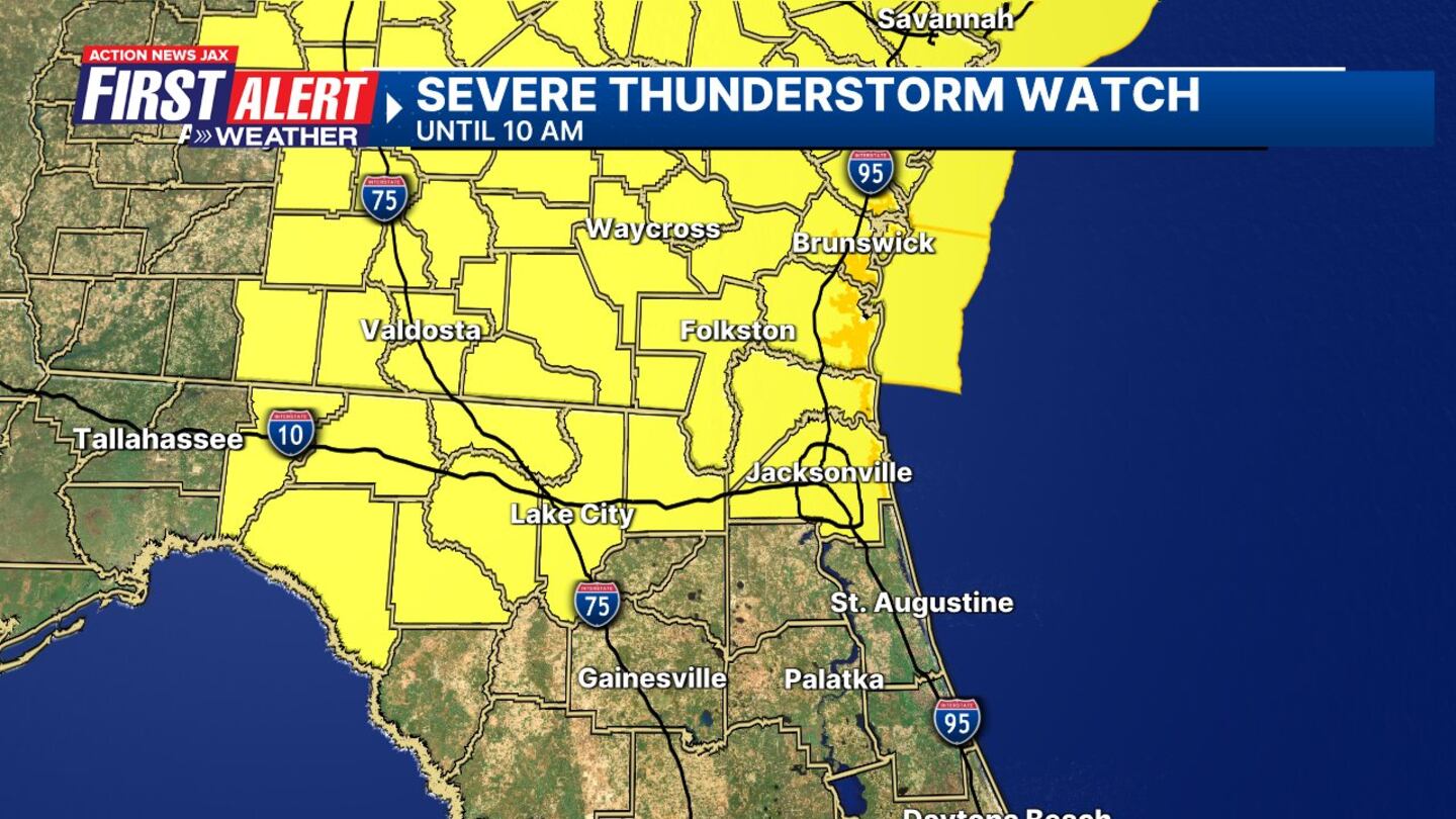
Severe Thunderstorm watch until 10 a.m. for I-10 and north into SE Georgia
>>> STREAM ACTION NEWS JAX LIVE <<<
TODAY: Mild, humid, breezy, line of showers and an isolated strong t-storm. 60/77
TONIGHT: Mostly clear and breezy. LOW: 47
THURSDAY: Sunny and much cooler. Breezy. 47/64
FRIDAY: Sunny. 40/72
SATURDAY: Mostly sunny to partly cloudy, showers late. 49/79
SUNDAY: Cloudy with showers. 57/72
MONDAY: A few showers early. Turning partly cloudy. 48/68
TUESDAY: Mostly sunny. 47/73
[DOWNLOAD: Free Action News Jax app for alerts as news breaks]

[SIGN UP: Action News Jax Daily Headlines Newsletter]
Click here to download the free Action News Jax news and weather apps, click here to download the Action News Jax Now app for your smart TV and click here to stream Action News Jax live.


