
Here’s what the First Alert Weather Team said you can expect for the forecast:
TROPICS: Isaias to make landfall early this evening just southeast of Pensacola. Some “fringe” effects for the local area – a few heavy thunderstorm bands and isolated tornado threat this evening and again midday through afternoon Saturday.
Always more: “Talking the Tropics With Mike”.

NUGGETS:
** Isaias outer bands to bring periods of heavy rain, gusty winds, isolated tornadoes **
- Bands of very heavy showers & storms will produce gusty winds & produce an isolated tornado into early this evening as hurricane Isaias makes landfall near Pensacola in the far Western Florida Panhandle.
- Saturday will be windy with several bands of heavy and gusty showers and thunderstorms as well as a continued isolated tornado threat.
- By Sunday a few showers and storms will occur through about midday but will be brief with a much lower severe threat. The afternoon will become mostly sunny and warm.
- The area will finally dry out next week with plenty of sun.
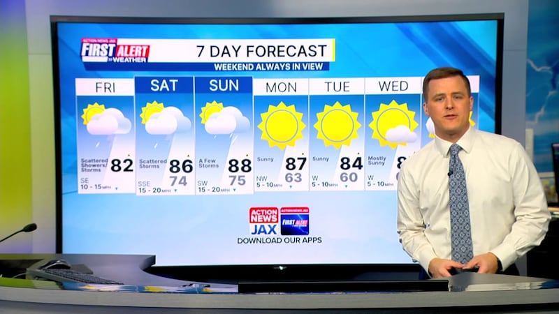
TONIGHT: Breezy with scattered evening gusty showers and storms shifting north and diminishing by midnight. Low: 77
SATURDAY: Windy.. partly to mostly cloudy with scattered heavy showers and storms – severe storm possible. High: 89
SATURDAY NIGHT: Mostly cloudy and breezy with a few showers, a t’storm. Low: 75
SUNDAY: Partly cloudy with a morning shower or storm then sun and breezy in the afternoon. High: 88
MONDAY: Sunny, far less humid. 63/87
TUESDAY: Sunny. 60/87
WDNESDAY: Mostly sunny. 60/87
THURSDAY: Partly sunny. 64/86
FRIDAY: Partly cloudy. 66/83
WATCH THE FORECAST | DOWNLOAD THE APPS
Follow Action News Jax Meteorologists on Twitter for updates:
Mike Buresh | Garrett Bedenbaugh | Corey Simma | Trevor Gibbs
ALLERGY TRACKER: See what the pollen counts look like in our area
LISTEN: Mike Buresh ‘All the Weather, All the Time’ Podcast
INTERACTIVE RADAR: Keep track of the rain as it moves through your neighborhood


