
May 6, 2019 — Miami air Boeing 737 ended up at the end of the runway nosing into the St. Johns River Fri. evening, May 3rd.
It is not known for certain why the plane skidded off the runway as of this writing but the plane was landing during a heavy thunderstorm - winds were gusting to 18 mph out of the W/NW (tailwind) but could have been much stronger with a change in direction at higher altitudes due to the storms... visibility was as low as 2 miles in heavy rain... cloud ceiling (base of clouds) was near 1,500 feet and there was frequent lightning. The "nerdy" METAR (Meteorological Aerodrome Report) observation near the time of the incident:
KNIP 040145Z 29008G16KT 3SM +TSRA BR SCT008 BKN015CB OVC032 24/22 A2999 RMK AO2 TSB04 FRQ LTGIC OHD TS OHD MOV E T1 SET P0063 T02440222
The cloud tops on these storms were as high as 30,000-40,000 feet as measured on First Alert Doppler HD:


First Alert Doppler HD imagery as the Boeing 737 was landing - lightning rainfall rates of 2"+ per hour:


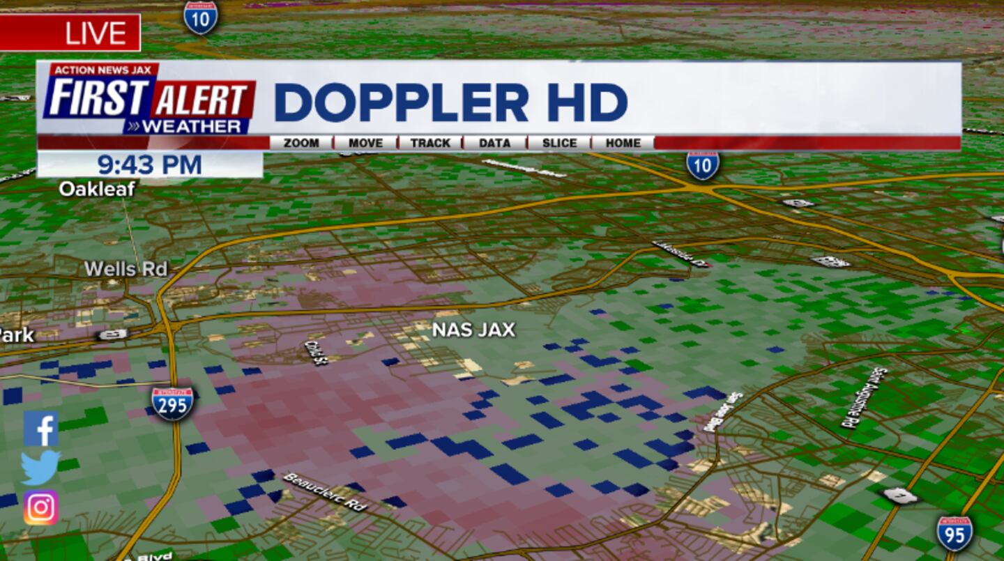
Velocity data on First Alert Doppler HD does not show any extreme wind at the surface as was indicated by the weather ob of a wind out of 290 degrees (W/NW) at 8 knots (7 mph) gusting to 16 knots (18 mph):
At first light early Saturday, 05/04 from the First Alert Skycam Network at Riverside (~ 8 miles):

Air speed at landing was 163 knots (188 mph) ... landing speed was 178 knots (205 mph).


This week - through Sat., May 11th - is 'Hurricane Preparedness Week'. There are daily themes & safety tips * here * -
* help your neighbor &....
Always prepare for storm season & hurricanes far in advance. In conjuction with messaging preparation, the NHC will conduct their annual "awareness tour" with the last stop in our own 'backyard' - Brunswick, Ga. We hope to see you there. We'll have the First Alert Storm Tracker & will be talking with the new hurricane center director, Ken Graham as well as several hurricane center forecasters.

0
NHC media / public announcement:
What: 2019 Hurricane Awareness Tour
Where: Brunswick Golden Isles Airport
295 Aviation Pkwy, Brunswick, GA 31525
When: Friday May 10, 2019
Open to the Public: 2:00 PM – 5:00 PM
Mark your calendars! The Hurricane Hunter aircraft and pilots will be visiting Brunswick, GA on Friday May 10th, 2019.
The 2019 Hurricane Awareness Tour will make a stop Brunswick Golden Isles Airport on May 10, 2019. Public tours will occur from 2 – 5pm with all ages welcome to join us! This opportunity will allow the public to tour inside the aircraft, meet and talk with crew members and pilots, and speak with the National Hurricane Center Director Ken Graham. Additionally, local first responders will be on site displaying their helicopters, firetrucks, and other emergency response vehicles. We invite you to learn more about all the hazards associated with hurricanes from National Weather Service meteorologists and Georgia Emergency Management. This will be the first visit near the Jacksonville, FL area since 2015 when it was hosted in St Augustine, FL. If you’re interested in the opportunity to meet a hurricane hunter or hurricane specialist, this is your chance to visit them in person to learn more about their exciting mission.
Have you ever been fascinated by hurricanes or wondered how it is possible for people to fly safely into them? If the answer is yes, then mark your calendar for the 2019 Hurricane Awareness Tour in Brunswick, Georgia on May 10th! Here’s a quick video of what it’s like to be a Hurricane Hunter
Hurricane specialists representing the National Oceanic and Atmospheric Administration (NOAA) and members of the USAF Reserve will visit five U.S. East Coast cities. Together, they will be showcasing aircraft they use for tropical cyclone interrogation, a WC-130J Hurricane Hunter aircraft along with the NOAA Lockheed WP-3D Orion aircraft. Their visit is intended to raise awareness of the impacts from tropical cyclone threats and why it’s dangerous to face a land falling storm without a hurricane plan in place.
The National Hurricane Director, Ken Graham, and Hurricane Specialist Daniel Brown will also be present to help educate those in vulnerable communities about hurricane preparedness and will be available for interviews. Staff from Emergency Management offices, non-profit organizations including the American Red Cross, Federal Alliance for Safe Homes (FLASH), and Meteorologists from the National Weather Service will be part of the tour at each stop.
Among those invited to participate and tour include community groups, media, local elected officials and select local schools (by invitation only) as well as the general public. Public tours will be given from 2:00 to 5:00 pm. Registration is not required for public tours. However, due to the schedule of the aircraft crew, public tours will promptly end at 5:00 pm.
1
The NHC has completed its post storm report on historic hurricane Florence - click * here *. The tropical cyclone dumped record breaking rainfall on parts of the Carolina's in mid September, 2018 & was one of two names retired (Michael was the other name retired).


Cox Media Group


