
Aug. 27, 2019 — The "Buresh Bottom Line": Always be prepared!.....First Alert Hurricane Survival Guide... City of Jacksonville Preparedness Guide... Georgia Hurricane Guide.
STAY INFORMED: Get the * FREE * First Alert Weather app
FREE NEWS UPDATES, ALERTS: Action News Jax app for Apple | For Android
WATCH "Surviving the Storm"
READ the First Alert Hurricane Center "Survival Guide"
DORIAN:
It's still early on this one but POSSIBLE Jacksonville/NE Fl./SE Ga. impacts (primarily Sat./Sun./Mon. & very dependent on exact location & intensity of Dorian:
* moderate to high rip current risk at area beaches. Always swim & surf with a "buddy" & as near a lifeguard as possible.
* rough seas & surf... some coastal flooding (accentuated by new moon phase Fri.)
* breezy winds out of the east 15-20 mph, higher gusts
* several periods of heavy showers & t'storms but probably not a "washout"
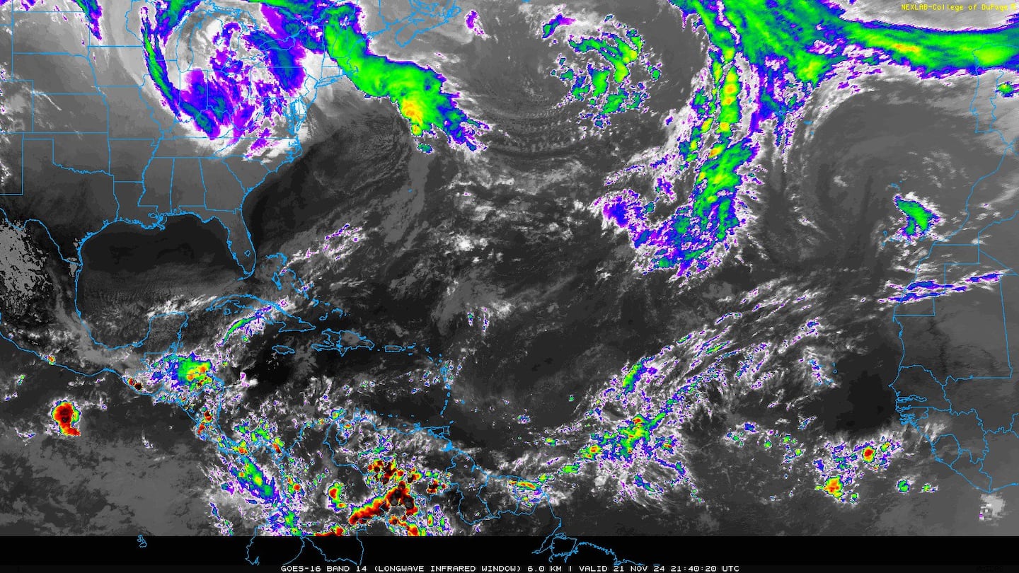
Tropical storm Dorian continues to move steadily west/northwest with gradual structural organization (some banding + bursts of t'storms) evident on satellite data though considerable nearby dry air often interrupts the process, do Dorian seems to have start all over again. Sort of 1 step forward, 2 back which is keeping the tropical cyclone essentially steady state. Squalls of heavy rain & gusty winds hit Barbados & St. Lucia head-on Mon. night into early Tue. & now Dorian will move "freely" over the NE Caribbean before approaching Puerto Rico Wed. & the Dominican Republic Wed. night/Thu. where tropical storm WARNINGS & a hurricane WATCH are in effect. The official NHC forecast takes Dorian to near hurricane strength while traversing the NE Caribbean but overall conditions (shear & especially dry air) look marginal which may very well result in some weakening in the longer term, especially if there's much land interaction. So the overall marginal atmospheric conditions + possible land interaction - Puerto Rico & Hispaniola - should limit - & possibly decrease - Dorian's intensity - at least for a while - from late Wed. into Thu. It's worth noting that Dorian is a small/compact system - tropical storm force winds extend about 45 miles from the center - & therefore may be susceptible to even small changes in its environment (shear/ dry air/land) resulting in wide intensity swings over a short period of time. In any case.... anyone with travel plans to the Caribbean through the week should stay up to date on the latest forecasts. Strong winds & heavy rain will affect especially the Northern Lesser Antilles through Tue. followed by impacts on Puerto Rico Wed. & Haiti & especially the Dominican Republic by Wed. night/Thu.
As for once beyond the Caribbean..... the GFS & European models had been consistent on weakening - or even dissipating - Dorian once deeper into the Caribbean &/or over/near Hispaniola (mountainous terrain). HOWEVER, the European continues - so far - with a relatively weak Dorian surviving & then reaching the Florida coast over the weekend while trying to re-strengthen over & near the Bahamas followed by a move over Fl. as a tropical storm. The GFS model, on the other hand, remains emphatic on a more westward move of a much weaker system with lots of interaction with Hispaniola which helps cause Dorian to weaken at least to a depression if not an open wave resulting in Dorian being steered more by the low level easterly trade winds which then take a very weak Dorian well west. This scenario certainly is not off the table but doesn't seem to have a lot of other support - at least for right now - from other global models nor given the current analysis vs. its forecast output.
Our "fork in the road" is coming down to what Dorian's core looks like once out of Hispaniola (if it survives that transit). It seems likely that a weak trough over the Western Atlantic later this week will not be strong enough to pick up Dorian. Instead, high pressure will rebuild in place of the exiting trough turning Dorian back more to the west/northwest. In addition.... the trend now is for Dorian to possibly on brush Hispaniola which would imply less interaction with very mountainous terrain though there may be some interaction with Puerto Rico as well. The UKMET model is showing a similar trend as the European though is even strogner (but has not done particularly well w/ t.d. #6 - too strong, too far west). IF Dorian survives to see the weekend then conditions over the SW Atlantic & near the Bahamas do appear favorable for at least maintaining Dorian if not allowing for strengthening.
So.... the bottom line is stay up to date on the latest forecasts for the Caribbean, Fl. & Southeast U.S. this week into the upcoming holiday weekend.

Spaghetti model plots for Dorian (the GFS is so weak that it doesn't generate a longer range forecast path!):

Ensemble (An ensemble weather forecast is a set of forecasts that present the range of future weather possibilities) spaghetti plots: (for an in-depth look on ensemble modeling see * this * [Blake/Brennan, NHC])

The shear analysis (see image below) helps tell some of the steering as well. There is a relatively small area of shear over the northwest portion of the circulation. But more importantly is a larger area of shear north Hispaniola over the Bahamas associated with an upper low that's moving south/southwest. Two things on this upper low: (1) it will continue to produce shear over or near Dorian, especially as Dorian advances W/NW.... (2) there should some nudge at least northward on the east side of the upper low. This is where it seems a lot of the modeling differences are coming in - on the handling of this upper low feature. The GFS model doesn't seem to find it to be a "big deal" vs. some of the other models. So this is another forecasting aspect to closely watch.

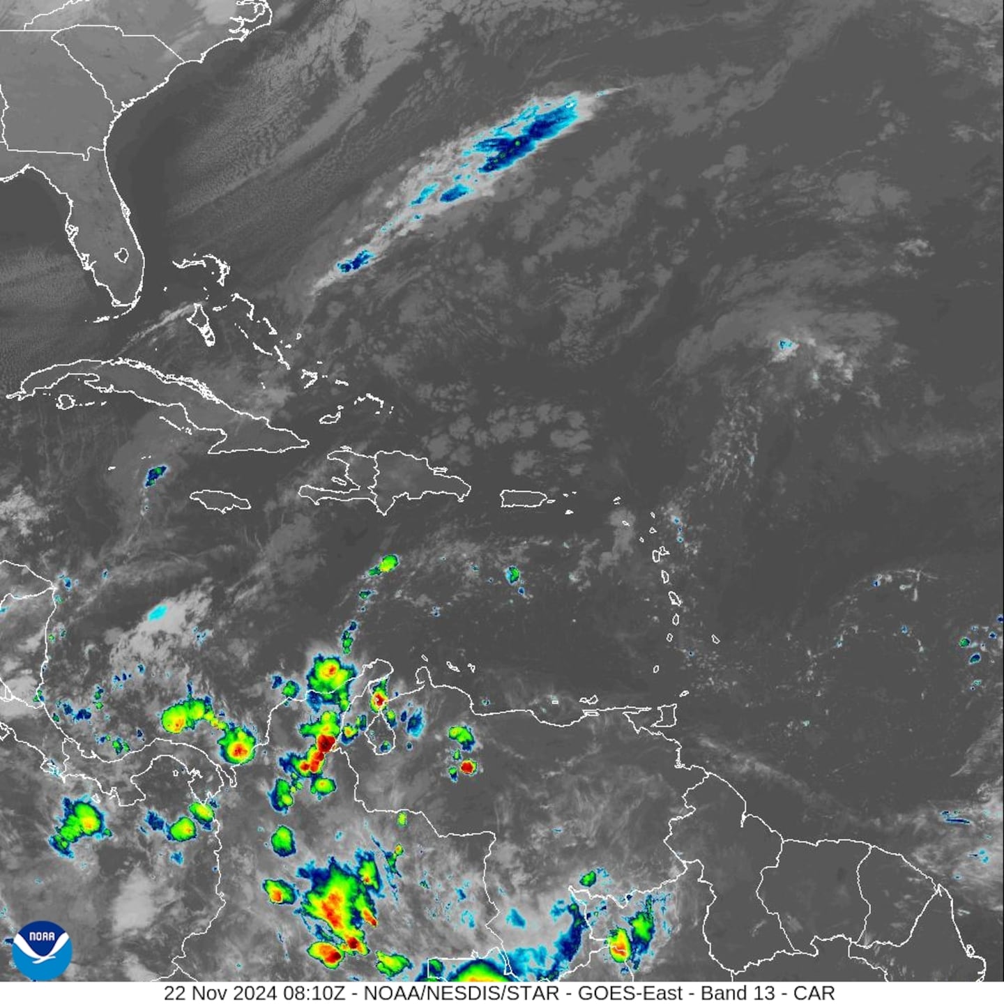
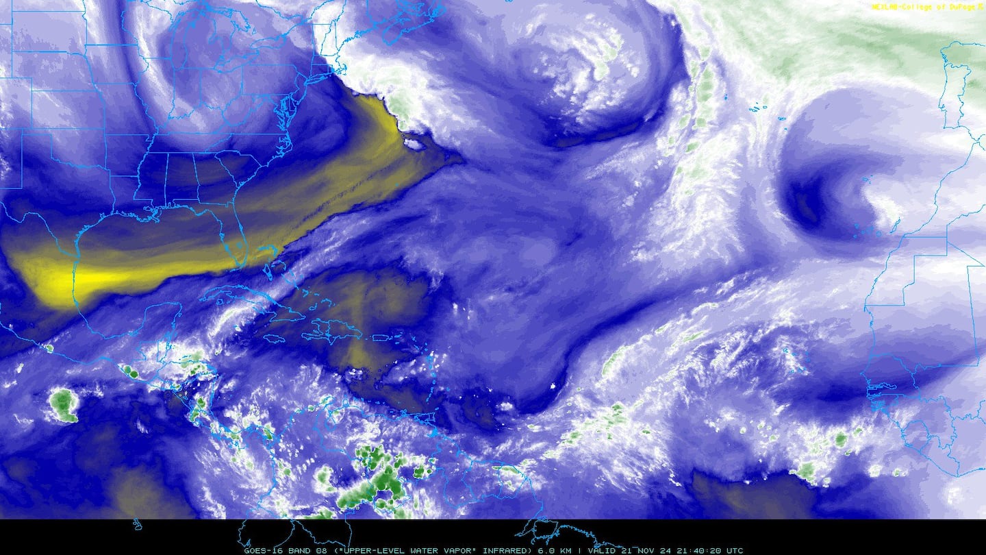
IR satellite:

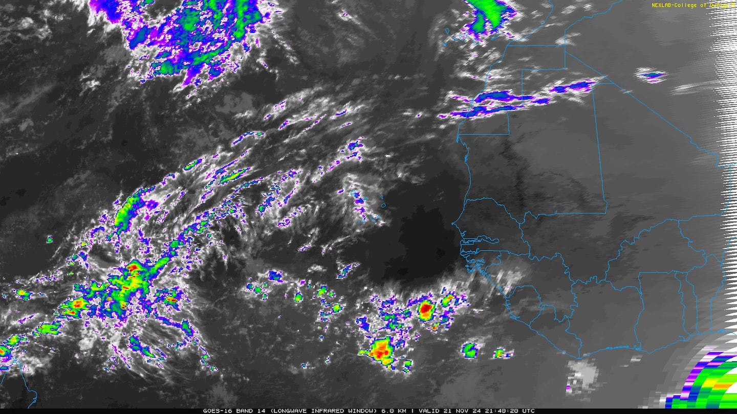
Visible satellite:

Tropical wave '98-L' was upgraded to tropical depression #6 late Mon. & will likely become tropical storm "Erin" over the Western Atlantic east of the Carolina's. Rip currents along area beaches are the biggest threat from the Carolina's to Chesapeake Bay to possibly New England.
No change in the movement forecast. An upper level trough to the north has become the main steering mechanism taking the storm well east of the U.S. east coast & west & northwest of Bermuda. Other than the rip current risk along the U.S. east coast, no major direct impacts are expected & certainly no impacts for NE Fl./SE Ga.
Spaghetti model forecasts for '98-L' & t.s. "Dorian":
0
1


An examination of dust over the Central & Eastern Atlantic shows a continuation of a good deal of dust over the Central & Eastern Atlantic as well as parts of the Caribbean. Dorian will encounter much of this dry air in the coming days.

2019 names..... "Erin" is next on the Atlantic list (names are picked at random... repeat every 6 years... historic storms are retired (Florence & Michael last year):
East Atlantic:


Mid & upper level wind shear (enemy of tropical cyclones) analysis (CIMMS). The red lines indicate strong shear of which there is plenty across the Atlantic at the moment:

The Atlantic Basin:

Water vapor imagery (dark blue indicates dry air):
Deep oceanic heat content:

Sea surface temp. anomalies show a warm Gulf of Mexico, Central & Northwest Atlantic while the "Main Development Region" (MDR) remain cooler than avg. along with parts of the Central Caribbean.....

SE U.S. surface map:

Surface analysis centered on the tropical Atlantic:
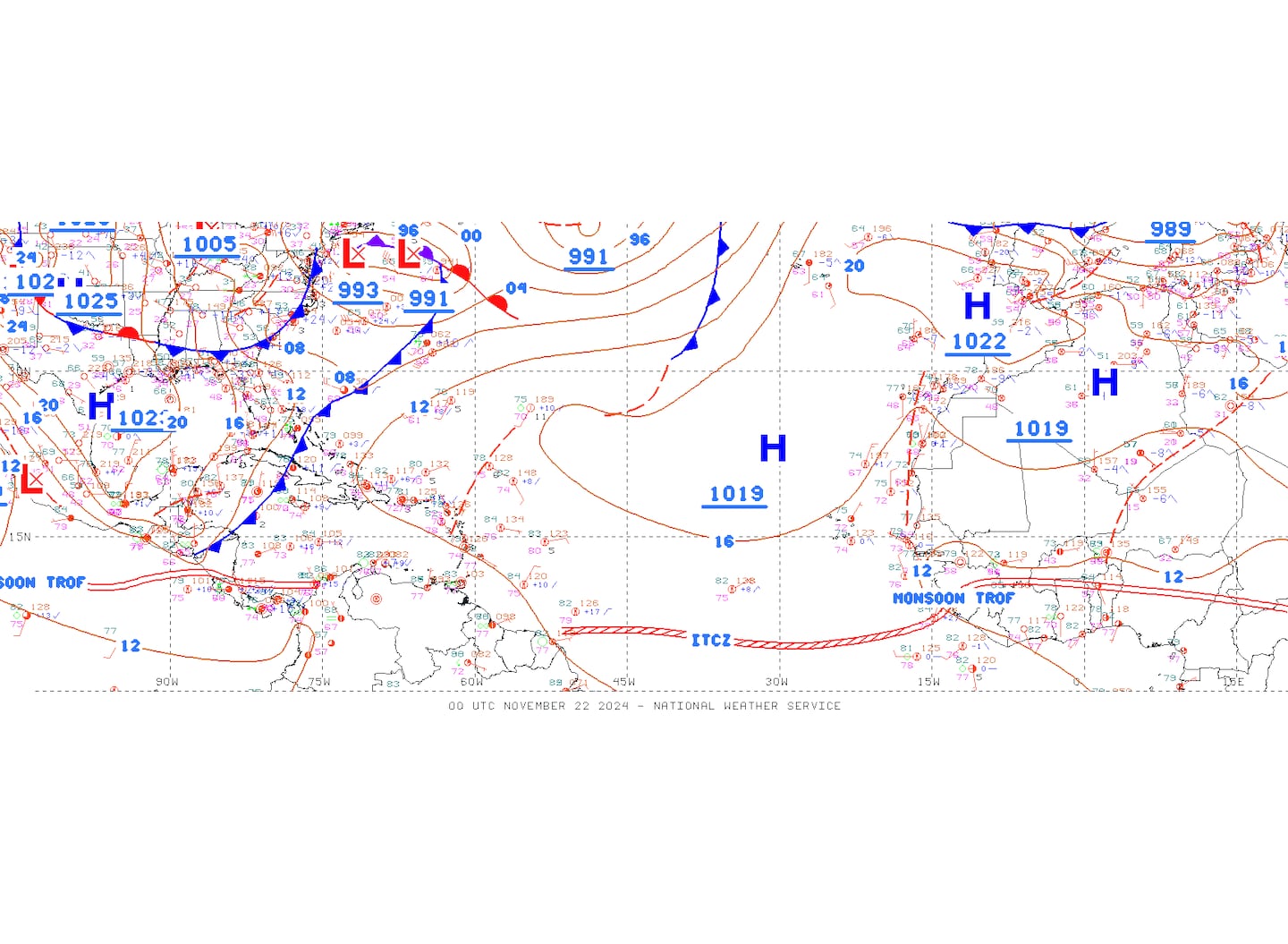
Surface analysis of the Gulf:

Caribbean:

Cox Media Group


