June 20, 2017 — Two systems over the Atlantic Basin: "Bret" far Southern Caribbean.... & what's likely to become "Cindy" over the Central Gulf of Mexico......
Impacts on Jacksonville/NE Fl./SE Ga.: Zero.
The area of "disturbed weather" -- wave '93L' / potential tropical cyclone #3 -- continues to produce numerous albeit pretty disorganized showers and thunderstorms from the Western Caribbean northward into the Gulf of Mexico. After "jumping" north Mon., the surface low has a decent circulation over the Central Gulf just about due south of New Orleans . The low pressure continues to be heavily weighted on the right side - in other words, most of the heavy rain, squalls & storms are over the eastern portion of the low pressure area. This slow festering if you will -- with a system tilted to the right -- is pretty classic for early season tropical systems. It's possible "Cindy" will be initially classified as subtropical (not a pure warm core yet).
The GFS forecast model is still trending west & is more in line with the European & UKMET (a pretty reliable model during last year's hurricane season) showing a track more to the west. It looks like the low will take an alleyway toward Louisiana & Texas - between two strong upper level highs - the sprawling Bermuda high over the Central/Western Atlantic & a building ridge over the SW U.S.
This system will not have a major impact on Jacksonville/NE Fl./SE Ga. Heavy tropical-like rains will occur through midweek with or without a direct tropical storm hit. The heaviest rain will be closer to the low from the Florida Panhandle west to Texas where total rainfall will exceed a foot along with a threat for isolated tornadoes. Tropical storm WATCHES & WARNINGS extend from the upper Texas coast to SE Louisiana.


Spaghetti plots for the Gulf disturbance:

Gulf of Mexico satellite imagery shows very strong convection but an exposed low (the storms do not wrap around the center):

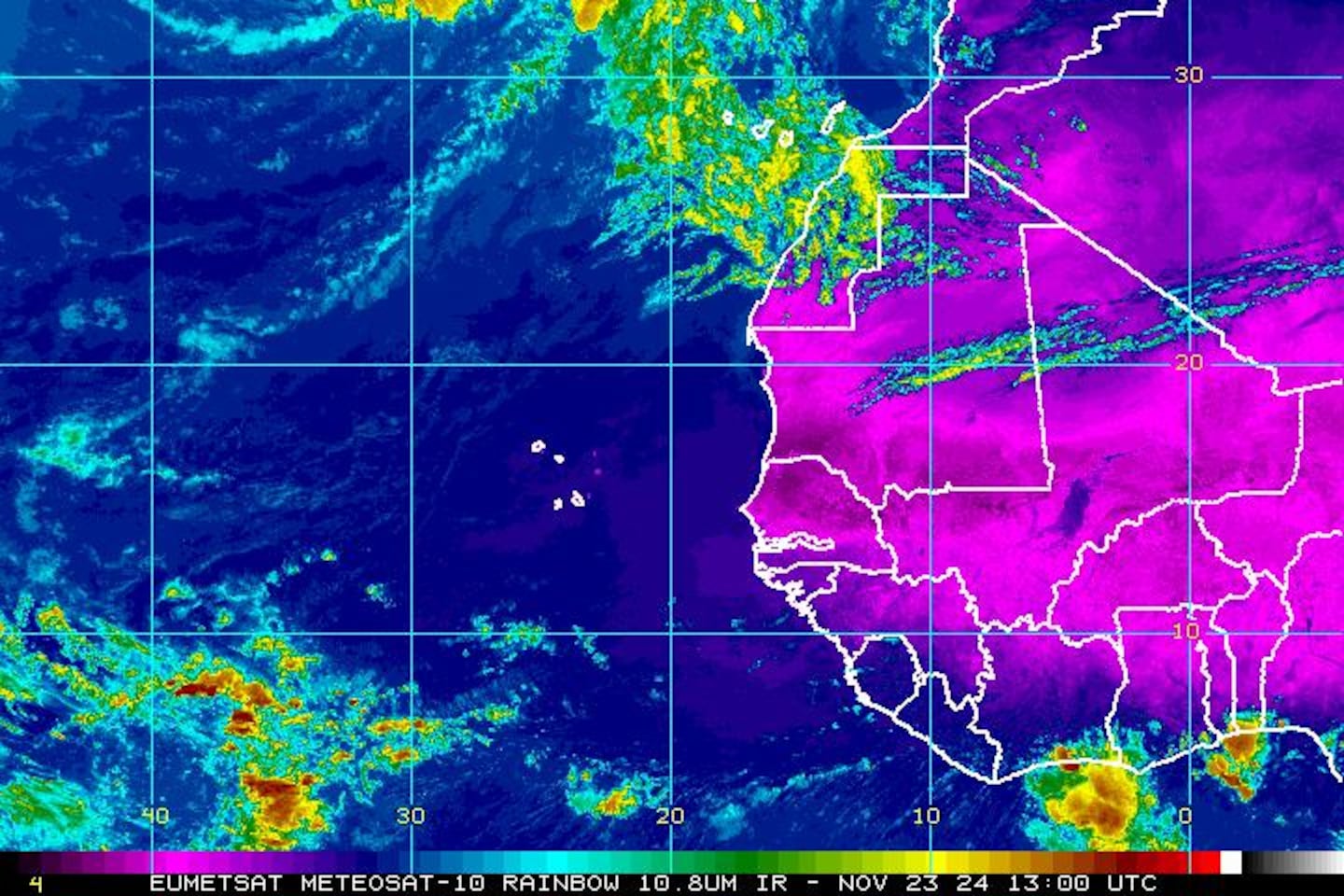
Water vapor imagery below shows the expansive tropical moisture plume from the S.W. Atlantic & Florida extending southwest through the Caribbean & into the Eastern Pacific.

Surface disturbance over the Gulf:

"Bret" in the SE Caribbean:

Heavy rain for much of the eastern half of the U.S. this week.... particularly near the Gulf Coast as tropical moisture surges north in association with the Gulf tropical disturbance. Rainfall could reach 15"! near New Orleans with 4-6" north into Tennessee. Major flooding is a concern this week along the I-10 corridor from the Fl. Panhandle to Texas as well as the Southern Appalachians west to the Mississippi River.....
0
Meanwhile.... tropical storm "Bret" was upgraded late Monday. Tropical storm force wind gusts - & possibly sustained winds - will affect the far southern Lesser Antilles as well as the north coast of Venezuela & Aruba through early Wed. The system will move steadily W/NW then W steered by the large upper level high over the Atlantic. Interaction with land + increasing shear will limit "Bret" which will stay far to the south of Florida so no local impacts.
1
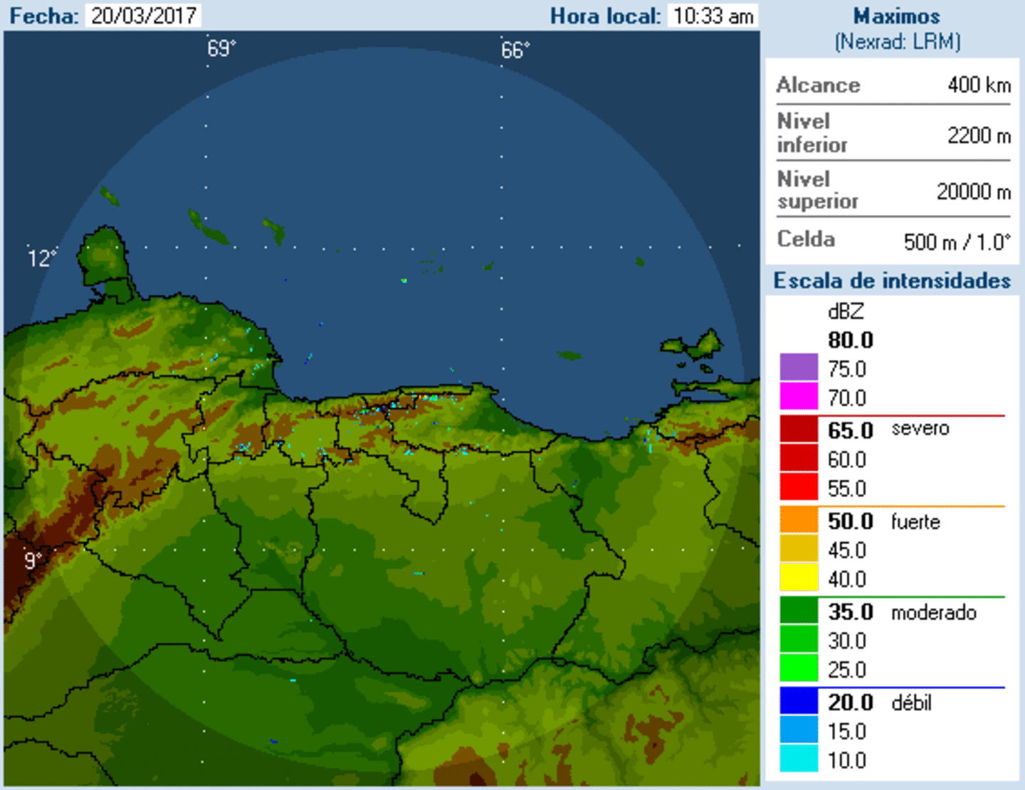
Radar imagery from Northern Venezuela:

Spaghetti plots for wave "Bret":

It's awfully early in the season to see an African wave develop into a tropical cyclone such as "Bret" has managed to do. Nothing organized moving off Africa for the moment, but there are still some decent tropical waves for this early in the season:
An analysis of wind shear shows why significant strengthening has been -- & will be -- difficult for tropical waves. Shear exceeds 50 knots across much of the Gulf of Mexico, Caribbean & SW Atlantic:

Cox Media Group