
Jacksonville, Fl. — The “Buresh Bottom Line”: Always be prepared!.....First Alert Hurricane Survival Guide... City of Jacksonville Preparedness Guide... Georgia Hurricane Guide.
STAY INFORMED: Get the * FREE * First Alert Weather app
FREE NEWS UPDATES, ALERTS: Action News Jax app for Apple | For Android
WATCH “Talking & Tracking the Tropics: The Science Behind the Season”
WATCH “Preparing for the Storm”
READ the First Alert Hurricane Center “Survival Guide”
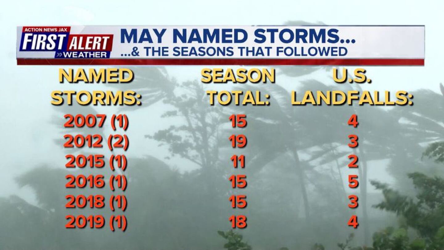
The 2020 hurricane season has been off to an early start. Tropical storm “Arthur” formed in mid May (16th) east of Florida staying offshore over the Western Atlantic. On May 27th, tropical storm “Bertha” quickly formed just off the coast of S. Carolina moving ashore near Charleston within a few hours of being upgraded. While not necessarily always true, recent history has shown tropical development in May has been followed by “active” seasons including U.S. landfalls:
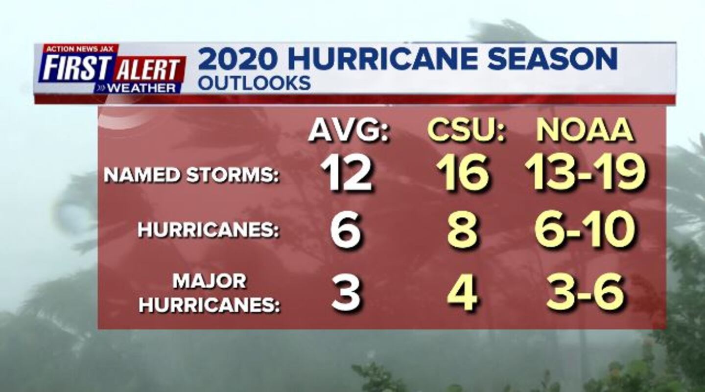
Forecasts for the season ahead are indicating above average numbers:
An active season is largely predicated on above avg. sea surface temps. & the neutral ENSO conditions that may trend La Nina which is a cooling of the equatorial Pacific & often correlates to more active Atlantic hurricane seasons.
As a whole, the Atlantic Basin is quiet for the moment. Strong low pressure over the Central Atlantic is nontropical & will stay far to the east over the open Atlantic.
An area that does need to be watched this week is the NW Caribbean &/or Central & Western Gulf of Mexico. Some long range models shows some gradual development of low pressure that may become tropical. A very large “envelope” of low pressure is over the Central America & nearby areas. One tropical storm - “Amanda” - has already evolved from this area moving ashore over the weekend over Central America. The remnants of Amanda &/or a new low pressure may emerge over the SW Gulf of Mexico this week with at least some potential for gradual development. This would also correlate well with “atmospheric conditions” that generally appear favorable for tropical development in this part of the basin. No cause for immediate concern but something to keep an eye on during the next week or so. Initial indications are that this system would stay well west of Florida & IF is ever a threat to land, it would be Mexico &/or Texas/Western Gulf area. In fact, there are indications of a possible “separate” area of development later in the week over the W. Gulf of Mexico.


