
Sept. 4, 2019 — The "Buresh Bottom Line": Always be prepared!.....First Alert Hurricane Survival Guide... City of Jacksonville Preparedness Guide... Georgia Hurricane Guide.
STAY INFORMED: Get the * FREE * First Alert Weather app
FREE NEWS UPDATES, ALERTS: Action News Jax app for Apple | For Android
WATCH "Surviving the Storm"
READ the First Alert Hurricane Center "Survival Guide"
DORIAN:
Forecast variance has settled down with Dorian moving offshore to the east - by about 80-90 miles - of Jacksonville Beach about 5pm Wed...... FOLKS! - Do not fixate on the exact center as impacts will occur far away from the eye. The most significant impacts - by far - will be at the coast & along the St. Johns River.
We are on track with the eye of Dorian well offshore but still close enough for significant impacts for some parts of Jacksonville/NE Fl./SE Ga. impacts (primarily through Wed. night/early Thu.) & dependent on exact location, movement & intensity of Dorian:
* storm surge of up to 3 - 5 feet along the coast & intracoastal.... 2-4 feet along the St. Johns River & some tributaries. It should be noted & remembered that Dorian could deliver a punch (waves, surge & wave run-up) to the beaches more like that of a Cat. 3 hurricane at 100 miles offshore due to the hurricane's size & previous intensity.
* a deadly rip current risk at area beaches. Always swim & surf with a "buddy" & as near a lifeguard as possible. Severe rip currents & a "washing machine effect" will occur at our beaches through Wed. Rip current explainer & safety info * here *.
* rough seas & surf... some coastal flooding with above avg. tides at the coast, St. Johns River & its tributaries. Breakers at our beaches may reach 15-20+ feet!
* Coastal winds will steadily increase... Wed- early Thu..: 35-50 mph with gusts to 60+ mph before rapidly diminishing late Thu. The wind direction will become more northerly through Wed. afternoon then offshore out of the NW & west as the eye of Dorian moves away & to the north then northeast.
Winds near the I-95 corridor will be 15-30 mph with gusts to 40-50 mph into Wed. night
Winds near & west of Highway 301 will not be near as strong averaging 10-20 mph with gusts to 30 mph.
As Dorian approaches, winds will howl out of the east/northeast for many hours at & near the beaches.
* several periods of heavy showers. All this water including the higher than avg. tides & onshore flow will trigger localized flooding. Total rainfall (Tue./Wed.) averaging 3-6" at the beaches/intracoastal... 2-4" along & a little either way of I-95... & an inch or less near & west of Highway 301.
* isolated fast-moving tornadoes/waterspouts
The strongest winds - tropical storm force (39+ mph) gusts - will occur on & off through Wed. night for the intracoastal & beaches + along some parts of the St. Johns River.


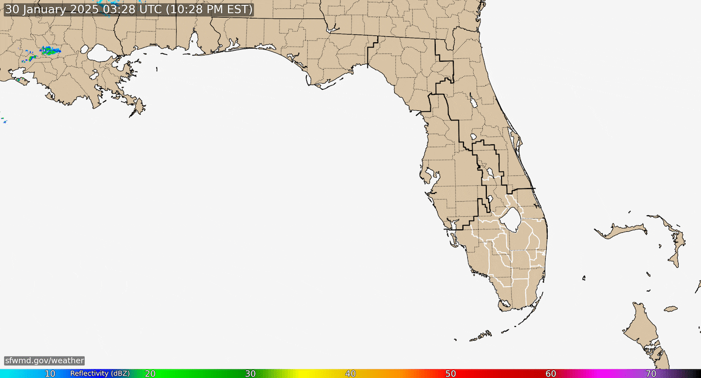
Radar imagery courtesy S. Fl. Water Management District:
Dorian went through a classic rapid intensification (RI) cycle from about mid afternoon Fri. into early Sat. as the central pressure dropped more than 40 mb & winds increased by some 60+ mph followed by yet another rapid intensification cycle Sunday taking the sustained winds to 185 mph making Dorian tied with the 1935 Labor Day hurricane (Fl. Keys) as the most intense Atlantic hurricane on record to make landfall. As of Mon. morning, Dorian had been a Cat. 5 for more than 24 hours - remarkable. Tropical storm force winds extend about 175 miles from the center & hurricane force winds out to about 60 miles from the center as the wind field gradually expands. Realize that wind field is not a perfect circle around the eye & that the widest field of strongest winds are to the east of the eye - especially true when closer to land. Dorian was the first Cat. 5 hit ever on the Abaco Islands - while the Central & especially Southern Bahamas will fare far better. A very close call for Nassau, but the most severe part of Dorian will stay north.
According to Dr. Klotzbach, CSU hurricane researcher, this would be only the 2nd Cat. 5 hit on any of the Bahamas since 1985 (Andrew, 1992) & is the 27th Cat. 5 in the Atlantic Basin since 1950. Since 2016, there has been a relative "slew" of Cat. 5's: Matthew in 2016, Irma in 2017, Maria in 2017, Michael last year & now Dorian. Only Michael made a landfall (Fl. Panhandle) as a Cat. 5.

As for movement.... Forecast models continue to key on a northwest move then into a fairly sharp turn to the north near Florida that spares Florida a direct hit with the broad eye staying offshore. Virtually all of the reliable global forecast models are east of the Florida coastline & are essentially on top of one another for track & timing. The eye is forecast to move roughly 80-90 miles east of St. Augustine Wed. afternoon... 90-100 miles east of Jax Beach late Wed. then about 80-90 miles southeast of St. Simons Island Wed. night.
The positioning AND western edge of a significant upper level ridge of high pressure - Bermuda high - across the Central Atlantic continues to be a key factor in the future movement. The upper level high is acting like a brick wall stopping northward movement & turning Dorian westward. We had the stall Monday which had to happen before the true turn. Remember that the cone of uncertainty has everything to do with the avg. forecast error over 30 years & nothing to do with the size of the hurricane or where damage will occur. A skinny cone just means an increase in forecast confidence as to where the hurricane is going. Dorian's intensity has peaked with either a steady state or slight increases or decreases in intensity thanks to bursts of convection wrapping around the eye... upwelling thanks to Dorian's slow movement in addition to dry air drawn in from the U.S. not to mention friction caused by proximity to land.
A weak upper trough of low pressure is nosing south between the Bermuda high across the Central Atlantic & another upper level high over the Southern Rockies. Dorian is likely to seek out the alleyway (weak trough/softening of the ridge) in the middle helping to tug the hurricane northward keeping the tropical cyclone east of Florida while increasing its forward speed. The eye will be in close proximity to the warm Gulf Stream through Wed. which may aid in at least maintaining Dorian's intensity.
So.... the bottom line is stay up to date on the latest forecasts for Fl. & Southeast U.S. The Northern Bahamas suffered a severe/historical hit from Dorian while Florida will be faced with a menacing hurricane east of the state threat & the Carolina's will be heavily impacted Wed.-Thu.
It looks like Dorian will be a "nice" compromise between 2016's Matthew which was only offshore Jacksonville's coast by 40-45 miles & 1999's Floyd which was farther east. It's interesting that Floyd caused one of the greatest mass evacuations in U.S. history while Dorian's evacuation has been far more limited - especially for Fl. & Ga. This is a true testament to the advances of modern meteorology & tropical forecasting (realizing the Dorian forecast has been painful!).

Satellite imagery reveals Dorian ingesting some dry air due to continental dry air from Fl.

The chart below is at 500 mb (~30,000 feet) & shows that ever so critical Bermuda high - its positioning & strength. Hurricanes follow the path of least resistance.

Interesting possible/probable correlation to W. Pacific tropical cyclone "Lingling". The storm is forecast to become a typhoon while moving almost due north into Korea & China over the next several days. The positioning of the ridge over the W. Pacific teleconnects with the Bermuda high over the Atlantic adding confidence to the forecast of Dorian's northward move this week.


Spaghetti model plots for Dorian:

Ensemble (An ensemble weather forecast is a set of forecasts that present the range of future weather possibilities) spaghetti plots: (for an in-depth look on ensemble modeling see * this * [Blake/Brennan, NHC])

See the map below loop * here *.....


While the sea surface temps. are warm, there's also - arguably more importantly - the depth of the available warm water - deep oceanic heat content to consider. Image below from CIMSS shows there's plenty of such energy ready to "feed" Dorian, especially closer to the Bahamas & coastal Fl. (partly the Gulf Stream). The deep oceanic heat content is far less right along the upper Fl. coast but is still significant offshore with the Gulf Stream.

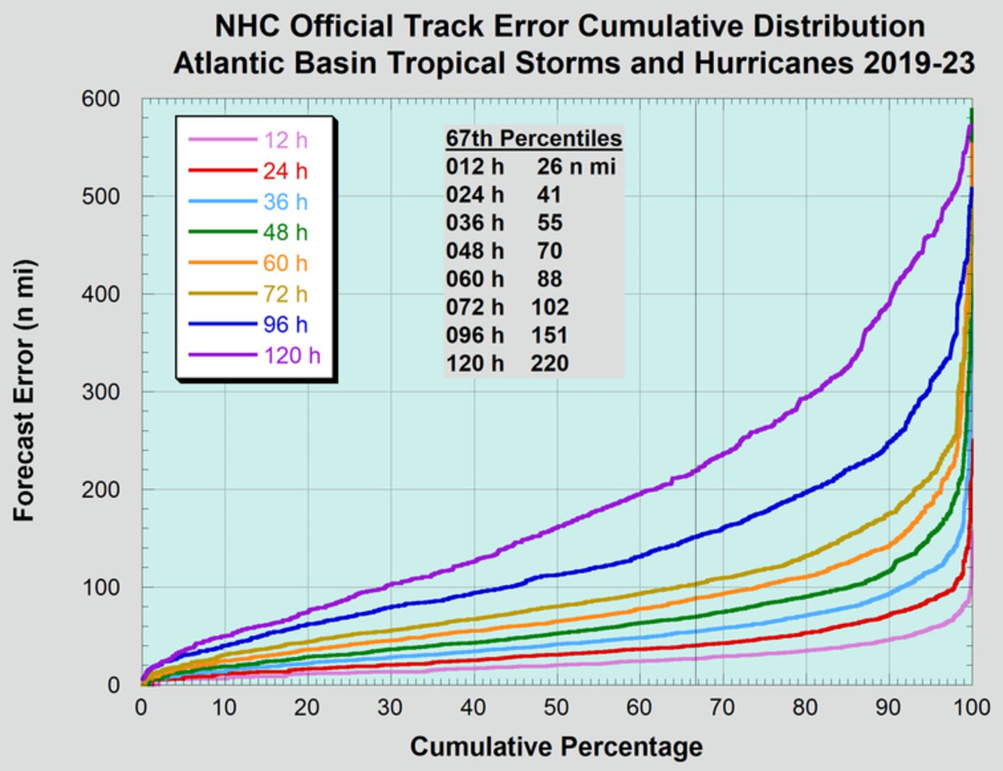
And remember what that "cone of concern or uncertainty" means & does not mean. That cone has everything with the historic track error ranging from the moment the forecast was issued all the way out to 5 days when the avg. error is nearly 200 miles! The cone does NOT take into account the size of the hurricane nor where damage will occur.

National Hurricane Center average track error starting with 12 hours & ending at the 120 hour forecast from 2014-'18:
IR satellite:

Integrated Microwave imager courtesy CIMSS: (remarkable & detailed evolution of Dorian)

What to do now in addition to making sure ready for possible power outages & some tree trimming:

Phil Klotzbach - September landfalling hurricanes:

The rest of the Atlantic Basin is active too - Fernand has moved ashore in Mexico just south of Texas while Gabrielle has developed over the East Atlantic.


An examination of dust over the Central & Eastern Atlantic shows a continuation of a good deal of dust over the Central & Eastern Atlantic as well as parts of the Caribbean. Dorian is now clearly free of the dust plumes.

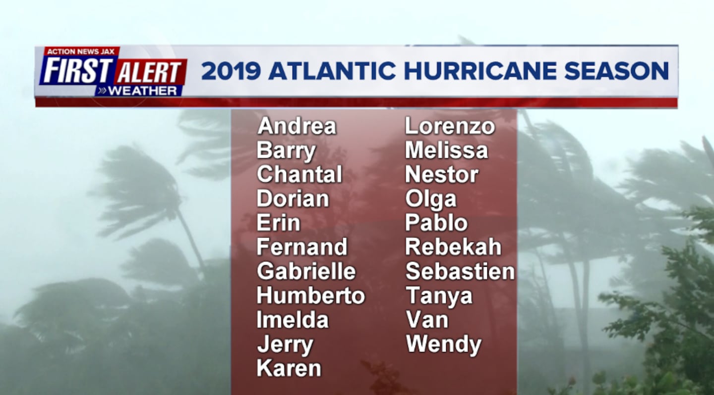
2019 names..... "Humberto" is next on the Atlantic list (names are picked at random... repeat every 6 years... historic storms are retired (Florence & Michael last year):
East Atlantic:
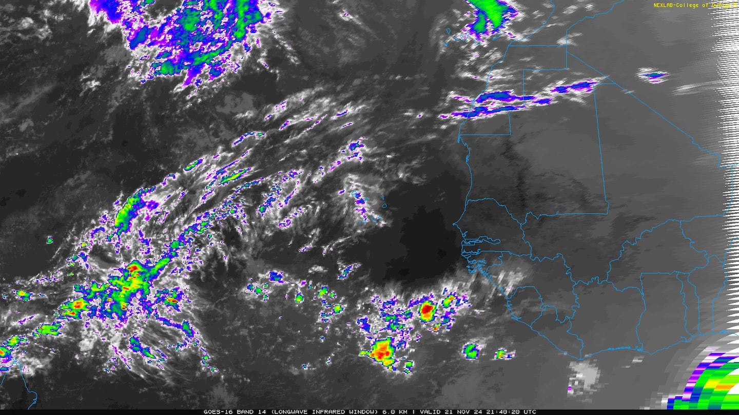

East Atlantic wave '91-L' has become tropical depression #8 & is no threat to any land areas:


Spaghetti plots for tropical depression #7 intensified into "Fernand" Tue. afternoon over W. Gulf & will move into Mexico though some heavy rain & isolated tornadoes will affect far South Texas:

Mid & upper level wind shear (enemy of tropical cyclones) analysis (CIMMS). The red lines indicate strong shear of which there is plenty across the Atlantic at the moment:

The Atlantic Basin:

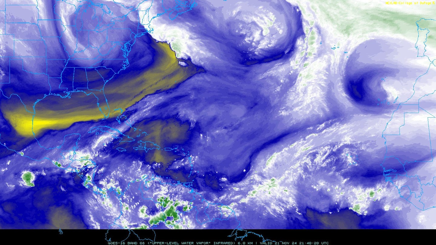
Water vapor imagery (dark blue indicates dry air):
Deep oceanic heat content:

Sea surface temp. anomalies show a warm Gulf of Mexico, Central & Northwest Atlantic while the "Main Development Region" (MDR) remain cooler than avg. along with parts of the Central Caribbean.....

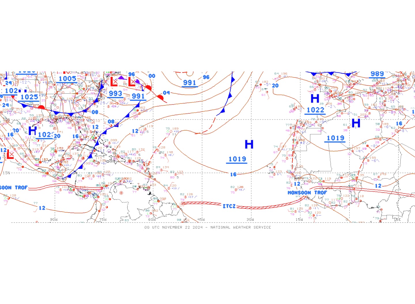
SE U.S. surface map:

Surface analysis centered on the tropical Atlantic:
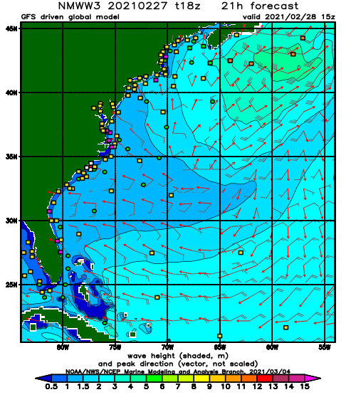
Surface analysis of the Gulf:

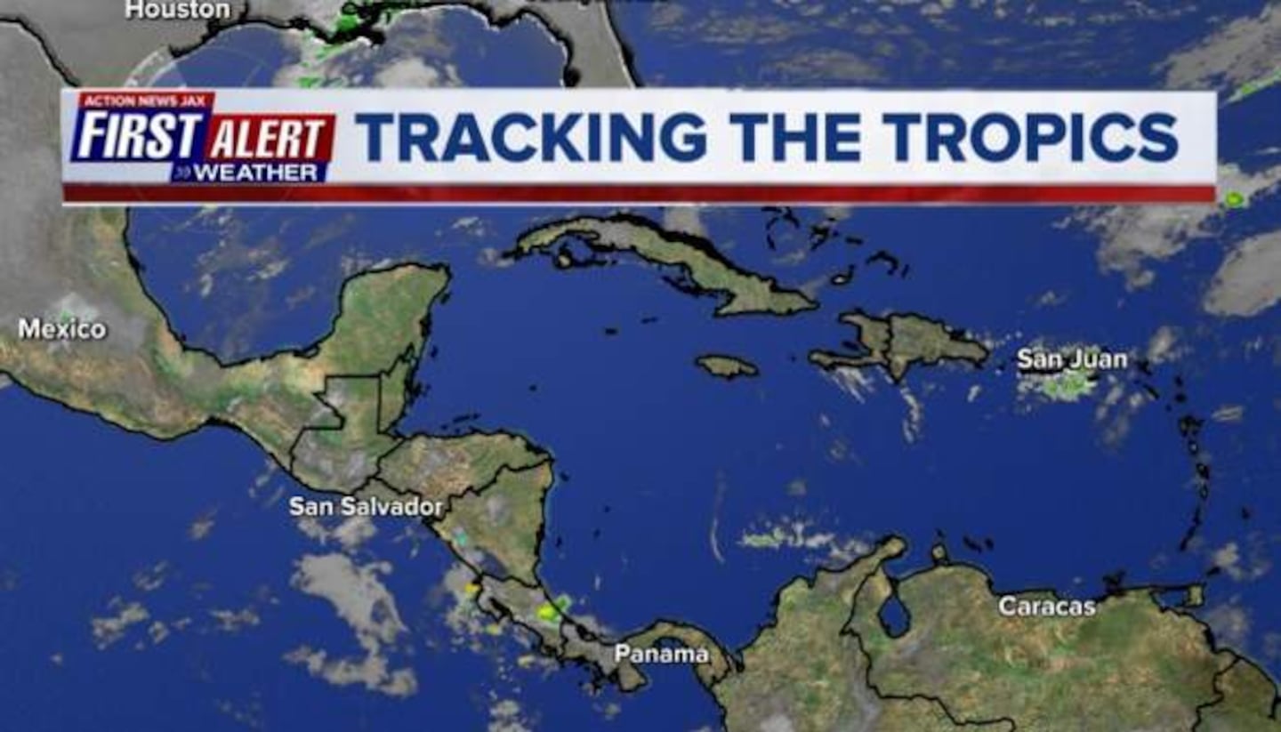
Caribbean:

Cox Media Group


