
July 5, 2018 — The "Buresh Bottom Line": Always be prepared!.....First Alert Hurricane Survival Guide... City of Jacksonville Preparedness Guide... Georgia Hurricane Guide.
Watch "Surviving the Storm".....
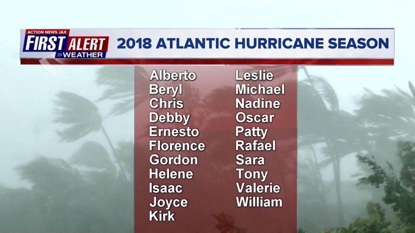
An early season (May) storm - "Alberto" is in the books so "Beryl" will be the next named storm in the Atlantic Basin. There has not been a named storm in the Atlantic Basin from May 29th through July 4th which has not happened since 2009.
Dr. Phil Klotzbach, Colorado State University has updated his seasonal forecast & has lowered numbers now calling for a slightly below avg. season. Much of the reasoning is based on persistent cooler than avg. water temps. over the Central & especially Eastern Atlantic Basin as well as the potential for an El Nino - see "Buresh Blog" - to emerge over the equatorial Pacific by the peek of the hurricane season. But remember you should always be prepared & don't get too caught up in the numbers as just how "bad" a season is often is measured by where, when & how strong there any landfalls.

At the moment across the Atlantic....
An interesting & well defined (see satellite images) upper level "feature" - a so-called TUTT - tropical upper tropospheric trough - has moved across Fl. & will scoot quickly westward over the Northern Gulf of Mexico through Fri. night. SOMETIMES, these troughs can develop a surface wave/low pressure that can eventually lead to tropical development. However, this disturbance will remain mainly upper level. Scattered to numerous heavy showers & t'storms will accompany the upper low, especially to the east of upper low.
Another weak upper low will develop over or near Fl. through the weekend but again with no surface development.
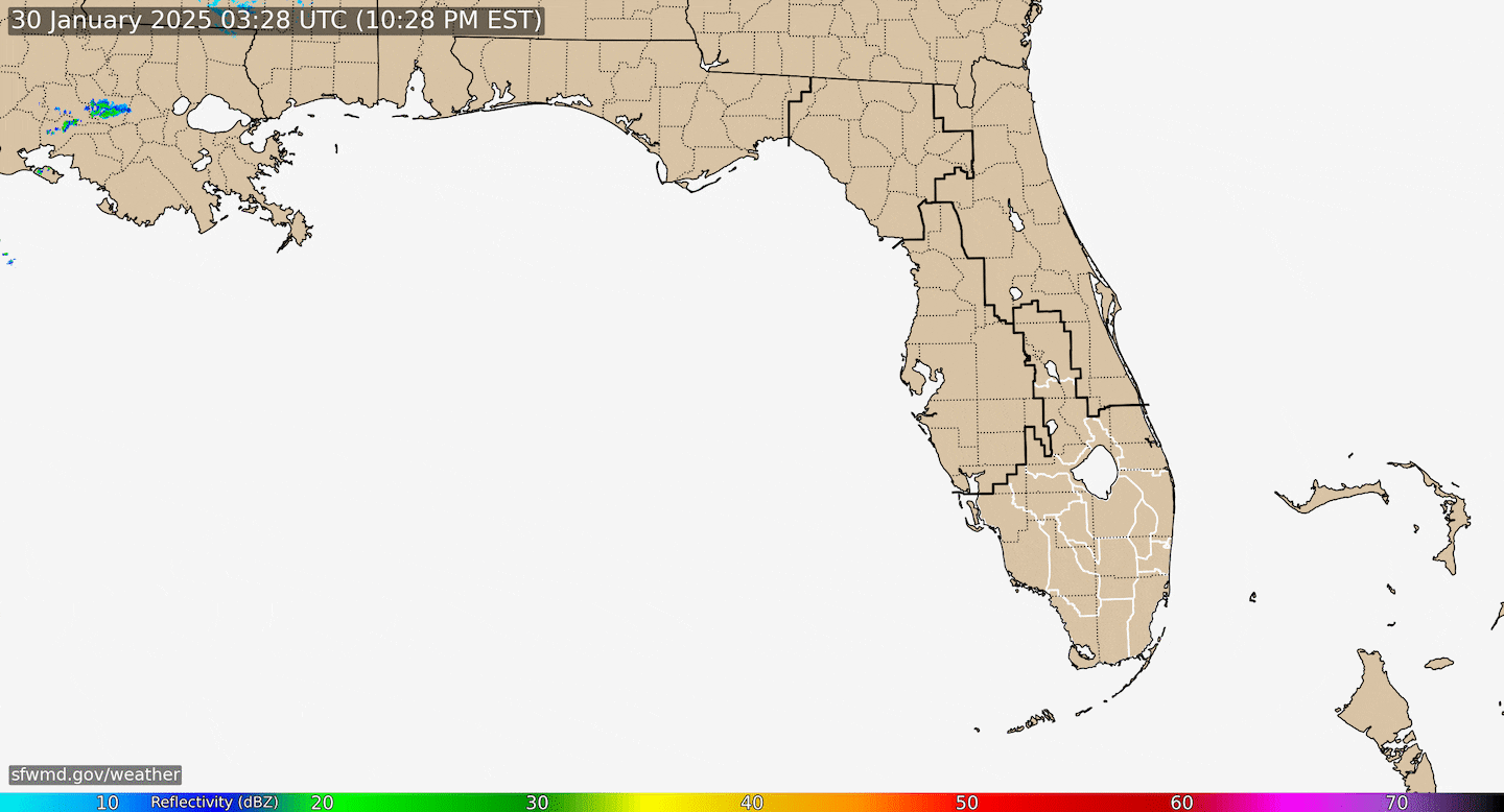
Radar imagery courtesy S. Fl. Water Management District:
An upper level trough - but with a weak surface low - is over the Central Atlantic south/southwest of Bermuda. This low could become subtropical or even tropical while moving northward over the Atlantic before merging with a cold front over the N. Atlantic late in the weekend/early next week. Some heavy rain & gusty winds for Bermuda but otherwise no impact to any land areas as the low moves between the U.S. east coast & Bermuda.
And one of the first bona-fide African tropical waves of the season is over the E. Atlantic. There is some potential for some development in the short term, but the shear is strong over the Caribbean which should limit any further development - & even cause weakening - by the weekend as the wave approaches the Lesser Antilles/Eastern Caribbean Sunday / Sunday night.
Spaghetti plots of 'Invest 95L':

Upper low near Fl..... & low pressure south of Bermuda....
Tropical wave E. Atlantic....

Gulf of Mexico:


Water vapor imagery:
0
Mid & upper level wind shear (enemy of tropical cyclones) analysis (CIMMS). The red lines indicate strong shear...... note how strong the shear is over the Caribbean which should "arrest" the African tropical wave that will be approaching over the weekend....
1

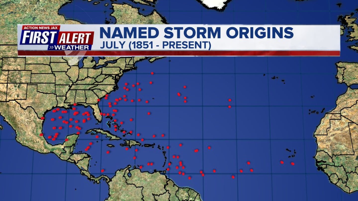
July tropical cyclone genesis areas since 1851 courtesy Dr. Phil Klotzbach:
Deep oceanic heat content is slowly increasing.....

Sea surface temp. anomalies are below avg. across much of the middle of the Atlantic with unseasonably cool temps. off the coast of Africa....

SE U.S. surface map:

Surface analysis centered on the tropical Atlantic:

Surface analysis of the Gulf:

Caribbean:

Meanwhile.... the E. Pacific... "Fabio" is far away from any land areas... has weakened below hurricane strength & will become a remnant low rather soon while moving west/northwest.
0
1
2
Cox Media Group


