BRANTLEY COUNTY, Fla. — UPDATE 4:00 PM: Brantley County Sheriff’s Office announces that limited re-entry is now allowed for residents with a placard for Highway 110W or those returning to voluntary evacuation areas, with specific guidelines.
Crews in Northeast Florida and Southeast Georgia continue to battle wildfires. Action News Jax is tracking with the latest updates.
An update from Brantley County officials will be happening at 4 p.m. Action News Jax will stream the briefing. You can watch it at the link below:
>>> STREAM ACTION NEWS JAX LIVE <<<
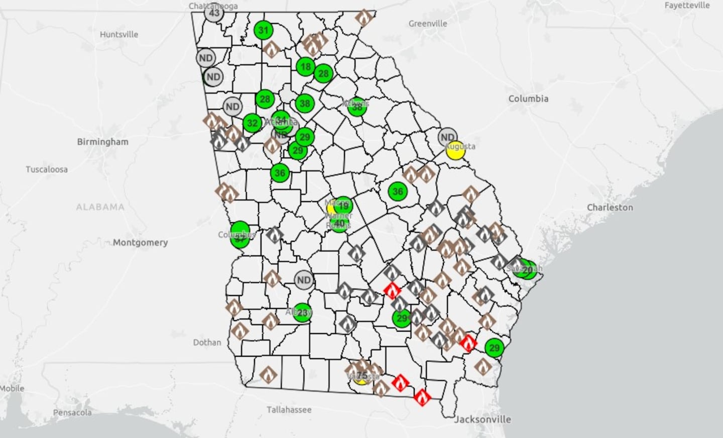
Georgia Wildfires
The Highway 82 wildfire in Brantley County doubled from Sunday to Monday to 22,600 acres. As of Tuesday at 10:40 a.m., the blaze was 32% contained, according to the Georgia Forestry Commission.
It expanded into neighboring Wayne County on Monday forcing evacuations there.
The Brantley fire along with the Pineland Road fire are the two worst wildfires currently in the U.S., Gov. Brian Kemp said Friday.
As of Tuesday at 10:40 a.m., the Pineland Road fire was estimated at 32,331 acres and is 23 percent contained, the Georgia Forestry Commission said.
Both fires have destroyed more than 120 homes making it the worst in Georgia’s history, Kemp said.
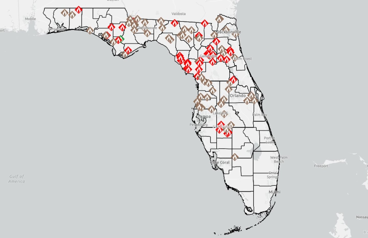
Florida Wildfires
In Florida, one of its worst wildfires, the Railroad fire in Clay and Putnam counties was last updated Monday at 4,796 acres and is now 80 percent contained, the Florida Forest Service said.
Here’s a county-by-county update with what you need to know about the wildfires in Georgia and Florida.
Current Evacuations:
Brantley County
Mandatory Evacuations
- North: Highway 32
- South: Highway 82
- West: Highway 110
- East: Post Road
Voluntary Evacuations
Brantley County and Wayne County EMA have issued a Voluntary Evacuation for:
- Highway 32 East of Needmore Road, Highway 301 up to Ed Harrell Road, includes all areas in these boundaries.
The Brantley County Sheriff’s Office says residents in the area should be prepared to leave if conditions worsen.
Wayne County
Mandatory Evacuations
- From the intersection of Ten Mile Road and Mt. Pleasant Road to the county line (7926 Mt. Pleasant Rd to 92 Mobile Rd)
Voluntary Evacuations
- The entire community of Manningtown
- The area from the Brantley County line at Wire Road to Post Road to Ten Mile Road, including all areas in between
Glynn County
Voluntary Evacuations
- Old Post area between Route 32 and Route 341
- Alpine Road
- Gilley Road
- Boones Branch Road
- Sallie Cline Road
- Mauney Street
- Chelsea Circle
- Post Road north of Highway 82
- Old Post Road north of Highway 32
- Old Post Road to Highway 32
- Highway 32 to Thalman Park Lane
- Thalman Park Lane to Bladen Road
- Bladen Road to Old Post Road
Evacuation Shelters
- The American Red Cross Shelter - Day and Night - Accepts Pets
- 100 Genoa Martin Drive, Brunswick, GA 31520
- Southside Baptist Church - Day
- 550 School St., Nahunta, GA 31553
- Nahunta United Methodist Church - Day
- 107 E. Cleveland St., Nahunta, GA 31553
- Unity Church of God - Day and Night
- 1580 Sunset Blvd, Jesup, GA 31545
- Venture of Faith Camp - Day and Night
- 1309 Highway 135 South, Lake Park, GA 31636
You can also visit the link here for additional information.
Mandatory curfew
- Brantley County has a mandatory curfew from 8:30 P.M. to 6:30 A.M. will remain in effect through the duration of this incident. There is a burn ban in place for all counties in South Georgia.
Current road closures:
Brantley County
- Highway 110 W – from Highway 82 to Highway 32
- Highway 32 – from Highway 301 to Post Road
- Browntown Road – from Highway 82 to the Wayne County line
- Mineral Springs
- Boots Harrison
- Mumford Road
- Crandall Road
- Hawthorne Road
RESIDENTS ONLY (Restricted Access): Hwy 32 from Hwy 301 to Hwy 110 West, Hwy 32 – Post Rd to Browntown Rd NE (north of 32, east of Browntown Rd)
Placard Access ONLY: Hwy 110 West from Hwy 82 to Hwy 32
Wayne County
- Manningtown Rd & Ron Rd
- Post Rd @ Ten Mile Rd to Wayne–Brantley line
- Wire Rd to Brantley line
- Mt. Pleasant Rd @ Browntown Rd
Glynn County
- Hwy 32 (Hwy 301 to Hwy 99)
- Hwy 110 (Hwy 32 to Hwy 82)
- Hwy 82
Destroyed homes in current wildfires most in Georgia’s history
Georgia Gov. Brian Kemp, who toured much of the scorched areas in the southern part of the state on Friday, said the 120 homes lost to wildfires in Brantley and Clinch counties are the most in the state’s history.
“The two fires we’re fighting, among many others in Georgia, ... the Pineland fire and the Highway 82 fire rank No. 1 and 2 in the country,” Kemp said during a news briefing Friday at the Waycross-Ware County Airport. “So we got the two most dangerous, biggest, problematic fires anywhere in the United States in the small area we’re having to fight. It’s a lot for us to deal with.”
How Brantley Co. fire started
Officials said the wildfire in Brantley County was started by a balloon from a kids’ birthday party that landed on a power line and created an arc, which caught the ground on fire.
County-by-County Wildfires Update
Northeast Florida
Baker County
- Sargent Fire - 2,523 acres, 81% contained
Bradford County
- Deden Fire - 205 acres, 60% contained
Columbia County
- Gun Range Fire - 129 acres, 60% contained
Clay, Putnam counties
- Railroad Fire - 4796 acres, 80% contained
Putnam County
- Pace Court Fire - 343 acres, 85% contained
- Mondex 3 Fire - 419 acres, 30% contained
Southeast Georgia
Brantley County
- Highway 82 Fire - 22,600 acres, 32% contained
Clinch County
- Pineland Road Fire - 32,570 acres, 23% contained.
Click here to see locations of wildfires in Florida
Click here to see locations of wildfires in Georgia
[DOWNLOAD: Free Action News Jax app for alerts as news breaks]
[SIGN UP: Action News Jax Daily Headlines Newsletter]
Click here to download the free Action News Jax news and weather apps, click here to download the Action News Jax Now app for your smart TV and click here to stream Action News Jax live.