
Jacksonville, FL — The “Buresh Blog” will take a week off leading up to Christmas but will updated again the last week of Dec (the year in review). Here’s wishing one & all the Very Best of the Holiday Season!
‘Tis the season for holiday travel. After a fairly quiet first half of Dec., the jet stream is “snapping” so to speak and the weather pattern looks to be very active through the end of the month & will include some bitterly cold air dipping southward from Canada. Plan on some travel woes for the holidays.
Click * here * for weather & road conditions. Specifically for Florida * here *.... for Georgia * here *.
If flying to your destination, click * here * for airport delays/cancellations (FAA).


Dreaming of a White Christmas? The NOAA map below shows your best chance for some snow:

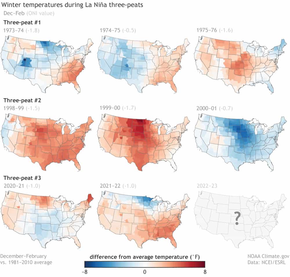
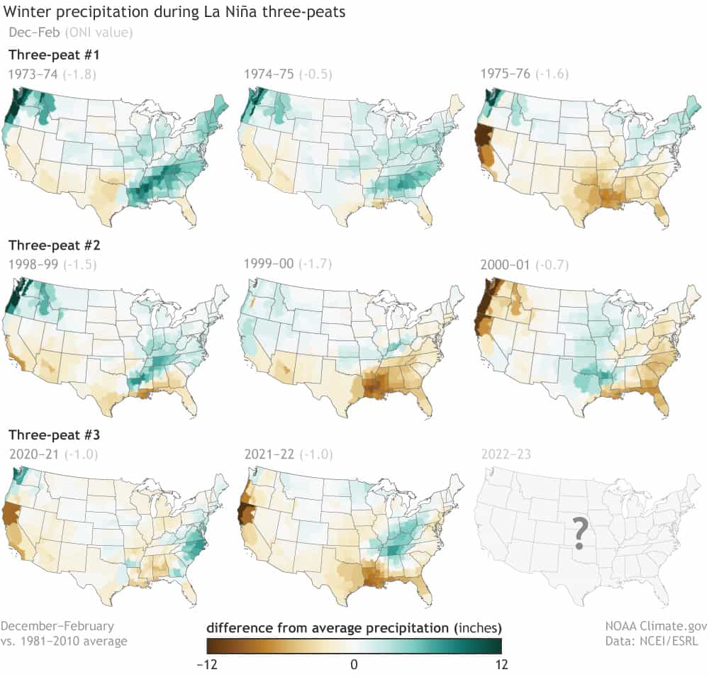
Our “3rd year” La Nina continues unabated. The latest NOAA update calls for La Nina to continue through most of the winter but gradually easing with the potential for a switch to El Nino conditions by next summer/autumn. But predicting the ENSO - as it’s called - is far from an exact science. I believe - given the overall warm oceans - the typical impacts from a La Nina or El Nino seem less reliable over at least the last 12 years. It is worth noting that La Nina winters often coincide with wide temp. ranges for Jacksonville/NE Fl./SE Ga. including some sharp, cold outbreaks that feature moderate to hard freezes. Time will tell.
For Jax/NE Fl. & SE Ga., of the 8 “three-peats” of La Nina, 6 winters have been warmer than avg. & 5 have been drier than avg. The map below show the temp. & precip. patterns for the U.S. Lower 48 during past La Nina’s that were 3 years running:
Sea surface temp. vs. avg. for the Central Pacific clearly shows the ongoing La Nina:

Forecast for the ENSO through next summer:

©2022 Cox Media Group


