:quality(70)/cloudfront-us-east-1.images.arcpublishing.com/cmg/JIFG55NSN5HKZK6LKEZ4C7UU5I.jpg)
Jacksonville, Fl. — The “Buresh Bottom Line”: Always be prepared!.....First Alert Hurricane Preparation Guide... City of Jacksonville Preparedness Guide... Georgia Hurricane Guide.
STAY INFORMED: Get the * FREE * First Alert Weather app
FREE NEWS UPDATES, ALERTS: Action News Jax app for Apple | For Android
WATCH “Preparing for the Storm”
WATCH “The Ins & Outs of Hurricane Season”
READ the First Alert Hurricane Center “Survival Guide”
LISTEN & WATCH “Surviving the Storm” - WOKV Radio & Action News Jax
***** ALWAYS CHECK & RE-CHECK THE LATEST FORECAST & UPDATES! *****
REMEMBER WHEN A TROPICAL STORM OR HURRICANE IS APPROACHING: Taping windows is *not* recommended & will not keep glass from breaking. Instead close curtains & blinds.
Realize the forecast cone (”cone of uncertainty”) is the average forecast error over a given time - out to 5 days - & *does not* indicate the width of the storm &/or where damage that might occur.

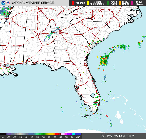
*** LOCAL (Jacksonville/NE Fl./SE Ga.) IMPACTS FROM THE TROPICS: Ophelia will continue to cause rough seas & surf along with at a high rip current risk through Saturday but with an offshore wind.
The Atlantic Basin Overview:
** Ophelia is moving northward after a N. Carolina landfall early Sat....
** Tropical depression #17 has formed over the Eastern Atlantic...

(1) Ophelia...
A Storm Surge WARNING: Ocracoke Inlet, North Carolina to Chincoteague, Virginia ... Chesapeake Bay south of Colonial Beach, Virginia ... Neuse and Pamlico Rivers ... Portions of Pamlico and Albemarle Sounds. A Storm Surge WATCH: Remainder of Pamlico and Albemarle Sounds. A Tropical Storm WARNING: East of Cape Lookout, North Carolina to Fenwick Island, Delaware ... Albemarle and Pamlico Sounds ... Tidal Potomac south of Cobb Island ... Chesapeake Bay south of North Beach.
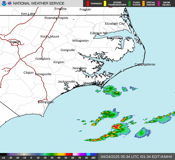
Ophelia made landfall about 6:20am EDT Saturday on the southwest coast of North Carolina with sustained winds near 70 mph.
A stalled front to the north & northwest of Ophelia will help focus the heaviest rainfall & well as a secondary area of stronger winds north & northwest of the deteriorating center. Significant storm surge & moderate to major flooding can be expected from the central coast of N. Carolina northward through Chesapeake Bay to the Jersey coast. Weakening over land + a pretty sharp turn to the east should keep the *most serious* impacts away from New York City & Boston.
Anyone traveling to - or living in - the Carolina’s northward to New England should stay up to date on the latest forecasts through the weekend.
Ophelia is the 15th named storm of the ‘23 Atlantic hurricane season surpassing the avg. of 14 for an entire season (June 1 - Nov. 30).


Rainfall forecast:


(2) A strong tropical wave - ‘90-L’ was upgraded to tropical depression #17 midday Saturday over the Eastern Atlantic while moving west/northwest. Forecast trends are for an early turn to the northwest then north which should keep the disturbance east & north of the Caribbean & well to the east of the U.S. T.D. #17 should become Philippe soon & is likely to become a hurricane over the Central Atlantic.


Check out the upper oceanic heat content (UOHC) [tropical cyclone heat potential/TCHP] across the SW Atlantic, Gulf & Caribbean. The warmth is very deep. But keep in mind warm ocean temps. alone doesn’t necessarily equate to a “big” hurricane season (need other ingredients & factors to be favorable too) but it’s obvious there is a lot of very warm water at great depths over the Caribbean & Gulf of Mexico stretching eastward all the way into the Central Atlantic:


Water vapor loop (dark blue/yellow is dry mid & upper level air):


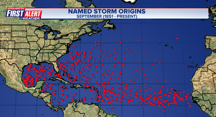
July tropical cyclone origins:
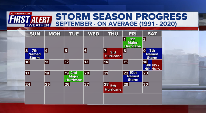
Averages below based on climatology for the Atlantic Basin for August:
Wind shear:


Saharan dust spreads west each year from Africa by the prevailing winds (from east to west over the Atlantic). Dry air - yellow/orange/red/pink. Widespread dust is indicative of dry air that can impede the development of tropical cyclones. However, sometimes “wanna’ be” waves will just wait until they get to the other side of - or away from - the plume then try to develop if other conditions are favorable. In my personal opinion, way too much is made about the presence of Saharan dust & how it relates to tropical cyclones. In any case, the peak of Saharan dust typically is in June & July.

2023 names..... “Philippe” is the next name on the Atlantic list (names are picked at random by the World Meteorological Organization... repeat every 6 years). Historic storms are retired [Florence & Michael in ’18... Dorian in ’19 & Laura, Eta & Iota in ‘20, Ida in ‘21 & Fiona & Ian in ‘22]). In fact, this year’s list of names is rather infamous with “Katrina”, “Rita” & “Wilma” retired from the ‘05 list & “Harvey”, “Irma”,“Maria” & “Nate” from the ‘17 list. The WMO decided - beginning in 2021 - that the Greek alphabet will be no longer used & instead there will be a supplemental list of names if the first list is exhausted (has only happened three times - 2005, 2020 & 2021). The naming of tropical cyclones began on a consistent basis in 1953. More on the history of naming tropical cyclones * here *.


East Atlantic:


Mid & upper level wind shear (enemy of tropical cyclones) analysis (CIMMS). The red lines indicate strong shear:

Water vapor imagery (dark blue indicates dry air):

Deep oceanic heat content over the Gulf, Caribbean & deep tropical Atlantic. The brighter colors are expanding dramatically as we near the peak of the hurricane season.:

Sea surface temp. anomalies:


SE U.S. surface map:

Surface analysis centered on the tropical Atlantic:

Surface analysis of the Gulf:

Caribbean:

Atlantic Basin wave period forecast for 24, 48, 72 & 96 hours respectively:


East/Central Pacific:


West Pacific:

Global tropical activity:


Cox Media Group
:quality(70)/cloudfront-us-east-1.images.arcpublishing.com/cmg/GUKNEPXKO4TU3TGUXRFOFQBQLY.jpg)
:quality(70)/cloudfront-us-east-1.images.arcpublishing.com/cmg/OP4L4IUHEIWRTTX257DKOM4IMU.jpg)
:quality(70)/d1hfln2sfez66z.cloudfront.net/07-24-2024/t_f1680e195e6e40ecbe5b78cf455c5d77_name_file_960x540_1200_v3_1_.jpg)
:quality(70)/cloudfront-us-east-1.images.arcpublishing.com/cmg/5CYYBCQQIZFKRPFL6IQAW3GNKE.jpg)
:quality(70)/cloudfront-us-east-1.images.arcpublishing.com/cmg/CVYBTSXAM2UFD3732J5MXRFD6E.png)