Jacksonville, Fl. — The “Buresh Bottom Line”: Always be prepared!.....First Alert Hurricane Survival Guide... City of Jacksonville Preparedness Guide... Georgia Hurricane Guide.
STAY INFORMED: Get the * FREE * First Alert Weather app
FREE NEWS UPDATES, ALERTS: Action News Jax app for Apple | For Android
WATCH “Talking & Tracking the Tropics: The Science Behind the Season”
WATCH “Preparing for the Storm”
READ the First Alert Hurricane Center “Survival Guide”
Tropical depression #5 was upgraded to tropical storm Edouard Sun. night but will remain harmlessly over the N. Atlantic quickly moving northeast. Edouard is like to lose its tropical characteristics by Tue. There will be no impacts on Jacksonville/NE Fl./SE Ga. or any of the U.S.
Edouard makes 2020 the fastest (July 5) known season in which to reach the ‘E’ name in the satellite era (since 1966) beating the 2005 season. However, the ’05 season had already been far more impactful even though ‘E'/”Emily” wasn’t reached until July 12th. Emily became the most intense - Cat. 5 - hurricane in the Atlantic Basin before Aug. before slamming into Mexico. Prior to Emily, “Dennis” one week before was the strongest (Cat. 4) pre-August hurricane in the Atlantic before rolling into the W. Fl. Panhandle. Cat. 1 hurricane “Cindy” hit SE Louisiana in early July as Dennis was forming. In June... tropical storm Bret hit Mexico & tropical storm Arlene had hit the Fl. Panhandle. (the’ 05 season went on the produce major hurricanes Katrina, Rita & Wilma.)
In 2020 so far, 3 of the 4 named storms will have last 24 hours or less with few serious impacts to any land areas. Cristobal did produce flooding & isolated tornadoes but damage was not widespread once ashore over Louisiana in June.


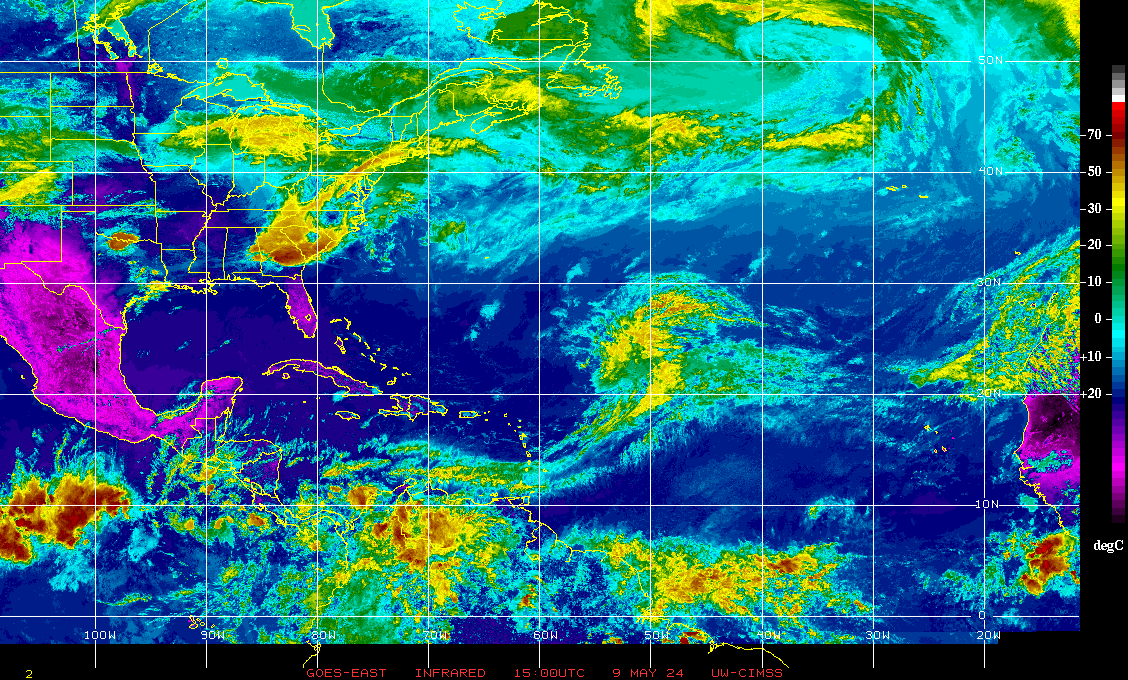
A weak upper level trough of low pressure/cut-off low will develop/evolve along & near the Gulf Coast into the upcoming week. Some kind of weak surface low pressure will eventually result anywhere from the NE Gulf to Florida to the Western Atlantic east of the Carolina’s through mid week. There’s some chance of tropical development with the low this week... perhaps just off the U.S. east coast but likely a fair distance north of Jacksonville.
There will be heavy rain at times over the next several days for Jacksonville/NE Fl./SE Ga.

And a rather large tropical wave - at a pretty far southern latitude - is approaching the S.E. Caribbean. Increasing shear + the proximity of some very dry air should ultimately limit much development but heavy gusty squalls will reach the Central & Southern Lesser Antilles Tue. This wave could then be something to carefully monitor in the long run once farther to the west.
Meanwhile... the Saharan dust (4th image below) remains dominant over a good part of the Central & E. Atlantic.
The recent dust “activity” - perhaps the most extensive in years a couple of weeks ago - as a whole is quite typical for June & July & is indicative of generally dry mid & upper level air which can often times inhibit tropical development. However, I’ve seen tropical systems thrive just outside the dust cloud ... or once away from the dusty atmosphere (see 2004)... so it’s not a “shoe in” that there will be no tropical development just because a lot of dust exists (see Dolly this week & Dorian last year). Other factors have to be considered such as the overall shear values across the Atlantic Basin, general vertical motion values & sea surface temps. which are nowhere near their seasonal peak yet.
Bottom line: we have a long ways to go (5 months) yet in the hurricane season with plenty of time to see the active basin we are anticipating.


:quality(70)/cloudfront-us-east-1.images.arcpublishing.com/cmg/WW5AJL3ARQUGDQMAQUNSFX4CLE.jpg)


:quality(70)/cloudfront-us-east-1.images.arcpublishing.com/cmg/YNYHQR4LBVFI3OJGCFF32OEDVM.png)
:quality(70)/cloudfront-us-east-1.images.arcpublishing.com/cmg/3KIGRHC2ANCXBIIWI7KCM6D6UE.jpg)
:quality(70)/cloudfront-us-east-1.images.arcpublishing.com/cmg/POXX4TMVYRE5NB2RYFKT6B6RF4.jpg)
:quality(70)/cloudfront-us-east-1.images.arcpublishing.com/cmg/F2HDNUPNINBJVMOJF6EVE2VRMI.png)
:quality(70)/d1hfln2sfez66z.cloudfront.net/04-29-2024/t_fe679c4495024c2399a845060113ad20_name_file_960x540_1200_v3_1_.jpg)