Jacksonville, Fl. — The “Buresh Bottom Line”: Always be prepared!.....First Alert Hurricane Survival Guide... City of Jacksonville Preparedness Guide... Georgia Hurricane Guide.
STAY INFORMED: Get the * FREE * First Alert Weather app
FREE NEWS UPDATES, ALERTS: Action News Jax app for Apple | For Android
WATCH “Talking & Tracking the Tropics: The Science Behind the Season”
WATCH “Preparing for the Storm”
READ the First Alert Hurricane Center “Survival Guide”
*** All eyes on the strong tropical wave/low pressure - ‘92-L’ moving west across the Central Atlantic - still unclear exactly how this scenario will unfold but some impacts to Fl. are possible over the weekend - stay up to date ***
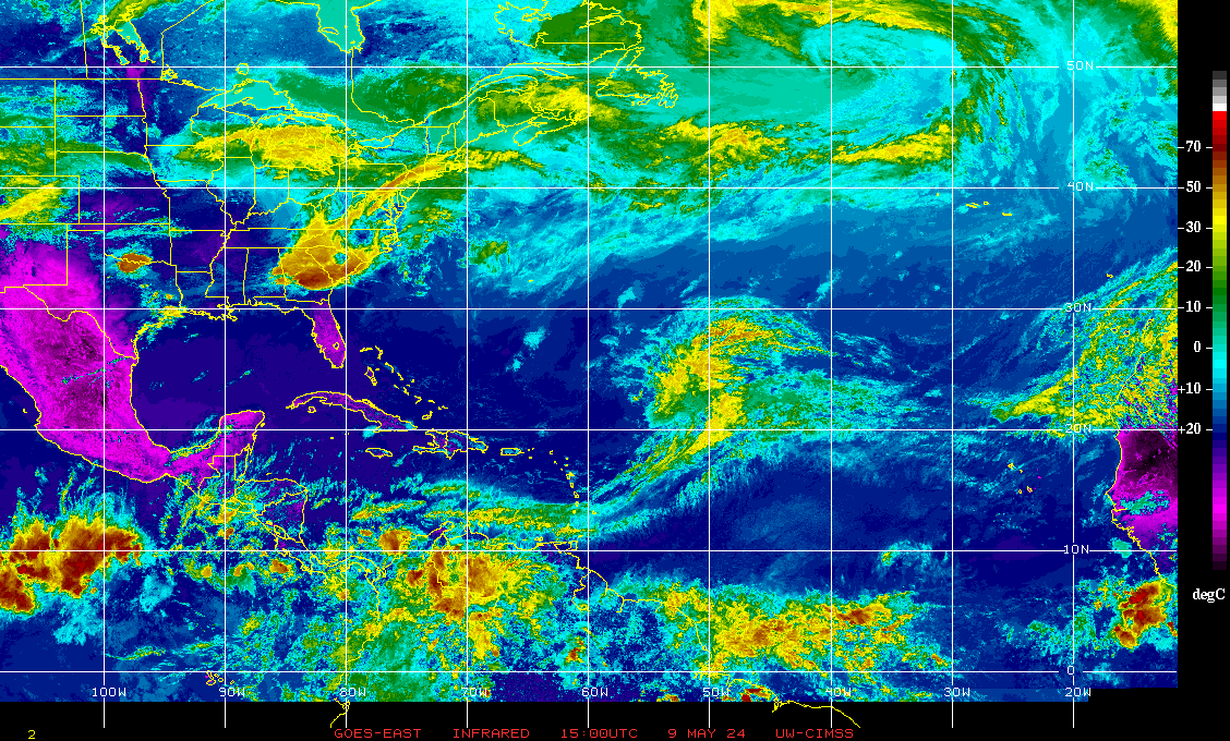
Tropical waves continue rolling off the coast of Africa. One wave - 92L over the Central Atlantic - in particular has potential to develop as it speeds west/northwest. A buoy near this wave indicates winds near tropical storm strength (39 mph), so it may not be long before we an official upgrade. Hurricane hunter recon will investigate the system Tue. afternoon.
The ultimate track will likely hinge on two things:
(1) the Bermuda high to the north which is broad & strong Bermuda high.
(2) intensity. Weaker - will be more west & south.... stronger - more north earlier. It’s possible that Puerto Rico & Hispaniola may also have a “say” if there’s any land interaction.
Forecast models, of course, have been & continue to be at odds with one another & sometimes at odds with themselves (from one cycle run to the next). It’s way too early to get too caught up in single model runs or to start to panic(!).
The European model has started to trend north & a little stronger bringing a tropical cyclone to near S. Florida over the weekend... the GFS is now relatively similar though a bit east in the long run... & the UKMET is between the two but has trended toward the European with a tropical cyclone in the vicinity of Fl. over the by the weekend.
Overall forecast models recently have generally trended north. Since the wave appears to be organizing/strengthening.... & the Bermuda high is strong, it seems likely the track will be near the Greater Antilles (Leeward Islands) then a move northwest, possibly N/NW. Stronger/earlier development would tend to support a more northward track solution. There is a good deal of shear in the vicinity of the wave now - on the order of 25-30+ mph - so any short term organization will likely be slow. But once farther west, shear relaxes. This in itself may lend to a more westward solution before gaining much latitude. One to watch no doubt!


E. Atlantic tropical wave/disturbance spaghetti plots:


:quality(70)/cloudfront-us-east-1.images.arcpublishing.com/cmg/WW5AJL3ARQUGDQMAQUNSFX4CLE.jpg)


:quality(70)/cloudfront-us-east-1.images.arcpublishing.com/cmg/ZTI23OI2UREPVASYSWEIYZBRK4.png)
:quality(70)/d1hfln2sfez66z.cloudfront.net/05-04-2024/t_1d4d3132700146178ae703ce930392b6_name_file_960x540_1200_v3_1_.jpg)
:quality(70)/cloudfront-us-east-1.images.arcpublishing.com/cmg/DZZZEVZAAJB6RLOCFSJZMGBWZI.png)
:quality(70)/cloudfront-us-east-1.images.arcpublishing.com/cmg/EIDV54CS7BAOJLLRBGH6BPX6OY.jpeg)
:quality(70)/cloudfront-us-east-1.images.arcpublishing.com/cmg/EFJ332YJFRBFFHS24Y3HFP2IEY.JPG)