
4:34 PM: #Naples Municipal Airport recorded a wind gust of 142 mph (WeatherBug mesonet NPLMP). #Irma
— NWS Miami (@NWSMiami) September 10, 2017
Sept. 11, 2017 — WATCH LIVE 24/7: Hurricane Irma updates for Jacksonville and vicinity
HURRICANE IRMA: Latest updates, shelter info, evacuation info
STAY INFORMED: First Alert Weather app (latest track, radar, warnings)
Irma is moving more north/northeast vs. northwest which will put the eye even closer to Jacksonville. However, do NOT panic - the wind will be a little higher for the local area but the hurricane will continue to weaken upon approach - likely a low end Cat. 1 storm. Timing takes the eye to Jacksonville's latitude - to the west - between 7 & 9am.
The image below shows the NHC forecast a little east of the Big Bend. I drew the yellow line which is simply an extension of the Sun. evening movement after the afternoon landfall at Marco Island. Seems the ultimate path will be along the line or between the line & the forecast positioning at 8am.

Jacksonville N.W.S. Doppler radar:

Melbourne N.W.S. Doppler radar:

There is a hurricane warning for most of Florida - including Jacksonville & all of Northeast Fl.... as well as a storm surge warning for the St. Johns River & coast... tropical storm warning for SE Ga.
Hurricane Irma has made the turn to the northwest & now north after ravaging the Keys. Ft. Myers & Tampa & all the Fl. west coast is next.. this is the first "major" Fl. hurricane landfall since Cat. 3 "Wilma" in Oct., 2005 (Twitter did not yet exist!)...
The "Buresh Bottom Line" is: stay tuned!... Always be prepared!..... City of Jacksonville Preparedness Guide... Georgia Hurricane Guide.
PRIMARY LOCAL - JACKSONVILLE/NE FL./SE GA IMPACTS (peak from midnight to noon Mon.):
- Strong winds increasing to 40-60 mph with gusts of 70-80+ mph Sunday night into Mon. - especially strong at the coast & along the St. Johns River.... & from Waycross to Macclenny, Jacksonville to Keystone Heights to Palatka closer to the eye where a few gusts could reach 100 mph. Winds will slowly diminish late Mon. afternoon & particularly Mon. night but power crews will have difficulty making progress on power restoration until overnight when winds completely diminish. The strongest winds will occur through 11am for Jacksonville & NE Fl... & through 3pm across SE Georgia. Winds will gradually diminish late in the afternoon & especially near & after sunset.
- Heavy rain & flooding. Rainfall average of 6-12" with locally higher amounts - highest approaching 13-18" near the coast & as far inland as I-95 - especially Clay, St. Johns & Putnam Co.
- Storm surge flooding. Surge averaging 2-4 feet but locally higher (5/6 feet) due to bends in the coast/river & depending on the orientation to hurricane Irma. Flooding of San Marco & Riverside likely Monday - especially near high tide early in the afternoon as Irma moves into Ga. shifting winds to out of the south pushing a good deal of water from the St. Johns northward into downtown.
- Increasing tornado & waterspout threat Sunday night into Mon. morning. These will be quick hitting tornadoes generally wrapped in rain so will be hard to know they are approaching with short notice (warnings) of winds that may exceed 100 mph in localized pockets. An approaching tornado will cause transformers & power lines to flash. If you suddenly lose power AND hear what sound like a train or low jet, it could be an approaching tornado.
- extreme rip current risk at area beaches that will only slowly improve beginning Tue.
DON'T GET TOO CAUGHT UP IN JUST TRACKING THE EYE & ITS IMPACTS ON YOUR LITTLE NECK OF THE WOODS BECAUSE IRMA'S HIGH WINDS EXTEND MORE THAN 200 MILES FROM THE EYE & WILL EXPAND EVEN MORE THROUGH MON.
While storm surge caused by hurricane Irma will - overall - be less than with Matthew last year, many of the other impacts will be greater including fresh water (rain) flooding, high winds & tornadoes. If you are told to evacuate, then evacuate is what you should do. If utilities are cut &/or compromised, you could have no modern conveniences for days. If flooding is considerable, you could become isolated & will have to deal with fire ants (see Texas during Harvey), snakes & other wildlife that might be seeking refuge.
It is important that you do not make decisions based on trying to compare Matthew to Irma as the comparison is not apples to apples, so to speak. Inland areas will suffer more damage than during Matthew because of the location of the eye of Irma (west coast). The tornado threat & winds will be higher than during Matthew while the storm surge will not be as severe with Irma.
Know your evacuation zone......
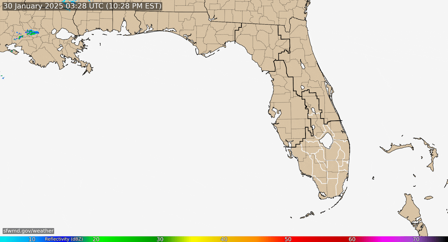
Radar imagery provided by S. Fl. Water Management District:
"Irma" finally made the northwest then northward turn Sat. night pounding the Keys as a Cat. 4 hurricane with the eye moving just east of Key West. There will be a good deal of shear once Irma moves into Central Florida which will help with the weakening process... in addition to land interaction & some dry air that will wrap into the circulation. The bend to the north & west will take longer which will bring the eye on more of a trajectory from near Orlando to Starke to near/west of Macclenny to south of Waycross, Ga. Remember the skinny cone in advance of the eye shows the track & potential forecast error BUT has nothing to do with where or how much damage is expected to occur.
Despite a fairly steady, rather fast weakening through Mon. be aware the wind field will expand even more with tropical force winds nearly 800 miles across!
The weak upper level trough/ "alleyway" in the upper levels of the atmosphere has finally pulled stubborn Irma north. A strong surface high will build into the Northeast U.S. which will block Irma from getting too far north while an upper level ridge builds underneath the departing trough. So Irma's remnants will get trapped over the Tennessee Valley before dissipating which will mean heavy rain for parts of N. Ga., N. Alabama & Tennessee.
SUMMARY:
Irma will move north - with some "wobbles" NW & even NE - through Florida then north/northwest into Ga. then stall over or near Tennessee where the remnant low will dissipate. The closest approach to Jacksonville will be the about 8am anywhere from 30-70 miles. Very heavy rain may accompany what's left of Irma north into Tennessee. The primary Fl. impacts will be through Mon. morning with some wind & rain as far west as the Panhandle though not as severe as impacts east of the center over the rest of Florida. Rain will rapidly diminish Mon. afternoon but winds will only slowly diminish through Mon. evening before going nearly calm by sunrise Tue. Offshore winds late Mon. into Tue. will entice surfers but the rip current risk will remain high & dangerous.
SUNRISE: ~7:10 AM .... SUNSET: ~7:35 PM


"Irma" model plots:


0
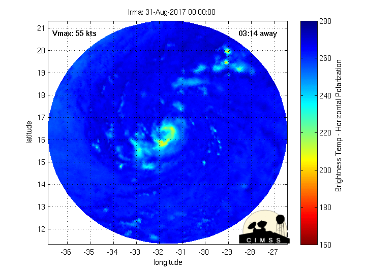
Fascinating imagery(!) from CIMMS, University of Wisconsin, Madison - Microwave radar-simulated imagery showing Irma wrapping up... click here for full definition.....
1
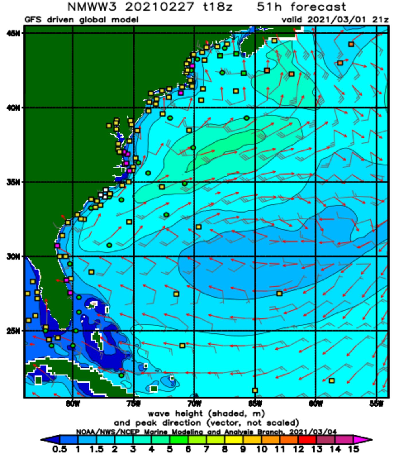
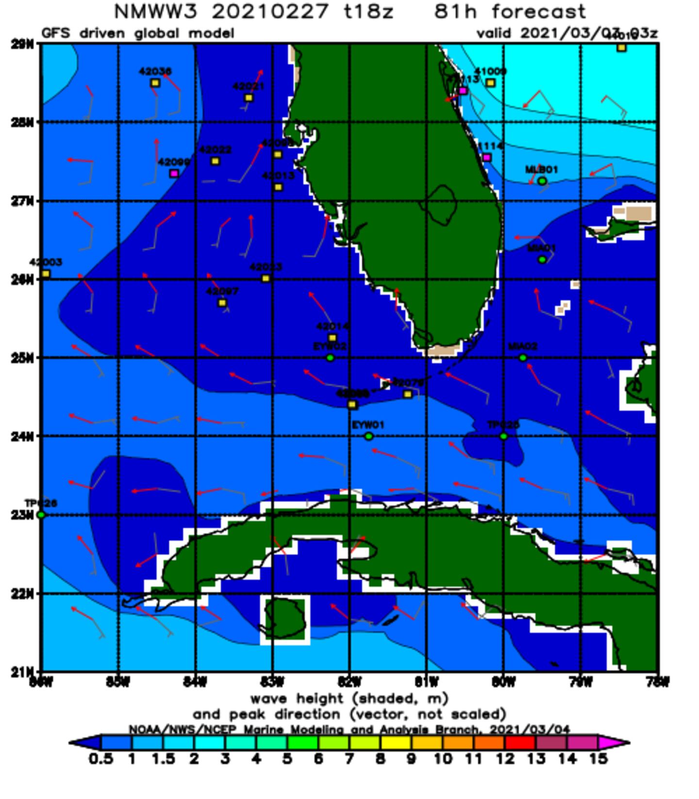
Wave forecast:.
NOAA WaveWatch III below predicated on GFS model - will change & update - hit refresh for latest + loop:
Hurricane "Jose" to the east/southeast of "Irma"....

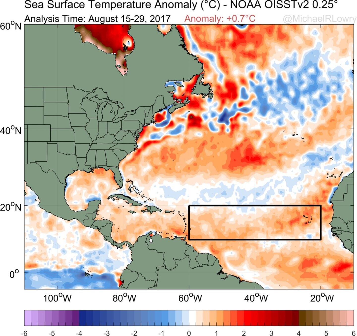
Very warm ocean water ahead for Irma:
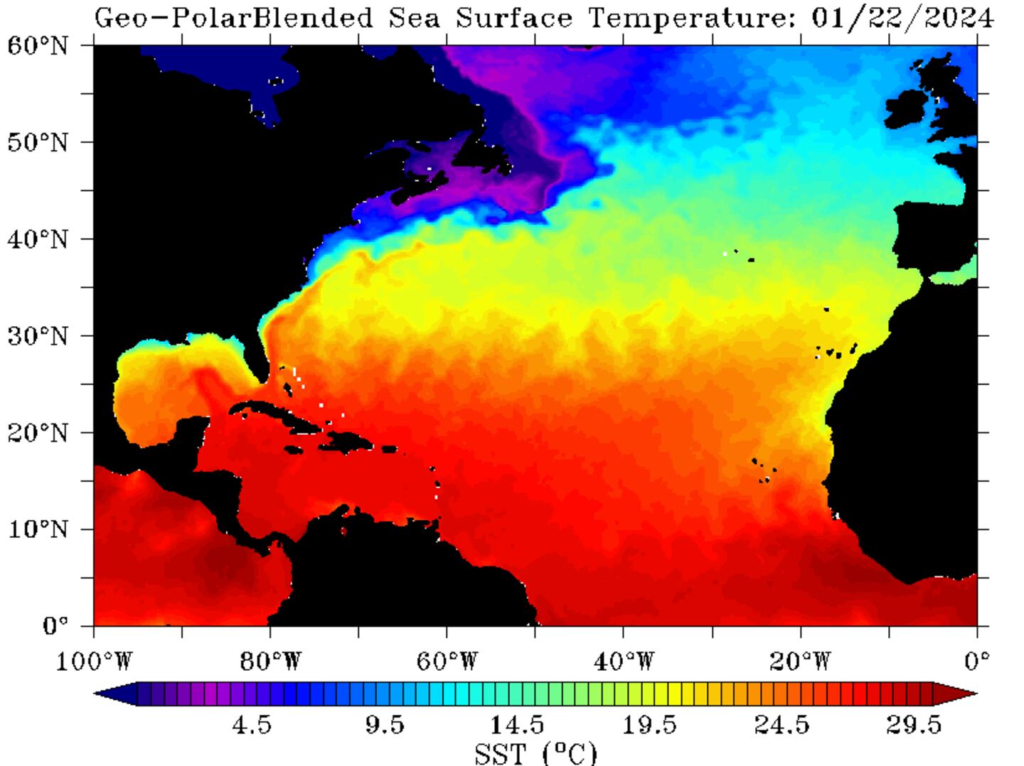
Even more telling - the oceanic heat content showing a wealth of deep warm water over the SW Atlantic/Caribbean & Gulf of Mexico:

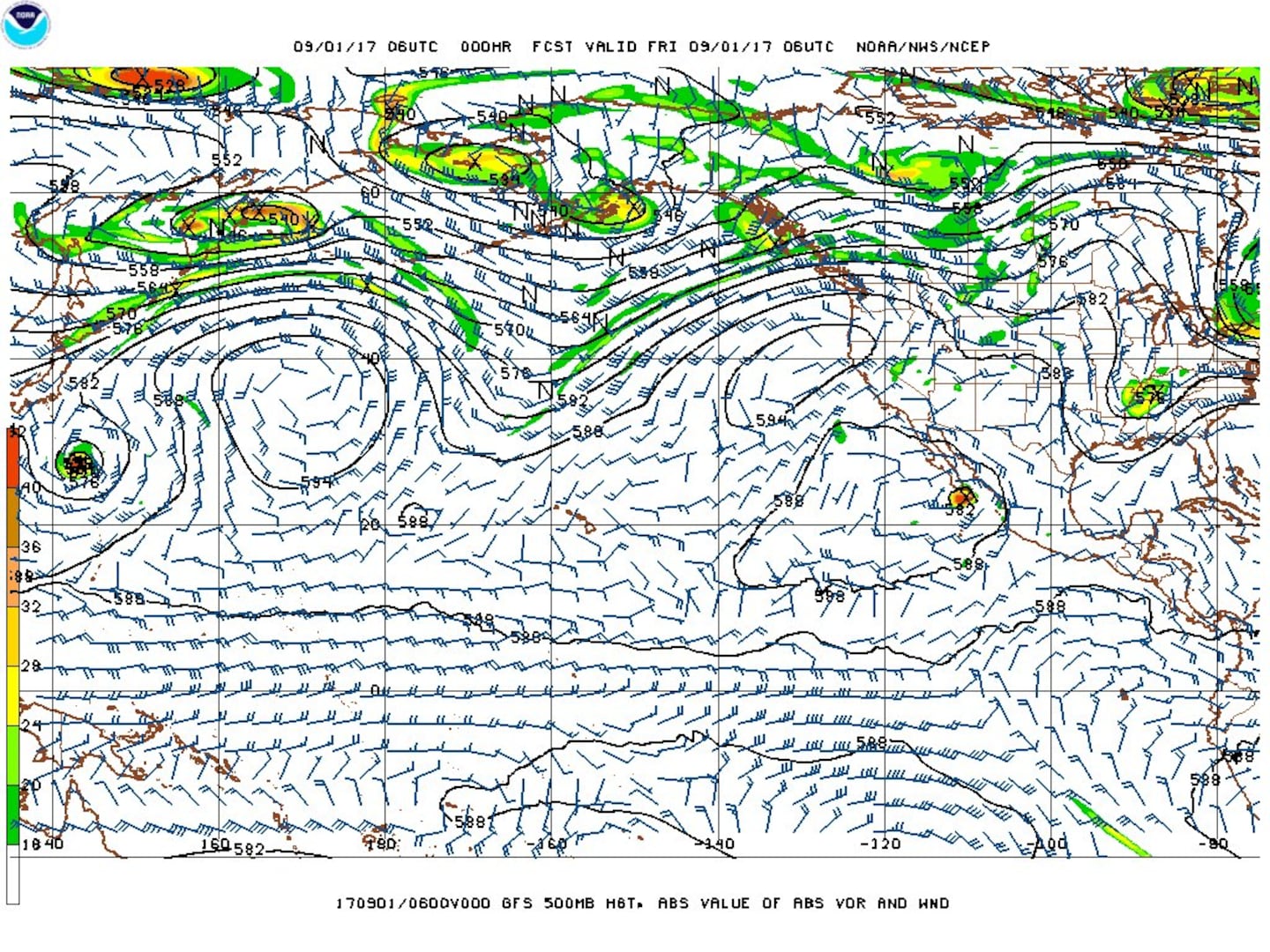
And let's dust off our Pacific typhoon teleconnection for trying to forecast "Irma" - it's lined up pretty nicely so as to draw some parallels. The 500mb chart below from the GFS for the N. Pacific to the Northern U.S. shows trough, ridge, trough, ridge, trough - the last trough being over or near the Eastern U.S. (it's what's picking up the "Harvey" remnants). The W. Pacific trough is picking up typhoon "Sanvu" keeping the tropical cyclone very near or to the immediate east of Japan. This MIGHT be - & so far has been - an early clue that at least some semblance of troughing or alleyway will remain in place over or near the Eastern U.S. which ultimately draws Irma northward over the S.E. U.S. coast.
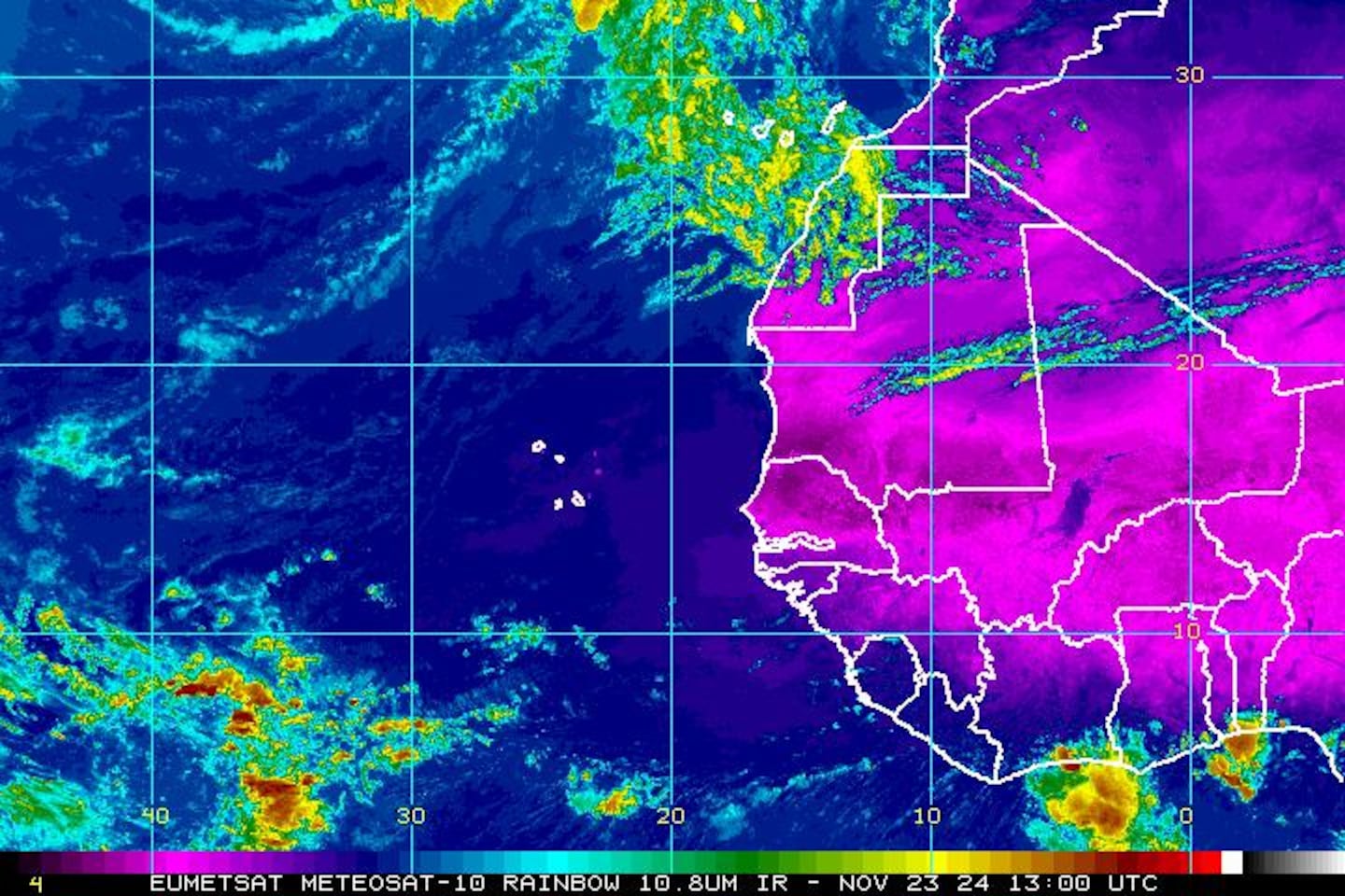
Satellite imagery below shows a band of clouds over the Eastern U.S./W. Atlantic - a weakening front that will be reinforced over the next couple days & is part of the weakness in the upper level flow that gradually pulls Irma northward....

Jose:
.... has become a "major" hurricane but is feeling the effects of southwesterly shear... & will languish in the "backwash" of Irma for many days & brushed the Northern Lesser Antilles over the weekend including some of the same islands hit by Irma! I'm still not certain this simply stays out to sea so bears watching in the long run - 10-14 days - for a possible loop then turn more to the west. At least a brush with the U.S. east coast is not out of the question as an upper level ridge rebuilds underneath departing/decaying Irma & to the north of "Jose". At the very least it appears a loop will occur over the Central Atlantic mid to late week. "Jose" almost reached Cat. 5 intensity Fri. night!


East Atlantic IR satellite shows another strong tropical wave which has a good chance to become a named storm(!):
Mid & upper level wind shear (enemy of tropical cyclones) analysis (CIMMS) - note how strong the shear is across the N. Gulf of Mexico, the north two-thirds of Fl. into the W. Atlantic which eventually will help shred Irma:

The main development region (MDR) remains above avg. temps. - in fact - only 2005 & 2010 were warmer. The deep warm ocean water can "energize" tropical cyclones:
SE U.S. surface map - cold front is part of the equation for where Irma goes....


Surface analysis centered on the tropical Atlantic:

Surface analysis of the Gulf:

Caribbean:

Cox Media Group


